Devils Dyke, West Sussex, South Downs National Park
Walk Photo 348801
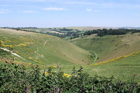
Caption - Devil's Dyke is a V-shaped valley on the South Downs Way in southern England, near Brighton and Hove. It is part of the Southern England Chalk Formation. The 300-foot-deep valley was carved by tremendous amounts of water running off the Downs during the last Ice Age when large amounts of snow thawed and the frozen chalk prevented any further absorption; erosion was aided by the freeze-thaw cycle and the valley was deepened by the 'sludging' of the saturated chalk.
Walk 3488 : Devil's Dyke Circular
Photographer : Paul Gillett
Use back button to return to the photo gallery lists.
Further Information
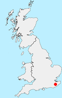
Location Map
South Downs
The South Downs is Britain's newest National Park and stretches from Winchester to Beachy Head. Steeped in history there are ancient hill-forts, barrows, a Roman road and deserted medieval villages. The area has a rich diversity of natural habitats including flower-studded chalk grassland, ancient woodland, flood meadow, lowland heath and the particularly rare chalk heathland. This varied environment provides an excellent basis for those who enjoy outdoor pursuits, such as walking, cycling and horse riding. More Information
Messaging & Social Media
Message Walking Britain and follow the latest news.

Mountain Weather
Stay safe on the mountains with detailed weather forecasts - for iOS devices or for Android devices.