Rackwick Burn, Isle of Hoy, Orkney Islands
Walk Photo 364801
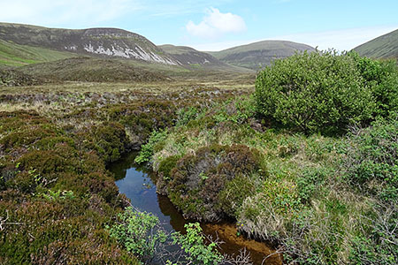
Caption - Rackwick Burn, Isle of Hoy, Orkney Islands. The burn drains the Glens of Kinnaird between Ward Hill and Cuilags.
Walk 3648 : Old Man of Hoy & Glens of Broadiface
Photographer : Anne Burgess
Use back button to return to the photo gallery lists.
Further Information
Location Map
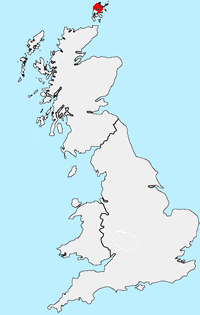
Orkney Islands
The Orkney Islands are an archipelago with about 70 islands, of which 20 are inhabited. Kirkwall, the largest centre is situated on the largest island, Mainland. The islands have been inhabited for at least 8,500 years with many of the oldest and best-preserved Neolithic sites in Europe. Most of the islands are based on underlying Old Red Sandstone and are home to an abundant marine and bird life. The islands are mainly low-lying except for some sharply rising sandstone hills on Mainland, Rousay and Hoy where Ward Hill is the highest point in the islands. Dramatic, rugged cliffs can be found on some western shores and provide an added scenic attraction.
Messaging & Social Media
Message Walking Britain and follow the latest news.

Mountain Weather
Stay safe on the mountains with detailed weather forecasts - for iOS devices or for Android devices.