The Templars' Hall, Temple Balsall
Walk Photo 371101
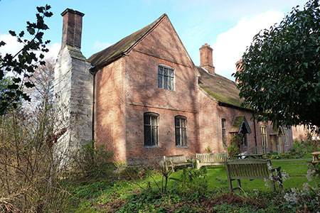
Caption - The Templars' Hall - 13th or 14th century, and although now encased in brick, it's actually a 3-bayed timber-framed aisled hall, with this 15th century wing and 16th century chimney stack on the gable. The whole was Grade II* listed LinkExternal link in 1952, and clearly dates back to the times of the Knights Templar in the area.
Walk 3711 : Heronfield & Temple Balsall Circular
Photographer : Richard Law
Use back button to return to the photo gallery lists.
Further Information
Location Map
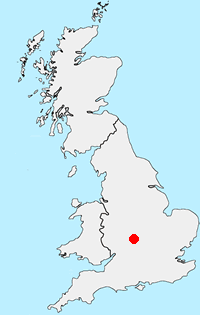
Warwickshire
The county of Warwickshire is in the English Midlands. The north and centre of the county are the areas with the highest population density. The north offers undulating countryside in contrast to the largely rural and sparsely populated south, which contains a small section of the Cotswolds. The highest point in the county, at 261 m (856 ft), is Ebrington Hill, on the border with Gloucestershire. The featured walks include sections of the Millennium Way and Heart of England Way.
Messaging & Social Media
Message Walking Britain and follow the latest news.

Mountain Weather
Stay safe on the mountains with detailed weather forecasts - for iOS devices or for Android devices.