Milldale & Hall Dale from Alstonefield
Peak District Walk
Nat Park - Peak District - Dovedale Manifold Valley
County/Area - Derbyshire & Staffordshire
Author - Lou Johnson
Length - 5.0 miles / 8.1 km Ascent - 500 feet / 152 metres
Time - 3 hours 0 minutes Grade - easy/mod
Walk Route Description
Click image to visit gallery of 3 images.
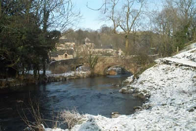
This Peak District walk starts from the car park (Grid ref. SK 131556) located in the centre of the pleasant village of Alstonefield with its pub, the George Inn. Head south out of the village past the chapel and along Millway Lane to locate the footpath on the right (Grid ref SK 134553). This leads over fields down to the busy hamlet of Milldale beside the River Dove.
Cross the footbridge at the south end of the village by the toilets and follow the main path down the River Dove. Despite its popularity this is still a pleasant stretch of Dovedale with high limestone crags on either side. Continue down Dovedale to the first footbridge located between Pickering Tor on the eastern side of the river and Ilam Rock on the western side. Cross the footbridge and turn north retracing your route for about 400 yards where you turn left up Hall Dale.
With wooded slopes on one side and open grassland on the other this is a pleasant dale and typical of the "White Peak" with dry stone walls adding that essential character of the area. Continue up Hall Dale to join Pasture Lane, which leads into a road at Stanshope. Turn right here and walk north along this track to drop down to another road at Dale Bottom. Cross the road and take the footpath opposite. The first section involves a sharp uphill section before levelling off for the final section through fields to Alstonefield and the start of the walk.
Maps 

| Ordnance Survey Explorer OL24 | Sheet Map | 1:25k | BUY |
| Anquet OS Explorer OL24 | Digital Map | 1:25k | BUY |
| Ordnance Survey Digital Map Subscription | |||
| Latest Ordnance Survey Discounts | |||
Other walks nearby
| Walk 1257 | Wolfscote Dale | easy/mod | 7.5 miles |
| Walk 1709 | Milldale and Wolfscote Dale | easy/mod | 6.5 miles |
| Walk 3597 | Manifold Valley, Thor's Cave, Ecton & Wetton Hills from Alstonefield | moderate | 10.0 miles |
| Walk 3601 | Dove & Manifold Valleys | moderate | 10.0 miles |
| Walk 1181 | Wetton Hill & the Manifold Valley | easy/mod | 6.5 miles |
| Walk 1653 | The Manifold Valley from Wetton | easy/mod | 7.8 miles |
| Walk 2681 | Wetton & Manifold Valley from Wetton | easy/mod | 3.6 miles |
| Walk 2762 | Slade House & Rushley | easy/mod | 6.3 miles |
| Walk 2537 | Ecton Hill & Wetton from Wetton Mill | moderate | 7.0 miles |
| Walk 3455 | Manifold Valley & Dovedale om Ilam | moderate | 9.5 miles |
Recommended Books & eBooks
Great Mountain Days in the Pennines
 An inspirational guidebook to 50 classic walks on the rolling Pennine landscape. The graded routes, between 6 and 13 miles in length, cover classic Pennine fells and moorland such as Whernside, Ilkley Moor and Pendle Hill; exploring the North and South Pennines, Yorkshire Dales, Howgills and Dark Peak. Many routes are also suited to fell running.
More information
Walking in the Peak District - White Peak East
 Guidebook describing 42 half-day and day walks in the limestone landscapes of Derbyshire's White Peak, part of the Peak District National Park. One of two volumes, this book covers the east of the region, with potential bases including Bakewell, Eyam, Castleton, Birchover, Matlock and Wirksworth.
More information
