Milldale and Wolfscote Dale from Alstonefield
Peak District Walk
Nat Park - Peak District - Dovedale Manifold Valley
County/Area - Staffordshire & Derbyshire
Author - Lou Johnson
Length - 6.5 miles / 10.6 km Ascent - 450 feet / 136 metres
Time - 3 hours 40 minutes Grade - easy/mod
Walk Route Description
Click image to visit gallery of 6 images.
This Peak District walk offers a relatively easy introduction to the delights of the White Peak and includes some well-known highlights of the area. The start is the small car park in the village of Alstonefield (grid ref. SK130556). There are other options for parking within the village but do be considerate when parking to reduce inconvenience to residents.
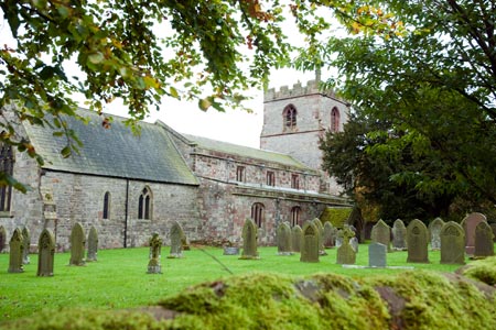
After parking turn right out of the car park and walk into the centre of the village. Take the lane leading past the church, which is on your right. A short way past the church take the signed footpath to Milldale on the right of the lane. This leads across fields to descend steeply to a lane in Milldale (grid ref. SK138548). Turn right and then left at the first junction. This leads you to the centre of Milldale and the picturesque bridge over the River Dove.
Turn left along the footpath beside the road keeping the river on your right. Continue along this path to reach the next bridge over the river (grid ref. SK145551). Cross the Dove into Derbyshire and once on the opposite side take the signed path on the left. This leads alongside the river, which is now on your left. This walk stays with the river for nearly three miles. It is useful to have a map so that you can regularly check your location.
Approaching way is the junction with Biggin Dale (grid ref. SK141570), which lies on your right. From this point north you are in Wolfscote Dale. Continue along the often busy path enjoying wonderful views with limestone outcrops. At the next bridge (grid ref. SK130584) you leave the riverside path, cross the bridge and return to Staffordshire. Follow this wide path towards Narrowdale keeping straight ahead at the first junction of paths (grid ref. SK126576). This path continues ahead before joining an enclosed lane.
Turn right up this lane. Just before reaching the wooded area on the map, take the signed footpath on the left. This leads across a meadow to the road (grid ref. SK126563). Do not go onto the road but turn sharp left and follow the path which almost doubles back on itself before turning right across a series of fields. At the first cross-junction (grid ref. SK129561) go straight ahead to bear right at the next junction. This leads you onto a road. Turn left to return to the car park which is a short way along this road on the right.
Maps 

| Ordnance Survey Explorer OL24 | Sheet Map | 1:25k | BUY |
| Anquet OS Explorer OL24 | Digital Map | 1:25k | BUY |
| Ordnance Survey Digital Map Subscription | |||
| Latest Ordnance Survey Discounts | |||
Other walks nearby
| Walk 1021 | Milldale & Hall Dale | easy/mod | 5.0 miles |
| Walk 1181 | Wetton Hill & the Manifold Valley | easy/mod | 6.5 miles |
| Walk 1653 | The Manifold Valley from Wetton | easy/mod | 7.8 miles |
| Walk 2681 | Wetton & Manifold Valley from Wetton | easy/mod | 3.6 miles |
| Walk 2762 | Slade House & Rushley | easy/mod | 6.3 miles |
| Walk 2537 | Ecton Hill & Wetton from Wetton Mill | moderate | 7.0 miles |
| Walk 3455 | Manifold Valley & Dovedale om Ilam | moderate | 9.5 miles |
| Walk 3527 | Dovedale and Manifold Valley from Ilam | moderate | 7.5 miles |
| Walk 1475 | Bunster Hill and Dovedale from Ilam | easy/mod | 4.5 miles |
| Walk 1042 | Pilsbury Castle | easy/mod | 5.5 miles |
Recommended Books & eBooks
Dark Peak Walks
 Guidebook to 40 walks in the Dark Peak area of the Peak District National Park. 35 circular routes for most abilities, from 8km to 19km, around Edale, Marsden, Fairholmes, Baslow and Castleton, including Kinder Scout and Mam Tor, and 5 longer (25km to 45km) routes highlighting the best of the Gritstone Edges, High Moorland and Deep Valleys.
More information
Walking in the Peak District - White Peak East
 Guidebook describing 42 half-day and day walks in the limestone landscapes of Derbyshire's White Peak, part of the Peak District National Park. One of two volumes, this book covers the east of the region, with potential bases including Bakewell, Eyam, Castleton, Birchover, Matlock and Wirksworth.
More information
