Ennerdale Horseshoe from Bowness Knott
Lake District Walk
Nat Park - Lake District - Lake District Western Fells
Wainwrights - Great Gable, Green Gable, Haystacks, High Crag, High Stile, Kirk Fell, Pillar, Red Pike (Buttermere)
County/Area - Cumbria
Author - Peter Smyly
Length - 18.0 miles / 29.3 km Ascent - 7000 feet / 2121 metres
Time - 16 hours 0 minutes Grade - severe
Maps 

| Ordnance Survey Explorer OL4 | Sheet Map | 1:25k | BUY |
| Anquet OS Explorer OL4 | Digital Map | 1:25k | BUY |
| Ordnance Survey Explorer OL6 | Sheet Map | 1:25k | BUY |
| Anquet OS Explorer OL6 | Digital Map | 1:25k | BUY |
| Ordnance Survey Landranger 89 | Sheet Map | 1:50k | BUY |
| Anquet OS Landranger 89 | Digital Map | 1:50k | BUY |
Walk Route Description
Click image to visit gallery of 10 images.
There are several recognised Lake District horseshoe walks, but surely none of them can be more of an endurance test than this one. The summits, if all included, read a bit like a Lakeland hall of fame: Red Pike, High Stile, High Crag, Haystacks, Green Gable, Great Gable, Kirk Fell and Pillar. Ideally, an early start is needed along with readiness for a late finish, long hours of daylight in summer and a willingness to keep going for long hours with only brief occasional stops for rest. The overall distance can be shortened by staying a couple of nights at the Youth Hostel at High Gillerthwaite, thus eliminating the walk in and back from the Bowness Knott Car Park.
Unless you are a fell runner, rather a walker who can keep up a fairly steady pace, then fourteen hours or more should be allowed to complete the full length version of the walk which includes over seven thousand feet of ascent. There are options to either shorten the walk or to cut corners as required, for instance, if energy levels are flagging, the weather has taken a turn for the worse or if you are behind schedule. Scarth Gap, Windy Gap and Black Sail all offer ways back down the Ennerdale valley without completing the rest of the walk while lower paths skirt around Green Gable, Great Gable and Kirk Fell, allowing any, or all three of these summits to be bypassed. The descents of Great Gable and Kirk Fell, in particular, involve making your way down steep slopes of loose rock and progress is likely to be slow.
One way of planning for the walk is to draw up a schedule for reaching key points on the walk, then, when on the walk, comparing estimated times with actual times. This may help given that there is a danger of trying to cover too much ground in haste late on in the day when energy levels may well have dropped and it could be a case of trying to "beat the clock" to get back down by a certain time. Bear in mind too, that estimating times is not just based on miles and height gain. Terrain is significant too and this should be factored in.
I have broken down the walk into different stages as set out below.
Stage 1 - Bowness Knott Car Park to High Gillerthwaite Youth Hostel.
Public access by car is only as far as the car park, grid reference NY112156. The first part is the easiest section of the whole walk, along an unsurfaced forest road that runs alongside Ennerdale Water. After the end of the lake has been passed, a bridge over the River Liza appears on the right before the route passes the Youth Hostel and this bridge is crossed in the latter stages of the walk around twelve hours or more later. This is the only part of the walk which repeats itself in reverse later on. Ennerdale Water is one of the remotest lakes in the district and can be seen through occasional breaks between trees. This section of the walk is part of the Coast to Coast (C2C) walking route, but you leave it when heading up Red Pike as the main C2C route heads up the valley to, and beyond, Black Sail Youth Hostel.
Stage 2 - Red Pike
Shortly after the Youth Hostel, follow a path through a wooden gate on the left and head up the grassy felllside in a break between two sections of forest. Higher up, after running alongside a beck, the path becomes indistinct and peters out as the route crosses tussocky grass and bog. Aim for a line of old fence posts on the skyline and follow these to the summit of Red Pike, though the path bypasses the actual summit. Views looking down on the lakes of Buttermere and Crummock Water are seen from here as well as the very steep path going up Red Pike from Bleaberry Tarn.
Stage 3 - Red Pike to Haystacks
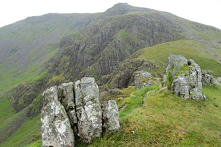
The traverse of the ridge is straightforward as far as the next summit, High Stile with views overlooking Bleaberry Tarn, Buttermere and Crummock Water. Be careful afterwards not to stray too far towards the Buttermere direction (not least since a seemingly inviting path leads that way) and instead head south east to reach the next top, High Crag. A steep descent follows down to Scarth Gap, partly aided by a reinforced stone path. Scarth Gap offers the first realistic option to cut short the walk back down the Ennerdale valley but next it is onwards and upwards to Haystacks with a few sections of the path requiring some basic scrambling over rocky sections. The summit of Haystacks features a small tarn and, as with the whole of the approach to it, Great Gable is seen clearly across the valley. From Haystacks, it seems a long way off, as does Pillar, two summits that feature later in the walk, and there is much ground still to be covered before either summit is reached.
Stage 4 - Haystacks to the Hopper Slate Quarry
Such is the popularity of the late AW Wainwright's favourite mountain that the main path along it can be seen from afar a little bit like an unsurfaced road. After passing two more tarns, Loaf Tarn and Blackbeck Tarn, the route goes down to a stream crossing then it leads up to the Hopper Slate Quarry and the point where you have completed the first of the three sides of the horseshoe. This is where the path meets another path coming up from Honister, another approach to Haystacks. Looking back Haystacks is seen to be diminutive in size compared with the surrounding peaks.
Stage 5 - Hopper Slate Quarry to Great Gable
At last there is a definite change of direction as you follow a path due south initially which skirts Grey Knotts and Brandreth. Branch left at a fork (the right hand path skirts round Green Gable via Moses Trod). Three small tarns appear at the next col (Gillercomb Head), then a rocky path leads up to the summit of Green Gable where Great Gable looms large across the next col.
The way ahead is obvious as you descend steeply to the col at Windy Gap. This point also offers a possible escape route back down the Ennerdale valley, or a lower level route that skirts Great Gable, but for the continuation of the route, take the rising rocky path ahead to gain the summit of Great Gable with views to the left of Styhead Tarn, Sprinkling Tarn, Great End and the Corridor Route up Scafell Pike. Perhaps surprisingly for such a well-known and high mountain, Great Gable does not have a summit cairn of any size or significance.
Stage 6 - Great Gable to Pillar
Having left the top of Great Gable, a key question to consider is whether, on reaching Beck Head, to continue over Kirk Fell or choose the path that skirts round it to the right. If time is limited, it should be the latter. Great Gable is a fine vantage point and if views are clear, there may be a temptation to linger. The descent to Beck Head follows a steep, rocky path with loose stones. The col at Beck Head is marked by two small tarns, one of which partly dries up in times of low rainfall to reveal its stony bottom The path round the side of Kirk Fell tends to peter out on approaching a ravine at Sail Beck, then the path leads quite steeply up to the col. at the top of the Black Sail Pass. I estimate that from the col to the top of Pillar via Looking Stead is around an hours walking at a steady pace. Pillar, as can clearly be seen from Mosedale below (a view not seen on this walk though) comprises in effect three tops, thus when approached from the east, from Looking Stead, the first two tops appear as what turn out to be false summits.
Stage 7 - Pillar - to Bowness Knott Car Park
This last stage could take as long as another three hours. All the summits have now been reached and it is pretty much all downhill or on the level from here, however, this final part of the walk should not be underestimated. Not only does it come at a time when tiredness may be setting in (if it hasn't already), but the terrain in places is awkward to negotiate. There is a steep descent path to the col at Wind Gap (not to be confused with Windy Gap between the two Gables) down loose rocky ground. Then at the col, the best way to descend is not obvious and leaves you to find your own way down steep rocky, pathless terrain, aiming to stay on the left of the river, though crossing one of its tributaries is also necessary. Once you have the river, High Beck, clearly below and alongside you on the right and the forest ahead, head for the forest and a track that leads down through thick trees on either side as well as overhead. Rocks and tree roots underfoot need to be dealt with. When the path emerges on a forest road at a T, relief is short-lived before the road narrows to a similarly narrow path as before but now with more daylight overhead and a gorge appears way below on the left down a very steep slope. The path follows at a similar level down to the stream on the left by the time the next T is reached and a left turning leads back to a bridge over Woundell Beck before a straight section of path leads you back to the bridge over the River Liza and the walk concludes by returning to the car park along by Ennerdale Water.
Other walks nearby
| Walk 3667 | Ennerdale Water Circular | moderate | 7.1 miles |
| Walk 2058 | Ennerdale Skyline incl. Steeple & other fells | mod/hard | 13.8 miles |
| Walk 1671 | Grike & Crag Fell | easy/mod | 6.6 miles |
| Walk 1745 | Grike and Caw Fell from Kinniside Stone Circle | mod/hard | 13.5 miles |
| Walk 2539 | Grasmoor and Rannerdale Knotts | moderate | 8.0 miles |
| Walk 3676 | Hen Comb from Loweswater | moderate | 5.4 miles |
| Walk 1142 | Buttermere Circular | easy | 4.5 miles |
| Walk 2609 | Grasmoor via Crag Hill | mod/hard | 8.0 miles |
| Walk 2735 | Fleetwith Pike and Buttermere Circular | mod/hard | 8.5 miles |
| Walk 1231 | Grasmoor via Whiteless Pike | moderate | 7.0 miles |
Recommended Books & eBooks
Outdoor Adventures with Children - Lake District
 Guidebook to 40 outdoor adventures in the Lake District with children under 12, including walking, cycling, orienteering, paddling, boating, hostelling and more. Graded activities for varying age ranges or for families with children of different ages.
More information
Walking the Lake District Fells - Patterdale
 Part of the Walking the Lake District Fells series, this guidebook covers a wide range of routes to 35 Lakeland summits that can be climbed from Ambleside, Grasmere and Patterdale and the Thirlmere and Ullswater valleys, with highlights including Helvellyn and Fairfield. Suggestions for longer ridge routes are also included.
More information
Messaging & Social Media
Message Walking Britain and follow the latest news.

Mountain Weather
Stay safe on the mountains with detailed weather forecasts - for iOS devices or for Android devices.