Walk 1131 - printer friendly version
Mynydd Mawr & Fron Walk
Author - Alan Birks
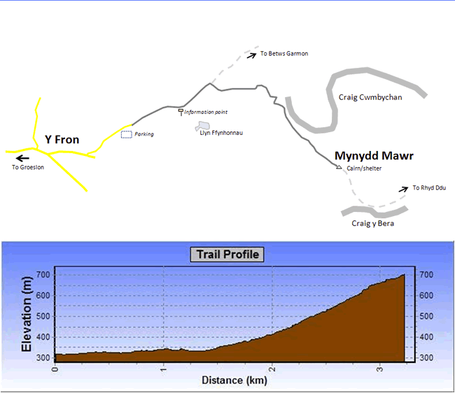
Length - 4.0 miles / 6.5 km
Ascent - 1250 feet / 379 metres
Grade - easy/mod
Start - OS grid reference SH516551
Lat 53.072459 + Long -4.2165324
Postcode LL54 7RF (approx. location only)
A straightforward and short ascent from the village of Fron, with fine views on the way up towards Moel Tryfan and Caernarfon castle in the north, and the Nantlle Ridge to the south. The lower section is popular with local dog walkers. This Snowdonia (Eryri) walk can be combined with Walk 1951, ending in Rhyd Ddu.
Just after passing through the main part of Fron village, turn left by some dilapidated buildings, cross a cattle grid and drive a little way down the lane to park on a flattish area near where it turns into a broad track. Pass through a kissing gate and continue along the track. After half a mile or so you will reach an information point on Uwchgwyrfai Common. As well as the usual notes on the nature and archaeology of the area there is a description of a local legend: according to this highly unlikely tale!
"This part of Wales is linked to many folklore stories. An area within the common to the south of this sign is named Rhos y Pawl for a particularly unusual reason. It is said that once a farm hand at Gelli farm fell head over heels in love with the daughter of the nearby landowner at Talymignedd, who refused permission for them both to marry. Tired of the constant whining, he set the young man an ultimatum -- only after spending a January night naked on the slopes of Mynydd Mawr would he allow them to marry. Undeterred, the young man survived by striking a wooden pole with a heavy hammer, thus gaining warmth from the force of his actions. Upon his survival they were married and to this day the area between Llyn Ffynhonnau and Gelli is named Rhos y Pawl. (Trans: Rhos / Moor or Heath - Pawl / Pole or Stake)"
History does not apparently record whether the girl snuck out at night to take a peek at her suitor, or to help keep him warm!
After a little while the path turns to the right towards the mountain, with the broad scar of the path clearly visible rising over the flank of the mountain. (The path straight ahead goes towards Betws Garmon.) Where it gets steeper, smaller paths zig-zag left and right to ease the way. The condition of the main path here is rather poor, partly because of the flow of water down the mountain in wet weather, and partly because the local youths sometimes use it for motorcycle scrambling. About half-way up there are some abandoned workings which are poorly fenced. The main path continues to the left of these workings, although there is also another path to the right-hand side. This is an excellent point to stop for a while and admire the view.
Eventually the path becomes indistinct, but carry on steeply uphill and the summit crags will eventually appear on the skyline, probably a little to the left of your heading. A line of low cairns marks the way up, and more usefully helps you find the path again on the way down.
The view from the top is magnificent in good weather, and when the wind howls there are two low-ish shelters to hide inside.
This walk can be combined with Walk 1951, ending in Rhyd Ddu.
Messaging & Social Media
Message Walking Britain and follow the latest news.

Mountain Weather
Stay safe on the mountains with detailed weather forecasts - for iOS devices or for Android devices.