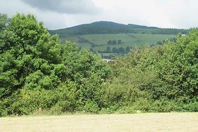
Foel Fenli & Moel Famau from Loggerheads
Clwydian Hills Walk
Region - Clwydian Hills
County/Area - Denbighshire
Author - Lou Johnson
Length - 9.5 miles / 15.4 km Ascent - 1680 feet / 509 metres
Time - 6 hours 30 minutes Grade - moderate
Walk Route Description
Click image to visit gallery of 9 images.
The Clwydian Hills are often ignored by walkers as they head for the bigger peaks in the nearby Snowdonia (Eryri) National Park. Moel Famau (554 m) is the highest peak in the range and provides excellent views in all directions often having the advantage of being below the cloud base when higher summits are hidden from view. An additional advantage is the excellent waymarking in Denbighshire, which is a credit to all those involved.
The start is the large parking area (Grid ref. SJ197626) at the Loggerheads Country Park on the A494 Mold to Ruthin road. Complete with a visitor centre, toilets and cafe it provides a base for other excellent walks in the area. However for this route return to the main road and turn right towards Ruthin. Cross the road and just opposite the garage take the signed bridleway over a bridge. This leads into a tarmac road which you follow south. Just past a cottage on your left (Grid ref. 195612), go left to take the signed path across fields to reach another lane. Turn left and pass a cottage on your right. Turn right onto a signed path that leads across fields to reach a track (Grid ref. 195605) which is followed to reach the main A494 at Llanferres.
Cross the main road and take the lane opposite keeping the public house on your right. Stay on this lane as it climbs steadily before turning south to reach a dead end. Take the path on the right and climb steeply up a field. At the top turn left and stay on a clear right of way that heads south west, eventually joining the Offa's Dyke Path (Grid ref. 173594). Turn right and climb to Bwlch Crug-glas where you get a superb view west over the Vale of Clwyd to the mountains of Snowdonia (Eryri). The main path contours around the western flank of Foel Fenli, however this route takes you steeply up to the summit where evidence of ancient fortifications still remains. Descend north from the summit to drop down to Bwlch Penbarra. With road access this can be a busy spot and there is a bus service from Loggerheads at peak periods.
Cross the col and take the very obvious path heading north along the ridge to Moel Famau with the summit marked by the ruins of a Jubilee Tower. The views on this section are good with even better panoramas from the summit. Leave the summit just east of north on a clear path that descends with a fence and plantation on your right. At the end of the plantation turn right onto a pleasant green lane heading east across the north side of Ffrith Mountain. Reaching Ffrith farm the track turns south to reach a lane (Grid ref. 184634). Turn left and descend to road junction. Half hidden on the opposite side is a footpath that descends to a river. Cross the footbridge and turn right. This path/track leads you back to the start.
Maps 

| Ordnance Survey Explorer 265 | Sheet Map | 1:25k | BUY |
| Anquet OS Explorer 265 | Digital Map | 1:25k | BUY |
| Ordnance Survey Digital Map Subscription | |||
| Latest Ordnance Survey Discounts | |||
Other walks nearby
| Walk 1912 | Moel Famau and the Clwydian Hills | moderate | 7.0 miles |
| Walk 2509 | Moel Arthur & Moel Famau | moderate | 10.0 miles |
| Walk 2550 | Cilcain, Moel Arthur & Moel Famau | mod/hard | 13.0 miles |
| Walk 1528 | Moel Famau | easy/mod | 10.0 miles |
| Walk 1885 | Moel Arthur and Penycloddiau | moderate | 7.5 miles |
| Walk 3655 | Rhewl, Moel y Gamelin & Moel Morfydd | moderate | 5.4 miles |
| Walk 1067 | Ruabon Mountain & The Limestone Edges of Llangollen | moderate | 11.0 miles |
| Walk 1845 | Castell Dinas Bran from Llangollen | easy/mod | 4.0 miles |
| Walk 2598 | Ruabon Mountain, World's End & Panorama Circular | moderate | 12.5 miles |
| Walk 2460 | Pontcysyllte Aqueduct Circular | easy | 4.5 miles |
