Moel Famau and the Clwydian Hills from Cilcain
Clwydian Hills Walk
Region - Clwydian Hills
County/Area - Flintshire & Denbighshire
Author - Lou Johnson
Length - 7.0 miles / 11.4 km Ascent - 1700 feet / 515 metres
Time - 5 hours 10 minutes Grade - moderate
Walk Route Description
Click image to visit gallery of 12 images.
This excellent route takes in the highest point on the Clwydian Hills and includes a lengthy section north along the main ridge. Offering contrasting views as far as Snowdonia (Eryri), with many of the peaks easily recognised, to the west and the delights of Merseyside and beyond to the east the route has much to offer. Apart from being busy around Moel Famau, the route is generally quiet with navigation offering few problems.
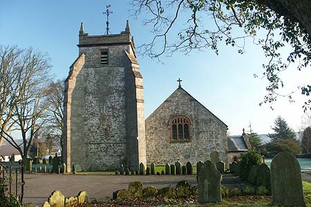
The start is the small village of Cilcain reached from the A541 Mold to Denbigh road. Parking is at a premium in the village with the small car park by the village hall being marked for residents only. However with care there are a few spots around the village where parking is easier and the start of this walk is by the front of the church (Grid ref. SJ176651). There is also some parking, passed on the final leg of the walk, out of the village on the lane to the junction at grid ref. SJ167652.
From the church take the narrow lane going south on the west side of the church. This descends quite quickly to reach a cross roads (Grid ref. SJ171647). Go straight across up the access drive to Tyddyn-y-foel. After a few metres go right on the signed path across two fields to a track (Grid ref. SJ168644). Go left down this track and immediately right down another track. This track is followed past a reservoir on your left into a steep sided valley cut into the hills. The track eventually becomes a path and the going gets steeper as you climb up to a junction (Grid ref. SJ163632). Go straight across the bridleway and continue the climb alongside the plantation on your left to reach open ground and the Jubilee Tower on Moel Famau.
You are unlikely to have this spot to your self. However the view is excellent and a short climb up the tower will give you the chance to see how good you are at recognising the mountains of Snowdonia (Eryri). Having enjoyed the panorama, descend just north of west on the Offa's Dyke National Trail. The path can be seen meandering across the hills towards Moel Arthur and unless the weather is bad you should have no trouble finding the route. You have nearly 4 km of ridge to enjoy with a couple of minor summits en-route. The final descent to the road before Moel Arthur is steep and badly eroded in places and with an added hazard of thick ice was not too pleasant.
Having reached the road (Grid ref. SJ146657) you can, of course, explore Moel Arthur before turning right down the road. After approximately 200 metres bear right on an un-surfaced track heading east back towards Cilcain. This leads past Gronfoel to a road junction (Grid ref. SJ165653). Go straight across and follow the lane down into Cilcain. On the way down this lane you will pass the parking mentioned earlier in this walk description.
Maps 

| Ordnance Survey Explorer 265 | Sheet Map | 1:25k | BUY |
| Anquet OS Explorer 265 | Digital Map | 1:25k | BUY |
| Ordnance Survey Digital Map Subscription | |||
| Latest Ordnance Survey Discounts | |||
Other walks nearby
| Walk 2509 | Moel Arthur & Moel Famau | moderate | 10.0 miles |
| Walk 2550 | Cilcain, Moel Arthur & Moel Famau | mod/hard | 13.0 miles |
| Walk 1259 | Foel Fenli & Moel Famau from Loggerheads | moderate | 9.5 miles |
| Walk 1885 | Moel Arthur and Penycloddiau | moderate | 7.5 miles |
| Walk 1528 | Moel Famau | easy/mod | 10.0 miles |
| Walk 3655 | Rhewl, Moel y Gamelin & Moel Morfydd | moderate | 5.4 miles |
| Walk 1067 | Ruabon Mountain & The Limestone Edges of Llangollen | moderate | 11.0 miles |
| Walk 1845 | Castell Dinas Bran from Llangollen | easy/mod | 4.0 miles |
| Walk 2598 | Ruabon Mountain, World's End & Panorama Circular | moderate | 12.5 miles |
| Walk 2460 | Pontcysyllte Aqueduct Circular | easy | 4.5 miles |
