Marton & the River Trent circular
Lincolnshire Walk
County/Area - Lincolnshire
Author - Hugh Marrows
Length - 3.0 miles / 4.9 km Ascent - 20 feet / 6 metres
Time - 1 hours 30 minutes Grade - easy
Walk Route Description
Click image to visit gallery of 5 images.
This is a most interesting walk along the river cliffs and banks of the Trent in the far west of Lincolnshire. Considerate parking is possible near the church in Marton, which lies on the A156 Lincoln-Gainsborough road.
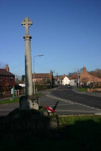
Marton's long history is obvious through the visible evidence its church, St Margaret of Antioch. Described by Henry Thorold (one of Lincolnshire's leading writers and architectural experts) as "a thrilling church" its great age clear from the solid, plain exterior and the large amount of Saxon herringbone masonry; no other Lincolnshire church has more! Inside there is Norman masonry too and some Early English work. In the churchyard stands what may be an old market cross, now the Marton war memorial, and a "Millennium" anchor dredged from the Trent. Look out too for the former Black Swan inn where local legend says Dick Turpin once lodged!
The Romans were here well before the Saxons however for on the edge of the village is Till Bridge Lane a Roman road that branched off Ermine Street to a ford at the Trent. The section at Marton, used on the walk, is known as Littleborough Lane for it led, via to a stone-paved ford, to Littleborough seen across the river in Nottinghamshire, formerly the Roman settlement of Segelocum. The little church there has Saxon masonry but also Roman tiles built into it. A ferry ran here until around the late 1920's.
Partway along Littleborough Lane a footpath departs to the left. Archaeologists think there may have been a Roman settlement nearby for contemporary pottery finds have been made here and about 200 yards to the left of the lane traces of a small Roman fort have been identified. Earthworks were recognised here as early as 1776 by the Lincolnshire antiquary William Stukeley but the "fort" was in a sense "re-discovered" in 1974 through aerial photography revealing crop marks in the fields although the site was ploughed level long ago.
Littleborough Lane soon appears to lead to a farmhouse directly ahead but then, quite suddenly, the river appears and the buildings revealed to be at Littleborough on the opposite bank. The Trent is still tidal here with OS maps showing the tidal limit to be at Trent Port. However at spring sides it experiences a tidal bore - The Aegir - named after the Norse god of the sea but (it must be admitted) this has usually lost most of its force by the time it reaches Marton. (Best seen downstream near Gainsborough the details of dates / times can be found on the Environment Agency website.)
We leave the river at Trent Port where, as the name indicates, there was a small though important port, similar to many others along the river that thrived before the arrival of the railways, at a time when the Trent was the busiest commercial river in the country. The old mill is known to date back at least as far as 1799 but was working until its internal machinery was removed in 1927.
Route Guide
From your parking place return to the main road by the church and then turn left to pass the inn. On reaching the crossroads turn left again, joining the Roman road as you do so. This is surfaced at first but quickly becomes a track; follow it down to the riverbank.
Climb the stile on the left, and shortly a second one, to proceed beside the Trent and following the river embankments for about a mile by broad left hand meanders. Then, as you see the river starting to swing away sharply to the right in a wide horseshoe bend, look for a small metal gate on the left. Go through it and bear right on a path through trees.
You will soon come to some railed steps climbing the hillside. Go up these and as the path levels out keep ahead, high above the river, and through a metal gate near the windmill. Continue to a short track that meets the end of Trent Port Road. There are marvellous views over the river here.
Return to Marton village by going left along Trent Port Road.
Maps 

| Ordnance Survey Explorer 271 | Sheet Map | 1:25k | BUY |
| Anquet OS Explorer 271 | Digital Map | 1:25k | BUY |
| Ordnance Survey Digital Map Subscription | |||
| Latest Ordnance Survey Discounts | |||
Other walks nearby
| Walk 1432 | Doddington circular | easy | 4.9 miles |
| Walk 1438 | River Witham, North Hykeham | easy | 4.5 miles |
| Walk 2113 | Haxey, Westwoodside & the Turbary | easy/mod | 7.0 miles |
| Walk 1440 | Lincoln Edge | easy | 5.0 miles |
| Walk 1431 | Haddington - Story of Two Churches | easy | 2.9 miles |
| Walk 1430 | Aubourn Country Circular | easy | 4.5 miles |
| Walk 3414 | Bishopbridge to Brandy Wharf | easy/mod | 9.0 miles |
| Walk 2069 | Brandy Wharf from Atterby Carr Lane | easy | 5.0 miles |
| Walk 2139 | Clumber Park and Lake | easy | 4.0 miles |
| Walk 2162 | Clumber Park & Freeboard Lane | easy | 5.5 miles |
