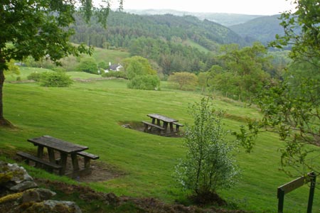
Gwydir ForestLakes from Tyn Llwyn
Snowdonia/Eryri Walk
Nat Park - Snowdonia - Eastern Carneddu
County/Area - Conwy
Author - Peter Smyly
Length - 6.5 miles / 10.6 km Ascent - 650 feet / 197 metres
Time - 3 hours 50 minutes Grade - easy/mod
Walk Route Description
Click image to visit gallery of 6 images.
Many walkers visiting Snowdonia (Eryri) will be drawn to the main attraction of Snowdon itself, but here is a walk that covers part of Snowdonia that few walkers visiting the area are likely to see. The Gwydir Forest provides a different insight into the area with some relatively low level walking, while helping to maintain stamina levels and its exploration can be a challenge to your navigational skills. This walk could be completed in an afternoon on a day of arrival in the area before heading for the mountains the next day.
To reach the car park at the start of the walk (Tyn Llwyn), turn off the main road between Betws-y Coed and Capel Curig past Ty Hyll (The Ugly House) up a narrow, steep road and this leads to the car park on the right. For the walk, set off from the car park and walk along the minor road ahead, watching out for the occasional car passing by. After about half a mile, take the road turning to the left and shortly, the first lake of the walk, Llyn Tyn-y-Mynydd, can be glimpsed through trees to the left. To get a better view of this small sheet of water will involve leaving the road briefly, passing between trees and climbing over a gate; however the lake is surrounded by boggy ground and therefore it is better viewed from a distance.
Returning to the road, look out for a footpath off to the right after another few minutes walking, a path which later swings round to the left and Llyn Geirionydd, a large, long lake, can be seen to the right. A tree-clad hill overlooks it from the west and at the near side is a tarmac road and a car park. Possibly the best view of the lake is from the southern end where the whole length of the lake can be seen at a glance between trees and reeds appear in the water in the foreground which lend a bit of variety to the view,
Finding Llyn Bychan is a little more complicated and a route map will help here as paths are generally not waymarked or signposted. Cross the outflow of Llyn Geirionydd, and, by following the route ahead, pass between some houses. The path then goes first to the left and then right up a hill before going left again (ignore the turn off down the hill to some farm buildings). The route then reaches a T junction where you go left and Llyn Bychan then appears on the right after the unsurfaced road has gone up a hill and down the other side. This is a pretty little lake despite the tree-cutting activities in its vicinity. A hill on the far side from the track overlooks the lake, below which there are outcrops of white quartz part way up the hill. In fact, the quartz on the hill overlooking the lake is visible in the distance before you top the final hill before the lake comes into view. This lake has clear waters with stones showing on the bottom and tree reflections when the water is still and this is a good place to stop for a pause.
The path continues to trend due south and a digression from it is necessary to locate the next and final lake of this walk. Take the path off to the left which swings round to the right and Llyn Goddionduon appears through the trees with an access path that soon becomes wet and muddy underfoot. There is a boathouse nearby on the north shore and your arrival may inadvertently startle some of the bird life in residence here who are apparently not used to human visitors to the lake. There was much evidence (in May 2011) of trees having been felled recently on the western shore of the lake. There are no paths offering further access to the lake from the north, therefore you need to go back to the turn off and resume the path south. The path leaves the forest to reveal Moel Siabod off to the right as the route branches left of a dry stone wall with a farm and fields below. By following the route ahead you pass across another field and then enter a lane to the left which, by following it straight ahead, joins up with the road from Ty Hyll (Ugly House) which is off the main road between Betws-y-Coed and Capel Curig. A left turning along the narrow road at the T junction takes you back past moss-covered dry stone walls and woodland to the car park at the start of the walk.
While the walk could be extended to include another lake nearby, Llyn Sarnau, this lake was completely overgrown in May 2011.
Maps 

| Ordnance Survey Explorer OL17 | Sheet Map | 1:25k | BUY |
| Anquet OS Explorer OL17 | Digital Map | 1:25k | BUY |
| Ordnance Survey Digital Map Subscription | |||
| Latest Ordnance Survey Discounts | |||
Other walks nearby
| Walk 2285 | Llyn Geirionydd & Llyn Crafnant | easy/mod | 5.5 miles |
| Walk 1151 | Moel Siabod | hard | 5.5 miles |
| Walk 2919 | Moel Siabod & Capel Curig | moderate | 6.0 miles |
| Walk 1037 | Two lakes of the Gwydir Forest - Llyn Elsi and Llyn Parc | easy/mod | 6.5 miles |
| Walk 2592 | Llyn Geirionydd & Llyn Bychan from Llyn Crafnant | moderate | 9.5 miles |
| Walk 2608 | Crimpiau & Creigiau Gleision from Llyn Crafnant | moderate | 7.5 miles |
| Walk 2679 | Circuit of Llyn Crafnant | easy | 3.5 miles |
| Walk 3005 | Clogwen | easy | 2.0 miles |
| Walk 2766 | Capel Pinnacle / Y Pincin | easy | 1.0 miles |
| Walk 2902 | Creigiau Gleision & Llyn Cowlyd from Capel Curig | moderate | 9.5 miles |
Recommended Books & eBooks
Great Mountain Days in Snowdonia
 Inspirational guidebook to 40 great mountain day walks and scrambles in Snowdonia. Inspirational routes for all abilities across the National Park with routes up Snowdon and Moel Eilio, the Glyderau, the Carneddau, Eifionydd, Siabod and the Moelwynion, Rhinogydd (the Harlech Dome), Migneint and the Arans and Cadair Idris and the Tarrens.
More information
Mountain Walking in Snowdonia
 Guidebook to 40 of Snowdonia's best day walks, with routes up Snowdon and Tryfan, including the Snowdon Horseshoe, Cadair Idris, Y Garn and The Rhinogs. The routes range from Grade 1 scrambles like Crib Goch or Bristly Ridge, to riverside and forest walks. Includes details of a 2-day traverse of all 15 of Snowdonia's 3000ft peaks.
More information
