Glyder Fawr & Glyder Fach from Pen-y-Pass
Snowdonia/Eryri Walk
Nat Park - Snowdonia - Glyders Tryfan
County/Area - Gwynedd & Conwy
Author - Alwyn Williams
Length - 5.5 miles / 8.9 km Ascent - 2650 feet / 803 metres
Time - 5 hours 20 minutes Grade - mod/hard
Maps 

| Ordnance Survey Explorer OL17 | Sheet Map | 1:25k | BUY |
| Anquet OS Explorer OL17 | Digital Map | 1:25k | BUY |
| Ordnance Survey Landranger 115 | Sheet Map | 1:50k | BUY |
| Anquet OS Landranger 115 | Digital Map | 1:50k | BUY |
Walk Route Description
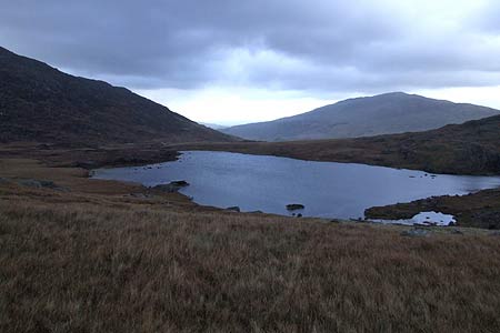
Click image to visit gallery of 6 images.
This Snowdonia (Eryri) walk takes place over remote and sometimes pathless terrain. Good map reading and navigational skills are essential on parts of this walk. This walk starts from the car park (Grid ref. SH647555) at Pen-y-Pass on the A4086 between Llanberis and Pen-y-Gwryd. The car park fills up early so arrival before 9 a.m. is essential. There is a Park and Ride service operating from Nant Peris if the car park is full.
Go left out of the car park and cross the A4086 road. Go through the gate to the left of the Pen-y-Pass Youth Hostel and follow the short path through the hostel's garden to a kissing gate. Continue along the path which gradually climbs uphill towards Llyn Cwmffynnon. Once the ground levels off, continue in a north-westerly direction towards an old sheepfold. Continue on, keeping the sheepfold to your right (Grid ref. SH646560) and head towards a small waterfall (Grid ref. SH643563). Keep the waterfall to your left and climb steeply uphill towards the crags and loose rocks at grid ref SH640565. Looking backwards you should now have an excellent view of Snowdon, Grib Goch and the Clogwyn y Person Arrête. Continue upwards until the path reappears and follow the path towards the summit of Glyder Fawr (Grid ref. SH643579).
From the summit of Glyder Fawr follow the obvious path which is marked with stone cairns in a easterly direction. Keeping the cliffs to your left continue in an easterly direction towards Bwlch y Ddwy Glyder. You will now have good views of the Ogwen Valley towards Bethesda. Pen yr Ole Wen and the High Carneddau are to the left, and Moel Siabod and the Moelwyns to the right. At Bwlch y Ddwy Glyder the path forks. Take the fork to the right dropping down for a short distance until you reach the cliffs directly in front of Castell y Gwynt (Castle of the Winds). From here an excellent view of the summit of Tryfan can be seen.
From this point the path continues in an easterly direction over the large boulders, which are a feature of this area. Continue over the boulders until you reach the summit of Glyder Fach (Grid ref. SH656583). At the summit of Glyder Fach turn back and retrace your steps back towards Bwlch y Ddwu Glyder. Reaching the Bwlch, the path forks in three directions. Take the lowest fork which goes downhill below the screes of Waun Gron and follow this path downhill back in the direction of Pen-y-pass. At grid ref. SH647576 stay to the right of the boggy ground and continue on towards where you join the path you used on the ascent to Glyder Fawr at grid ref. SH641573. Bear left and continue down this path along the crags and then look out for the small waterfall which you ascended by and continue on down to the Pen-y-Pass Youth Hostel.
Other walks nearby
| Walk 2650 | Tryfan, the Glyders & Y Garn | very hard | 8.0 miles |
| Walk 1088 | Glyder Ridge traverse | hard | 5.5 miles |
| Walk 1186 | Y Garn | mod/hard | 4.5 miles |
| Walk 3019 | Y Garn & Carnedd y Filiast Ogwen Cottage | hard | 8.5 miles |
| Walk 3062 | Pen yr Ole Wen | moderate | 5.0 miles |
| Walk 2417 | Glyder Fach, Glyder Fawr and Tryfan from Idwal Cottage | mod/hard | 6.5 miles |
| Walk 1137 | Y Garn (Route 2) from Ogwen Cottage | mod/hard | 4.5 miles |
| Walk 2680 | Circuit of Llyn Idwal | easy | 2.8 miles |
| Walk 1192 | Yr Aran | mod/hard | 6.5 miles |
| Walk 1103 | Snowdon & Cwm Llan horseshoe | very hard | 13.0 miles |
Recommended Books & eBooks
The Wales Coast Path
 A single guidebook to walking the whole Wales Coast Path - 1400km (870 miles) the length of Wales from Chester to Chepstow, including Anglesey, described in 57 stages. The route passes through the Snowdonia and Pembrokeshire National Parks and many AONBs and can be linked with the Offa's Dyke Path for a complete circuit of Wales.
More information
Snowdonia: 30 Low-level and easy walks - North
 Guidebook describing 30 walks in Snowdonia, Wales. Routes are mostly low level and on clear paths and showcase the region's beautiful scenery and rich history and culture. Part of a 2-volume set, this northern volume includes the Snowdon area, the Ogwen and Conwy Valleys, Betws-y-Coed, Beddgelert, Ffestiniog and the coast.
More information
Messaging & Social Media
Message Walking Britain and follow the latest news.

Mountain Weather
Stay safe on the mountains with detailed weather forecasts - for iOS devices or for Android devices.