Pershore Circular
Worcestershire Walk
County/Area - Worcestershire
Author - Millennium Way
Length - 8.3 miles / 13.4 km Ascent - 350 feet / 106 metres
Time - 4 hours 30 minutes Grade - easy/mod
Walk Route Description
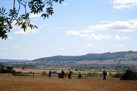
Click image to see photo description.
This enjoyable walk from the market town of Pershore, which has an interesting heritage with the possibility of visiting the medieval Abbey which was founded in 689AD. The walk starts from the ancient Pershore Bridge, follows the River Avon for a short section and offers pleasant woodland and open countryside with only gentle inclines. The first half of the walk follows the The Millennium Way where you will be guided by the distinctive green Millennium Way waymarkers. There is the opportunity to shorten the route to 6 miles.
A - We begin our walk from the ancient bridge in Pershore. There are some information boards in the car park about the history of the bridge which you may find of interest. From the bridge car park on the B4084 south of Pershore (grid ref. SO652451) cross the river on the old bridge used by Cromwell. Cross the road (B4804) and go L to find a kissing gate in the railings just before the new bridge. Take steps down to go with River Avon on your L. Follow the bank of the Avon for around 1/2 mile to find footbridge. Take footbridge to go ahead to cross second footbridge then ahead for a further 1/2 mile to find third footbridge. Take footbridge/gate and continue ahead to take next gate and go R with hedge R to take stile, then further stile to main road ( A4104.)
B - Turn R on main road and on reaching garden centre cross road and go L up slope ( by a house called "The Farthings" ) marked as a bridle path. At the top of the lane go through gate at R of Woodmans Cottage and then ahead between fencing. ignoring first footpath R, to reach cinder path. Go L on cinder path and keep ahead with ditch L to arrive at wood. Enter the ancient Tyddesley Wood through the stile/gate and go ahead down bridle path through the wood. Cross logging road and continue through wood ignoring side paths to maintain line down to take bridge over Bow Brook. Go through gate and up field with fence R to take gate at top corner of field to road (Salters Lane). Go L for 50yds on Salters Lane then take gap R and immediately turn R to walk around edge of field keeping hedge R. If you are walking the shorter route take the first footpath/bridge R and follow instructions from F below. For the longer walk, continue with hedge R and 50yds before field corner take stream bridge R.
C - After 50 paces turn L through gap into field. Go 1/2 R across field centre to find a waymarked footbridge to R of large oak tree. Cross footbridge then ahead over next field to find footbridge to L of Oak tree in top right field corner. Cross footbridge, go 1/2 L to find field corner gap to road. You are now at Crab Common T-junction. Turn left and follow road in direction Crome / Kempsey for approximately 600yds.
D - Here you will leave The Millennium Way to take footpath L through wide gap into field. Continue directly ahead across field keeping hedge far right and then take gap (just to L of large oak tree, by yellow waymarker) to next field. Stay close to R hand edge of this field to go through gap ahead to next field, continuing with hedge R to take corner stile / footbridge over ditch. Continue 1/4 L directly across field towards barns in far distance, then take kissing gate to road.
E - Go L on road passing Lower Drive Estate, then just past the entrance to Besford Court private estate take stile L into playing field . Stay ahead in playing field keeping hedge L and passing white house L to take metal kissing gate to field. The official ordnance survey footpath goes 1/4 R here to a disused overgrown footbridge/stile then across centre of field, however in view of the latter problem it is suggested you go L to follow around edge of field then through gap to continue around edge of next field to top L corner. Follow around R staying in same field, to find stream footbridge L, which you took earlier. You are now back at point C. Continue past this stream footbridge and after approx 200 yds take next footbridge and footpath L.
F - Go directly across centre of field. On reaching hedge, cross small plank bridge and go R between hedges to reach lane. (This is the official footpath but if overgrown it is suggested you avoid crossing the small plank bridge and go right along edge of field keeping hedge left and exit to lane.) Cross lane to take stile to next field then go 1/2 L to take mid fence stile and go 1/2 R across next field to cross stile to road.
G - Turn R on road and after crossing bridge over Bow Brook take footpath R over stile and continue along with brook on R and fruit orchard on left. After a short while you will reach a green five bar metal gate. Turn L here up path and take stile at top continuing directly ahead gently uphill keeping wood R. On reaching track go straight across (ignoring gate L) and stay directly ahead on woodland path maintaining the same line. At the top of the path take the corner stile on L into field, to turn immediately R up field keeping wood right. Take metal gate and stay on track with wood R. The track rises gently to exit alongside large field. Continue along edge of field with wood R. On your L you will have a fine view of Pershore Abbey in the distance, which we can visit near the end of the walk.
H - At the T-junction of paths follow waymarker L past a small copse and go ahead towards grey barn and houses ahead. Go past grey barn to reach road then turn R. Continue a gradual descent down road to T-junction then cross directly over to take New Road in the direction of The Abbey ahead. Follow road around to crossroads and turn R, to pass the Talbot pub on L. At small roundabout ahead, go L and enter Abbey grounds through metal gate R. Here you might like to visit Pershore Abbey Go past front entrance of Abbey and exit grounds by far L corner gate to road. Cross over road to enter the town and go ahead to the main road (B4084) turning R in the direction of Evesham. On your left you will find the 15th century Star Inn which is usually open all day for refreshments. Continue past the Inn to eventually turn L over the old bridge to return to your starting point at the car park.
Maps 

| Ordnance Survey Explorer 190 | Sheet Map | 1:25k | BUY |
| Anquet OS Explorer 190 | Digital Map | 1:25k | BUY |
| Ordnance Survey Digital Map Subscription | |||
| Latest Ordnance Survey Discounts | |||
Other walks nearby
| Walk 2483 | Cradley Circular | easy/mod | 6.0 miles |
| Walk 2365 | Mordiford & Hampton Bishop Circular | easy/mod | 7.6 miles |
| Walk 1211 | The Worcestershire Beacon | easy/mod | 4.5 miles |
| Walk 2817 | The Marcle Ridge from Much Marcle | easy/mod | 7.0 miles |
| Walk 2664 | Herefordshire Beacon from British Camp car park | easy | 2.0 miles |
| Walk 1556 | The Malverns - end to end | hard | 10.0 miles |
| Walk 1658 | Malverns circular from Noirth Hill | very hard | 18.0 miles |
| Walk 2380 | The Malverns from the Gullet | moderate | 12.0 miles |
| Walk 2192 | Wye Valley Walk | easy/mod | 6.6 miles |
| Walk 2326 | Herefordshire Beacon from Hollybush | easy/mod | 6.5 miles |
