Lathkill Dale & Bradford Dale from Back Lane
Peak District Walk
Nat Park - Peak District - Lathkill Dale High Peak
County/Area - Derbyshire
Author - Lou Johnson
Length - 8.2 miles / 13.3 km Ascent - 1000 feet / 303 metres
Time - 5 hours 10 minutes Grade - easy/mod
Maps 

| Ordnance Survey Explorer OL24 | Sheet Map | 1:25k | BUY |
| Anquet OS Explorer OL24 | Digital Map | 1:25k | BUY |
| Ordnance Survey Landranger 119 | Sheet Map | 1:50k | BUY |
| Anquet OS Landranger 119 | Digital Map | 1:50k | BUY |
Walk Route Description
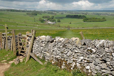
Click image to visit gallery of 12 images.
This varied Peak District walk traverses a section of the pretty Lathkill Dale, offers the chance to visit the village of Youlgreave and includes a section of Bradford Dale. Walking is generally easy and the route is mostly well signed. Opportunities for refreshment are limited and a visit to Youlgreave is necessary to quench your thirst.
Roadside parking is available on Back Lane at grid ref. SK192644 or the small car park a short distance away at SK194644. Having parked follow the well-trodden Limestone Way west towards Monyash. The path is clear and crosses a number of fields to reach Low Moor Plantation. The onward route takes you past Calling Low, where the path deviates to the north of this farm. Shortly afterwards the views open out ahead and you get your first look at Lathkill Dale across to your right.
The path descends steps to the bottom of Cales Dale (grid ref. SK172653), where you turn right and follow the bottom of the dale north. You soon reach Lathkill Dale, which at this point is open and a typical landscape of the Limestone dales. Reaching the main dale, cross the footbridge (grid ref. SK174655) and turn right on a clear path.
Follow this path down the dale, entering Palmerston Wood. The dale loses its open character and you have a pleasant walk through woodland. Alongside is the River Lathkill, which after very dry weather can dry up. Stay on the main path. There is no need to worry about navigation. It is a simple case of following your nose! You reach a bridge below Over Haddon (grid ref. SK202661) after which the character of the dale starts to change.
Conksbury Bridge (grid ref SK211656) is the next landmark. Here you cross the bridge using the road and walk a short way along the lane before taking the first footpath on your left. This leads you through walled fields down to the main road at Alport (grid ref. SK220645). Cross the road and take the signed footpath opposite. This leads you up Bradford Dale with the River Bradford on your right. Continue alongside the River to reach Mawstone Lane (grid ref SK213639).
Cross the river here and take the path on your left. You are now back on the Limestone Way. The river is now on your left and is followed upstream with the village of Youlgreave high above you on your right. At the next footbridge (grid ref. SK208640) you can reach the village centre by following the lane on your right uphill. To continue, cross the River Bradford here and follow the dale upstream with the river once again on your right.
At grid ref. SK199636, the Limestone Way turns right across the River Bradford. Once across ignore the minor path on your right taking the wider path as it climbs uphill to reach a road (grid ref. SK197637). Turn right along the road and follow the pavement past Lomberdale Hall on your left. Shortly after, there is a signed footpath on the other side of the road on your left. Take this uphill to reach another lane (grid ref. SK198641). Ignore the footpath opposite; instead turn left along the road for a short distance to take the Limestone Way signed on your right. This climbs out of the Dale and you are soon back at either the car park or roadside parking. If you are lucky the ice-cream man may be waiting for you to return!
Other walks nearby
| Walk 1945 | Lathkill Dale & Over Haddon circular | easy/mod | 5.7 miles |
| Walk 2503 | Robin Hood's Stride & Stanton Moor | moderate | 11.0 miles |
| Walk 2798 | Bakewell to Edale | mod/hard | 18.0 miles |
| Walk 1146 | Bradford & Lathkill Dales | moderate | 11.3 miles |
| Walk 3046 | Lathkill Dale & Monyash | easy | 4.0 miles |
| Walk 1827 | Ashford-in-the Water,Magpie Mine & Over Haddon | easy/mod | 7.1 miles |
| Walk 1369 | Tissington Trail - Hartington to Parsley Hey | easy | 4.0 miles |
| Walk 3018 | Cracknowl and the Monsal Trail | easy | 3.5 miles |
| Walk 1410 | Minninglow Hill, Roystone Grange and Cardlemere Lane from Gotham | easy/mod | 5.5 miles |
| Walk 1892 | Minninglow & Roystone Rocks | easy/mod | 5.8 miles |
Recommended Books & eBooks
Dark Peak Walks
 Guidebook to 40 walks in the Dark Peak area of the Peak District National Park. 35 circular routes for most abilities, from 8km to 19km, around Edale, Marsden, Fairholmes, Baslow and Castleton, including Kinder Scout and Mam Tor, and 5 longer (25km to 45km) routes highlighting the best of the Gritstone Edges, High Moorland and Deep Valleys.
More information
Great Mountain Days in the Pennines
 An inspirational guidebook to 50 classic walks on the rolling Pennine landscape. The graded routes, between 6 and 13 miles in length, cover classic Pennine fells and moorland such as Whernside, Ilkley Moor and Pendle Hill; exploring the North and South Pennines, Yorkshire Dales, Howgills and Dark Peak. Many routes are also suited to fell running.
More information
Messaging & Social Media
Message Walking Britain and follow the latest news.

Mountain Weather
Stay safe on the mountains with detailed weather forecasts - for iOS devices or for Android devices.