Eccup Reservoir circular
West Yorkshire Walk
County/Area - West Yorkshire - Leeds Wakefield
Author - Yorkshire Water
Length - 4.5 miles / 7.3 km Ascent - 100 feet / 30 metres
Time - 2 hours 20 minutes Grade - easy
Walk Route Description
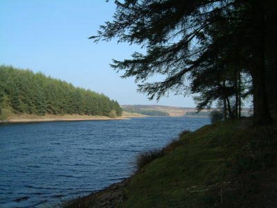
Click image to see photo description.
Eccup village lies to the north of Leeds and this route includes a visit to the quaint village as well as a circuit of Eccup reservoir. The walk includes a mainly forested environment with the area being designated a Site of Special Scientific Interest.
This is one of the free reservoir walks produced by Yorkshire Water who are one of the county's largest landowners, with around 72,000 acres of land spanning National Parks, Areas of Outstanding Natural Beauty, the North York Moors and the Yorkshire Wolds. There is a wide range of walks on offer from gentle strolls around one of their picturesque reservoirs to more adventurous routes. Yorkshire Water have selected some of their top walks for you and split them into three regional packs. Just print them out and off you go.
Each site has its own walk pack that you can easily print out and take along with you. Each pack includes directions to the site, a summary of the walk, a list of facilities available, a detailed route map and route instructions. To download walk descriptions go to Yorkshire Water Walks.
Maps 

| Ordnance Survey Explorer 297 | Sheet Map | 1:25k | BUY |
| Anquet OS Explorer 297 | Digital Map | 1:25k | BUY |
| Ordnance Survey Digital Map Subscription | |||
| Latest Ordnance Survey Discounts | |||
Other walks nearby
| Walk 1380 | Bramham Park & Newton Kyme from Kiddal Bridge | easy/mod | 10.0 miles |
| Walk 2160 | Wetherby to Follifoot without a car | easy/mod | 10.3 miles |
| Walk 1800 | West of Harrogate without a car | easy/mod | 9.0 miles |
| Walk 2802 | Shipley to Ilkley via Ilkley Moor | moderate | 10.8 miles |
| Walk 1408 | Saltaire - the model village | easy | 1.5 miles |
| Walk 1572 | Swinsty Reservoir | easy | 3.0 miles |
| Walk 3114 | Haystacks, Twelve Apostles & Idol Stone of Ilkley Moor | easy/mod | 4.5 miles |
| Walk 1078 | Hampsthwaite & Ripley Park | easy | 7.5 miles |
| Walk 1952 | Five Rise Locks and the River Aire, Bingley | easy | 5.3 miles |
| Walk 2319 | Ilkley to Bingley | easy/mod | 7.0 miles |
