Hawnby, Bilsdale West and Wetherhouse Moors
North York Moors Walk
Nat Park - North York Moors - North York Moors West
County/Area - North Yorkshire
Author - Andy Chaplin
Length - 8.3 miles / 13.5 km Ascent - 1220 feet / 370 metres
Time - 5 hours 20 minutes Grade - moderate
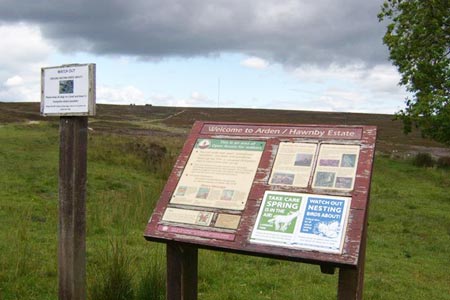
Walk Route Description
Click image to visit gallery of 2 images.
This North York Moors walk, north of the village of Hawnby, makes a circuit of Hawnby, Bilsdale West and Wetherhouse Moors and gives views into upper Ryedale, Bilsdale and Ladhill Gill. There is plenty of off-road parking (grid ref. SE539916) and the start of the walk is very easy to follow when you realise that you are heading for Bilsdale Transmitter. What seems unlikely is that it is actually over 3 miles away. Anyway, take the left hand moors track and follow it northwards up Hawnby Moor.
The views are mainly behind you - of Hawnby Hill and Easterside Hill - so keep looking back as you continue walking north. Keep left where a track bears off right (grid ref. SE541930) towards Sike House and carry on past Low Thwaites. Shortly after this the bridleway takes to a ditch on your right, which you must take to get through the next gate, but rejoins the track again shortly afterwards.
Carry on to the transmitter (grid ref. SE553961), which gives TV and radio signals to North Yorkshire, Teeside and County Durham. Then take the access road back down to Stingamires. There are now good views down into Bilsdale as you pass Stingamires then take the path off right at grid ref. SE563957 past Coniser to Stone House and then Fangdale Beck.
In the village you can carry straight on over the beck then turn right on the road to Malkin Bower. There is a path signposted off on the right (grid ref. SE569944) that follows the wall up on your right to the site of old quarries and you pick up the track coming up from Malking Bower as it makes its way up to open country again.
Go through the gate at the top, turn left on a moors track then take the middle of three tracks over the moor. The best defined track is the one on left - and it is no problem if you take this - but after 250 metres when you reach a gate follow the wall off to the right and you will pick up the "middle" track that heads south west down Shaw Side.
Carry straight on at the junction with bridleways/tracks going to Hazleshaw House on your right or Wethercote Farm on your left, and just past Bumper Castle the track swaps from the left of a wall to the right when it goes through a gate. It becomes less clearly defined when you leave the open country shortly afterwards but for some time now you should have been able to see the place where you are parked off to your right - so you can see where you are heading.
When you get to a small field on your right surrounded by a disintegrating stone wall and a track leading off uphill on the left to Crow Nest you need to head down to the Ladhill Beck. The path was not well defined here when I walked it so you may have to search for the footbridge over the beck. If it is a bit of a struggle to find the path don't worry, just head up hill and there is a new gate back into open country on the other side of the beck at grid ref SE545917 from where the path back to the parking at Sunley Slack is easy to follow.
Maps 

| Ordnance Survey Explorer OL26 | Sheet Map | 1:25k | BUY |
| Anquet OS Explorer OL26 | Digital Map | 1:25k | BUY |
| Ordnance Survey Digital Map Subscription | |||
| Latest Ordnance Survey Discounts | |||
Other walks nearby
| Walk 1524 | Cold Kirby, Rievaulx Bridge & Wass | moderate | 12.5 miles |
| Walk 1473 | Hollin Hill to Square Corner by the Cleveland Way | moderate | 9.5 miles |
| Walk 1497 | High Paradise around Arden Great Moor from Square Corner | moderate | 14.3 miles |
| Walk 1920 | Rievaulx Moor from Cowhouse Bank | moderate | 9.5 miles |
| Walk 1544 | Chop Gate, Round Hill & Stumps Cross | moderate | 10.1 miles |
| Walk 3581 | Gormire Lake from Sutton Bank National Park Centre | easy/mod | 3.4 miles |
| Walk 3718 | Scarth Wood Moor from Osmotherley | easy/mod | 6.0 miles |
| Walk 1542 | The Rudland Ridge from Ousegill Bridge | moderate | 10.1 miles |
| Walk 1525 | Beck Dale & Rievaulx from Helmsley | moderate | 9.8 miles |
| Walk 1498 | Kilburn White Horse, Cold Kirby, Murton, & Sutton Bank | moderate | 14.0 miles |
Recommended Books & eBooks
Trail and Fell Running in the Yorkshire Dales
 Guidebook to 40 of the best trail and fell runs in the Yorkshire Dales National Park. Ranging from 5 to 24 miles, the graded runs start from bases such as Ribblehead, Dent, Sedbergh, Malham and Grassington and take in the region's diverse delights, from castles and waterfalls to iconic mountains such as Whernside, Ingleborough and Pen Y Ghent.
More information
