Walk 1629 - printer friendly version
The River Arun & South Stoke Walk
Author - Lou Johnson
Length - 4.6 miles / 7.5 km
Ascent - 250 feet / 76 metres
Grade - easy
Start - OS grid reference TQ026117
Lat 50.895677 + Long -0.54247868
Postcode BN18 9LR (approx. location only)
This short walk explores a section of the River Arun and visits the attractive church at South Stoke.
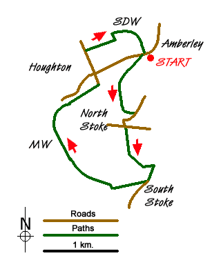
Exit Amberley station and walk down to the main road. Turn left to Houghton Bridge over the River Arun. Half way across the bridge take the footpath on the left. This leads you alongside the River Arun on the east bank of the river. Reaching a footbridge (grid ref TQ021113) cross the dyke and stile, and turn left away from the river. The path leads to Stoke Road (grid ref. TQ024109). Turn right along the road into the village of North Stoke. Reaching a T-junction turn left to take a path on the right within a few yards.
This path crosses a small suspension bridge continuing to reach the River Arun and a road bridge close to South Stoke (grid ref. TQ026101). Walk up past St Leonard's church to take the bridleway on the right just after South Stoke Farm. This bridleway then follows the west bank of the River all the way back to Houghton. At grid ref. TQ014103 the Monarch's way comes in from the left. Leave the riverside path and climb into Houghton. Reaching the main road through the village turn right and then almost immediately along a lane. Follow this north to reach the South Downs Way which crosses this lane at grid ref. TQ016118. Turn right onto the SDW, cross the footbridge over the River Arun and then follow the north bank back to Amberley station.
Messaging & Social Media
Message Walking Britain and follow the latest news.

Mountain Weather
Stay safe on the mountains with detailed weather forecasts - for iOS devices or for Android devices.