Flouch & Winscar circular
Peak District Walk
Nat Park - Peak District - Black Hill Dovestone
County/Area - South Yorkshire
Author - Andy Chaplin
Length - 9.0 miles / 14.6 km Ascent - 800 feet / 242 metres
Time - 5 hours 20 minutes Grade - easy/mod
Maps 

| Ordnance Survey Explorer OL1 | Sheet Map | 1:25k | BUY |
| Anquet OS Explorer OL1 | Digital Map | 1:25k | BUY |
| Ordnance Survey Landranger 110 | Sheet Map | 1:50k | BUY |
| Anquet OS Landranger 110 | Digital Map | 1:50k | BUY |
Walk Route Description
Click image to visit gallery of 3 images.
The Peak District walk described here starts at the Yorkshire Water car park (grid ref. SE201010) just south of the Flouch roundabout and is initially the same as Walk 1401. It covers a circuit that is north and west of Flouch and includes sections parallel to the Woodhead Road and comes back along the old Woodhead railway line, so the route may not be for everyone. On the plus side you get to see the old Woodhead line tunnel entrance, Winscar reservoir and part of the upper Don River valley.
Leave the car park at the south end, cross the road and go down a track through Langsett Woods on Brook House lane. After 400 metres, where the main track goes left, go down a few yards to the right to a signpost and then follow the middle path which is marked as a bridleway to Swinden. The stream is on your right and you come out of the woods at a gate and then follow a walled bridleway.
Continue along this bridleway and take the right hand route at a junction after a further 200 metres. This is Swinden Lane which leads to a stile into open country (grid ref. SE184008). Cross the stile and take the track on your right up to the A628, Woodhead Road. There is a path on the verge up to the Dog & Partridge where you cross over onto the Snow Road track.
The path climbs up towards and around South Nab then turns off right towards Upper Windledon Reservoir. There are good views down to Dunford Bridge and the Barnsley Boundary Walk (which we are following) takes the road down to the Woodhead tunnels.
At Dunford Bridge take the old railway track east towards Hazlehead. It is easy walking all the way to Cote Bank Bridge. Go off left to cross over the bridge to pick up the path leading south towards Swinden. It is an interesting diversion at Cote Bank Bridge to go down to the Don on the sunken, walled and paved path.
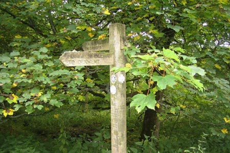
At the old Woodhead road turn left then take the path south to the new Woodhead road, cross over and take the path south through the wood back to the almost-four-fingered signpost and then back to the car park.
Other walks nearby
| Walk 1581 | Langsett Reservoir | easy | 3.0 miles |
| Walk 3401 | From Langsett to Crowden via Woodhead | moderate | 11.0 miles |
| Walk 2826 | Winscar Reservoir circuit from Dunford Bridge | moderate | 8.9 miles |
| Walk 2726 | Penistone Circular from Scout Dike Reservoir | moderate | 8.3 miles |
| Walk 2328 | Penistone to Shepley linear | easy/mod | 8.0 miles |
| Walk 1523 | Broomhead Moor & Ewden Beck | easy/mod | 6.0 miles |
| Walk 2238 | Thurgoland Boundary Walk Oxspring | easy/mod | 8.6 miles |
| Walk 1522 | Back Tor, Bradfield Moors and Reservoirs | moderate | 11.0 miles |
| Walk 1687 | Broomhead & Howden Moors | moderate | 12.4 miles |
| Walk 3049 | Bleaklow Stones from Derwent Valley | mod/hard | 12.0 miles |
Recommended Books & eBooks
Walking in the Peak District - White Peak East
 Guidebook describing 42 half-day and day walks in the limestone landscapes of Derbyshire's White Peak, part of the Peak District National Park. One of two volumes, this book covers the east of the region, with potential bases including Bakewell, Eyam, Castleton, Birchover, Matlock and Wirksworth.
More information
Dark Peak Walks
 Guidebook to 40 walks in the Dark Peak area of the Peak District National Park. 35 circular routes for most abilities, from 8km to 19km, around Edale, Marsden, Fairholmes, Baslow and Castleton, including Kinder Scout and Mam Tor, and 5 longer (25km to 45km) routes highlighting the best of the Gritstone Edges, High Moorland and Deep Valleys.
More information
Messaging & Social Media
Message Walking Britain and follow the latest news.

Mountain Weather
Stay safe on the mountains with detailed weather forecasts - for iOS devices or for Android devices.