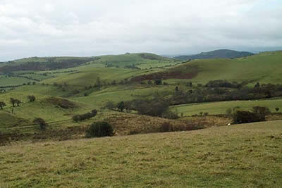
Shelve & the Stiperstones from The Bog
Shropshire Hills Walk
Region - Shropshire Hills
County/Area - Shropshire
Author - Lou Johnson
Length - 9.0 miles / 14.6 km Ascent - 1405 feet / 426 metres
Time - 5 hours 50 minutes Grade - moderate
Walk Route Description
Click image to visit gallery of 4 images.
This walk is in two contrasting sections. Firstly green rolling hills so typical of western Shropshire with a complete change of character in the final stages. Here the high ground offers superb views and tough going underfoot for those lacking decent boots! Adequate parking is available in the rather strangely named hamlet called "The Bog" (grid ref. SO357978). Formerly a thriving mine, there are a few remains which can be inspected with signage detailing the history.
Leaving the parking area take the bridle track that heads west to reach a wood. Stay on the northern boundary of this wood following the way marked path that continues west to cross a stream (grid ref. 343981). Here take the left fork to climb over the southern flank of Grit Hill. Continue along the northern side of Shelve Pool to reach Grit Farm.
From the Farm maintain a westerly direction with good vies ahead of Carndon Hill and Stapeley Hill to reach the A488 (grid ref. 320980). The waymarking is poor and the onward route unclear but with a little detective work one eventually locates the path that heads roughly north-east to climb to the woods that cover the summit of Shelve Hill.
Like many woods there are paths everywhere and it is best to keep to the eastern edge of the wood. This makes it easier to locate the path that cuts down east into the pleasant village of Shelve. Stay on the lane for about half a mile past the Church to where the lane turns sharp right. Here take the footpath that leads directly across fields to Tankerville. Here the scenery changes and ahead lie the steep slopes of the western flanks of the Stiperstones.
Reaching the lane turn right to climb steeply for a short way before taking the first bridleway on your left. The track climbs steadily past a few signs of habitation before reaching open country. As you climb the views to the north are very impressive with the deep valleys looking quite spectacular.
Reaching the ridge turn right. The climbing is not over yet although the summit tors can be clearly seen ahead. The onward section of the path is very rocky and is not suitable for those with flimsy footwear. There are three main tors - the Devil's Chair, Manstone Rock (the summit) and Cranberry Rock - all of which offer simple scrambles to reach the highest points. The views are good with the Long Mynd to the east and the hills and mountains of Shropshire and mid-Wales providing plenty of interest.
Reaching Cranberry Rock stay with the main ridge path that heads just west of south to reach a lane. Cross the lane and follow the waymarked footpath across fields back to "the Bog".
Maps 

| Ordnance Survey Explorer 216 | Sheet Map | 1:25k | BUY |
| Anquet OS Explorer 216 | Digital Map | 1:25k | BUY |
| Ordnance Survey Explorer 217 | Sheet Map | 1:25k | BUY |
| Anquet OS Explorer 217 | Digital Map | 1:25k | BUY |
| Ordnance Survey Digital Map Subscription | |||
| Latest Ordnance Survey Discounts | |||
Other walks nearby
| Walk 3395 | The Stiperstones Ridge | easy/mod | 5.5 miles |
| Walk 3422 | Ratlinghope & the Stiperstones from the Knolls | moderate | 7.5 miles |
| Walk 3596 | The Stiperstones from the Knolls | easy | 2.0 miles |
| Walk 3045 | The Stiperstones & Blakemoor Flat from the Knolls | easy/mod | 5.0 miles |
| Walk 1072 | Stiperstones low level circular | easy | 4.0 miles |
| Walk 2745 | Betchcott Hills & Pole Bank | moderate | 9.0 miles |
| Walk 1205 | Adstone Hill, Medlicott and the Long Mynd | moderate | 9.5 miles |
| Walk 3529 | Stiperstones from Snailbeach | easy/mod | 7.0 miles |
| Walk 1871 | Snailbeach & the Stiperstones | moderate | 7.0 miles |
| Walk 2814 | Corndon Hill from Priest Weston | easy | 1.5 miles |
Recommended Books & eBooks
Hillwalking in Shropshire
 Guidebook to 32 walking routes in Shropshire in the West Midlands. The routes range from 3 miles (5km) to 12 miles (19km), taking in highlights such as The Wrekin, Wenlock Edge, Long Mynd and Stiperstones, Castle Ring and Bury Ditches. Many routes start near delightful towns and villages including Church Stretton, Ludlow and Bishops Castle.
More information
