Ratlinghope & the Stiperstones from the Knolls
Shropshire Hills Walk
Region - Shropshire Hills
County/Area - Shropshire
Author - Lou Johnson
Length - 7.5 miles / 12.2 km Ascent - 1400 feet / 424 metres
Time - 5 hours 10 minutes Grade - moderate
Walk Route Description
Click image to visit gallery of 6 images.
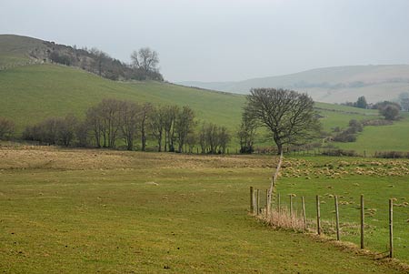
The Stiperstones with their quartzite outcrops offer superb views over the surrounding countryside including the Long Mynd, Corndon Hill and mid-Wales. The summit of the ridge is the second highest point in Shropshire and more interesting than its competitors. Running north south the eastern flank consists of gentle slopes whilst to the west deep, steep sided valleys cut into the ridge to form great "amphitheatres".
This walk starts from the Knolls Car Park (grid ref SO369976). Here an information board illustrates the geology and wildlife of the Stiperstones, an area of upland moorland, which is a National Nature Reserve and part of the Shropshire Hills Area of Outstanding Natural Beauty.
From the car park return to the road and go straight across to the stile. Follow this path keeping the field boundary to your left. Reaching Knolls Farm, go through the metal gate in the hedge and continue to reach a path junction (Grid ref. SO365974). Turn left here over a small wooden bridge and a short section of boardwalk. Walk in roughly the same direction across a field with little sign of a path and which is also quite wet underfoot. Cross a stile and continue on the path, which is now much clearer. Reaching a grassy ridge, cross the stile, turn right along a track and then veer off half left to descend across the hillside with a fence to your right. Continue in roughly the same direction to reach a lane (Grid ref. SO372963).
Turn left along the lane. Walk past Kinnerton farm. Two hundred metres past the farm turn left onto a broad track and cross the stream. Do not go through the first gate on your right instead take the next right and with the fence on your immediate right continue across the field to a stile (Grid ref. SO384964). Cross this and continue to the road (Grid ref. SO388964). Turn left along the road using the grass verge. Where the road bends left continue ahead on the signed footpath. This leads you to the Horseshoe Inn, Bridges. Go through the car park and turn right onto the narrow tarmac lane leading to Ratlinghope.
About four hundred metres up the lane turn left onto the signed footpath (The Shropshire Way). This takes you through pleasant woodland alongside Darnford Brook. Reaching a bridge continue northwards with the stream still on your right to reach a ford and footbridge (grid ref. SO401969). Turn left here and follow the clear track as is climbs up to a col before descending again to the a road (Grid ref. SO398976). Turn left along the road and, almost immediately, take the narrow lane on your right.
This lane leads uphill to pass by Near Gatten Farm with the tarmac lane becoming a track. Pass through a gate and begin to climb. Where the track begins to level off, take the footpath on your right. This leads across fields to another track (Grid ref. SO388986). Turn left along the track and descend to a tarmac lane. Go straight here and take the lane on your right signed "the Hollies". Walk up this lane past the farm to reach a junction of bridleways (Grid ref. SO377991). Turn right here and after a short distance bear left at a signpost and climb up to a gate. Go through this gate and maintain direction to reach open country (Grid ref. SO374996).
Continue straight ahead to reach the main ridge path near to Shepherd's Rock, one of the many quartzite outcrops you will pass during the remainder of the walk. Turn left onto the main ridge path and follow this climbing gently towards the Devil's Chair and Manstone Rock. The views are now superb. On your right you are able to see the deep steep-sided valleys that cut into the ridge. Further afield the views extend into mid-Wales. The path becomes quite rocky underfoot and progress slows. However you soon arrive at Manstone Rock with its concrete trig column. This is the highest point on the ridge (536 m). Staying with the main ridge path you start to descend with the option of making a short diversion to the Cranberry Rock. Soon the path reaches the Knolls car park and the end of the walk.
Maps 

| Ordnance Survey Explorer 216 | Sheet Map | 1:25k | BUY |
| Anquet OS Explorer 216 | Digital Map | 1:25k | BUY |
| Ordnance Survey Explorer 217 | Sheet Map | 1:25k | BUY |
| Anquet OS Explorer 217 | Digital Map | 1:25k | BUY |
| Ordnance Survey Digital Map Subscription | |||
| Latest Ordnance Survey Discounts | |||
Other walks nearby
| Walk 1809 | Shelve & the Stiperstones from The Bog | moderate | 9.0 miles |
| Walk 2083 | Linley Hill and Linley from The Bog | moderate | 8.5 miles |
| Walk 2745 | Betchcott Hills & Pole Bank | moderate | 9.0 miles |
| Walk 1205 | Adstone Hill, Medlicott and the Long Mynd | moderate | 9.5 miles |
| Walk 1072 | Stiperstones low level circular | easy | 4.0 miles |
| Walk 3529 | Stiperstones from Snailbeach | easy/mod | 7.0 miles |
| Walk 1871 | Snailbeach & the Stiperstones | moderate | 7.0 miles |
| Walk 2054 | Linley Hill & Beeches from Wentnor | easy/mod | 7.0 miles |
| Walk 1832 | The Hollies & Poles Coppice from near Habberley | easy/mod | 5.0 miles |
| Walk 2814 | Corndon Hill from Priest Weston | easy | 1.5 miles |
Recommended Books & eBooks
Hillwalking in Shropshire
 Guidebook to 32 walking routes in Shropshire in the West Midlands. The routes range from 3 miles (5km) to 12 miles (19km), taking in highlights such as The Wrekin, Wenlock Edge, Long Mynd and Stiperstones, Castle Ring and Bury Ditches. Many routes start near delightful towns and villages including Church Stretton, Ludlow and Bishops Castle.
More information
