Great Hill & Anglezarke Reservoir
Lancashire Walk
County/Area - Lancashire
Author - Lou Johnson
Length - 9.0 miles / 14.6 km Ascent - 1200 feet / 364 metres
Time - 5 hours 40 minutes Grade - moderate
Walk Route Description
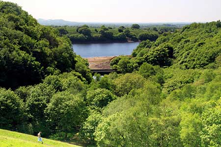
Click image to see photo description.
Starting from Anglezarke Reservoir this walk explores the West Pennine Moors including Great Hill and Spitlers Edge. The route explores an area that was once a hive of activity with farms, mines, and small quarries. The walk also passes three reservoirs that were built to provide water to the expanding urban populations and industries of Lancashire.
The start is the Anglezarke car park (grid ref. SD620161). After parking return to the entrance and follow the tarmac access road down to the shore of Anglezarke Reservoir. Continue along the access road with the reservoir on your right. Continue ahead when a road joins from the left. At the next junction (with a small green) bear left and follow the road uphill to pass beside Yarrow Reservoir on your tight. Continue to where the road bends sharp right across Alance Bridge. Go through the metal gate to join a track (grid ref. SD627160).
The track soon crosses a bridge to the east bank of the river and continues to reach a fork at the foot of Lead Mines Clough. On your left is a memorial to a Welling bomber crew that crashed in 1943. To continue bear right at the fork and climb up to a gate. Continue ahead on the track for just over two kilometres to reach the ruined farm of Lower Hempshaw (grid ref. SD647164). After 200 metres the track bends right with the ruins of Upper Hempshaw on your left. Turn left off the track and join a rising grassy path with a wall to your left. Continue ahead through a wall gap and continue to climb up to a cross wall (grid ref. SD654162).
Turn left onto a paved path that initially climbs across Hordern Pasture to a stile. Cross the stile and then continue over Spitlers Edge. After a short descent, the path crosses Redmond's Edge with Great Hill appearing ahead. Continue to another stile and then make the short ascent to the summit of Great Hill with its stone wall shelter (grid ref. SD646191). Take time to enjoy the view across the West Pennine Moors. Turn left onto an initially paved path that descends to a track (grid ref. SD640190). Bear right onto the track Just after passing the ruins of Drinkwaters Farm pass through trees to reach a fork (grid ref. SD634192). Bear left (signed to White Coppice).
After passing the ruins of Coppice Stile Farm, the path drops steeply before swinging left beside the Goit, which is an aqueduct linking Roddlesworth and Anglezarke Reservoirs. Continue ahead at the bridge on your right and follow the valley path passing Stronstrey Bank on your left before the path reaches a lane (grid ref. SD616179). Bear left and then right through a kissing gate. The onward path passes through trees with the reservoir down to your right, crosses fields before entering more woodland. The path descends briefly to a stream before rising to a junction (grid ref. SD618170). Turn left up a grassy bank and follow the path above High Bullough Reservoir. At the end of the reservoir the path descends to a track. Bear left and follow it back along Anglezarke Reservoir to the car park access drive. Turn left back to the start.
Maps 

| Ordnance Survey Explorer 287 | Sheet Map | 1:25k | BUY |
| Anquet OS Explorer 287 | Digital Map | 1:25k | BUY |
| Ordnance Survey Digital Map Subscription | |||
| Latest Ordnance Survey Discounts | |||
Other walks nearby
| Walk 2245 | Winter Hill & Rivington Pike | easy/mod | 6.0 miles |
| Walk 2532 | Rivington Pike | moderate | 8.0 miles |
| Walk 2108 | Darwen's Jubilee Tower from Abbey Village | easy/mod | 9.0 miles |
| Walk 2732 | Darwen Tower & West Pennine Moors | easy/mod | 5.5 miles |
| Walk 2584 | Turton & Entwistle and Wayoh Resrs. from Jumbles | moderate | 10.0 miles |
| Walk 2564 | Calf Hey, Ogden & Holden Wood Reservoirs | moderate | 7.5 miles |
| Walk 2624 | Tor Hill & High Moss, Nr Haslingden | moderate | 7.0 miles |
| Walk 1747 | Oswaldtwistle Moor | easy/mod | 6.0 miles |
| Walk 3619 | Ribchester Circular | easy/mod | 7.0 miles |
| Walk 3691 | Scout Moor from Ashworth Moor Reservoir | easy/mod | 4.5 miles |
Recommended Books & eBooks
Walking on the West Pennine Moors
 This guidebook describes 30 walks on the West Pennine Moors, around Blackburn, Darwen, Chorley and Bolton, home to some of the most inspiring and exhilarating walking country. The walks range from short, easy rambles to more challenging hikes covering a variety of terrain, all of it easily accessible for day walking.
More information
