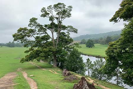
Chatsworth Park from Rowsley
Peak District Walk
Nat Park - Peak District - Abney Moor Chatsworth
County/Area - Derbyshire
Author - Lou Johnson
Length - 7.3 miles / 11.9 km Ascent - 900 feet / 273 metres
Time - 4 hours 30 minutes Grade - easy/mod
Walk Route Description
Click image to see photo description.
Starting from Rowsley, where the Wye and Derwent Valleys meet, this Peak District walk climbs steadily out of the Wye Valley with some excellent views. The route continues past Calton Plantations to reach the estate village of Edensor. Entering Chatsworth Park, there are views to Chatsworth House before turning south down the Derwent Valley back to Rowsley.
The start is the small car park on Old Station Close (grid ref. SK258659) on the south side the A6. After parking walk back to the A6 and turn left. Continue to the Peacock and turn right onto Church Lane. Continue uphill out of the village. The lane soon narrows and becomes a track (bridleway) with good views across the Wye Valley on your left. After a kilometre from the A6 the bridleway bears right with a plantation on the left. At the next junction (grid ref. SK250668), follow the bridleway left. Continue ahead to reach a metal barrier (grid ref. SK244669) where you fork right (signed Chatsworth) to enter Rowsleymoor Wood.
The path follows a twisting route through the trees to enter open pasture. Continue downhill to pass between the Calton Plantations. Once through the trees, the route turns sharp right. Reaching a grassy track bear left and continue towards New Piece Wood. A short diversion to the right leads to the Russian Cottage which is part of the Chatsworth Estate. Continue through New Piece Wood and head downhill passing to the left of a large copse before reach Edensor with its neat cottages and church. Pass the tea cottage on your right and continue to the B6012. Cross with care and take the clear path opposite.
Continue along this path to reach a bridge across The River Derwent (grid ref. SK257702). Do not cross the bridge and turn sharp right. Follow the grassy path which roughly parallels the River Derwent. You are now on the Derwent Valley Heritage Way DVHW). Continue south using the upper path to pass a ruined mill beside the river (grid ref. SK259688). Continue on the upper path to reach the B6012. Turn left past a cattle grid and take the right fork towards Calton Lees car park.
Continue past the carpark and garden centre (on your right). Follow the lane as it bends right to a junction. Turn sharp right and just after the last building follow the waymarks for DVHW. The route heads south across pastures with the River Derwent on your left. After just over two kilometres of easy walking you reach Church Lane in Rowsley. Turn left to the A6 and then left again back to the start.
Maps 

| Ordnance Survey Explorer OL24 | Sheet Map | 1:25k | BUY |
| Anquet OS Explorer OL24 | Digital Map | 1:25k | BUY |
| Ordnance Survey Digital Map Subscription | |||
| Latest Ordnance Survey Discounts | |||
Other walks nearby
| Walk 2218 | Cocking Tor from near Matlock | moderate | 9.5 miles |
| Walk 1460 | Hardwick Hall park | easy | 2.5 miles |
| Walk 2627 | Cromford to Bakewell | moderate | 11.5 miles |
| Walk 3557 | Chatsworth Park from Calton Lees | easy/mod | 6.5 miles |
| Walk 2899 | Cromford Canal & Black Rocks from High Peak Junction | easy/mod | 6.8 miles |
| Walk 1539 | Flask Edge and Bar Brook Moor from Shillito Wood | moderate | 9.4 miles |
| Walk 2456 | Flask Edge from Dronfield Woodhouse | moderate | 10.0 miles |
| Walk 2559 | Stanton Moor & The Nine Ladies Stones from Winster | moderate | 9.0 miles |
| Walk 3196 | Stanton Moor and Robin Hood's Stride from Winster | easy/mod | 7.0 miles |
| Walk 2136 | Wensley & Brightgate | easy/mod | 6.2 miles |
Recommended Books & eBooks
Walking in Derbyshire
 Walking guidebook to 60 circular day walks in Derbyshire and the Peak District. Includes the Derwent, Wye and Trent river valleys, near Derby, Matlock, Glossop, Bakewell and Ripley. Routes range from easy to moderate and are between 4 and 14km (2 to 10 miles). Walks focus on places of interest, from Stone Age forts to castles to grand estates.
More information
Great Mountain Days in the Pennines
 An inspirational guidebook to 50 classic walks on the rolling Pennine landscape. The graded routes, between 6 and 13 miles in length, cover classic Pennine fells and moorland such as Whernside, Ilkley Moor and Pendle Hill; exploring the North and South Pennines, Yorkshire Dales, Howgills and Dark Peak. Many routes are also suited to fell running.
More information
