Stanton Moor & The Nine Ladies Stones from Winster
Peak District Walk
Nat Park - Peak District - Stanton Moor Winster
County/Area - Derbyshire
Author - Mike Bexley
Length - 9.0 miles / 14.6 km Ascent - 1495 feet / 453 metres
Time - 6 hours 0 minutes Grade - moderate
Walk Route Description
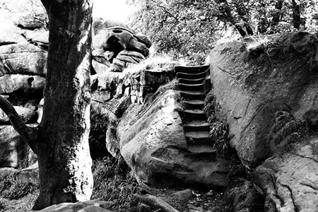
Click image to see photo description.
For the outward route this Peak District walk takes a longer scenic route through Clough Wood to Stanton Moor. On the way back it visits a vicar's hobby at Birchover and includes a section of the Limestone Way.
The walk starts from the village of Winster with its old Market Hall standing in the middle of the main street. This was the first property to be purchased by The National Trust. After parking locate Painters Lane (Grid ref SK244607) situated on the road east of the village. Go down this lane keeping to the fence and ignoring the first left turn. Climb over the stile and follow the feint path to the end of the narrow field. Climb over the stile in the top left hand corner then immediately turn right dropping down to a further stile at the edge of the woods.
Walk up the muddy wide path ahead through the woods and then continuing in the same direction across the first field. Go through the hedge. Do not take the farm track ahead but walk on the side of the hill, east towards the woods ahead of you. The stile is hidden behind a tree at the corner of the fence (Grid ref. 252614). Maps indicate a path sweeping left through the woods to Clough Lane. However this path is so little used that it has become an overgrown jungle trail and very difficult to follow. Ahead of you is a well- defined path that drops down through the old woods to join the lower path at approximately grid reference 254614. Turn left along this lower path and follow it until it reaches a limestone vehicle track. Here you turn left uphill then prior to the gate turn left again along a bridleway (Grid ref. 258618).
On reaching Clough Lane turn left. Go right at the first footpath uphill to Barn Farm where you should look out for the Peacocks. Proceed through the farm to the road ahead. Turn right on the road. Ignore the first footpath on the left, instead go downhill and take the next very wide path that climbs up to the old quarry. Continue on this path following the fence. You pass many interesting rock formations some with carvings. A carving of a Y over a crown dated 1826 is in memory of The Duke of York. There are also good views across the valley to Matlock. The path ends at a tower built in tribute to Earl Grey who made a major contribution to the Reform Bill. He also liked his tea!
Cross over the stile and turn right. The path leads you to The Nine Ladies stone circle, one of over sixty Bronze Age sites on this moor. The single stone standing on its own on the other side is called The King Stone. Leave The Nine Ladies via the path southward,. This crosses Stanton Moor. Turn right at the path junction (grid ref 246628). This path takes you past the Cork Stone with footholds cut into its side. The path terminates at a road. Turn left and proceed down the road passing the entrance to a quarry. Just before the corner turn right onto a footpath. This drops down behind the houses of Birchover ending opposite The Druid Inn.
Walk down the lane to the left of the Inn and look out for a very narrow path at the end of the Inn's car park. This leads up to Rowtor Rocks. The Reverend Thomas Eyre, a local vicar, carved these rocks to form caves, steps, armchairs and rooms. A word of warning - there are many holes in the path and unguarded edges that could lead to a fall.
Return to the lane, go past the church. Then at the end of the large house turn left. This path joins the drive to Rocking Stone Farm. At the top go through the gap to the left of the gate (grid ref 233619). The path now drops through the bushes opposite and down the fields to another gap to the left of a gate and a finger post pointing right. At first walk to the left of the hedge then bear left, keeping to the left of the hedge corner. Try and spot ahead of you at the top of the next field a low stone building with a wooden pylon next to it.
Continue across the fields to a small gate and a short stone path leading away from it. Then continue through the hedges to climb up to the low building. Go through the gap and cross the field to the small gate in the hedge leading into Birchover Lane. Turn right then left into Elton Road and walk as far as the cemetery on the right (grid ref 236608). Go up the footpath at the side of the cemetery. Cross over the next road to continue up the lane. Turn left onto the wide Limestone Way. On reaching the road turn left then continue on The Limestone Way. When the path reaches a gate crossing it prior to Luntor Rocks, drop down the fields and go through a stone gap in the left hedge to follow the clear path back to Winster.
Maps 

| Ordnance Survey Explorer OL24 | Sheet Map | 1:25k | BUY |
| Anquet OS Explorer OL24 | Digital Map | 1:25k | BUY |
| Ordnance Survey Digital Map Subscription | |||
| Latest Ordnance Survey Discounts | |||
Other walks nearby
| Walk 2503 | Robin Hood's Stride & Stanton Moor | moderate | 11.0 miles |
| Walk 1410 | Minninglow Hill, Roystone Grange and Cardlemere Lane from Gotham | easy/mod | 5.5 miles |
| Walk 1892 | Minninglow & Roystone Rocks | easy/mod | 5.8 miles |
| Walk 2218 | Cocking Tor from near Matlock | moderate | 9.5 miles |
| Walk 1569 | Lathkill Dale & Bradford Dale | easy/mod | 8.2 miles |
| Walk 1589 | Lathkill & Bradford Dales (short version) | easy/mod | 6.0 miles |
| Walk 1590 | Monyash & Lathkill Dale | easy/mod | 8.2 miles |
| Walk 1378 | Carsington Circular | easy | 4.5 miles |
| Walk 1379 | Carsington and Harboro Rocks | easy/mod | 5.8 miles |
| Walk 2993 | Carsington, Brassington & Cromford and High Peak Railway from Middleton | moderate | 9.5 miles |
Recommended Books & eBooks
Walking in Derbyshire
 Walking guidebook to 60 circular day walks in Derbyshire and the Peak District. Includes the Derwent, Wye and Trent river valleys, near Derby, Matlock, Glossop, Bakewell and Ripley. Routes range from easy to moderate and are between 4 and 14km (2 to 10 miles). Walks focus on places of interest, from Stone Age forts to castles to grand estates.
More information
Great Mountain Days in the Pennines
 An inspirational guidebook to 50 classic walks on the rolling Pennine landscape. The graded routes, between 6 and 13 miles in length, cover classic Pennine fells and moorland such as Whernside, Ilkley Moor and Pendle Hill; exploring the North and South Pennines, Yorkshire Dales, Howgills and Dark Peak. Many routes are also suited to fell running.
More information
