Winterburn Reservoir circular
Yorkshire Dales Walk
Nat Park - Yorkshire Dales - Malhamdale
County/Area - North Yorkshire
Author - Allan Friswell
Length - 6.0 miles / 9.8 km Ascent - 700 feet / 212 metres
Time - 3 hours 40 minutes Grade - easy
Maps 

| Ordnance Survey Explorer OL2 | Sheet Map | 1:25k | BUY |
| Anquet OS Explorer OL2 | Digital Map | 1:25k | BUY |
| Ordnance Survey Landranger 103 | Sheet Map | 1:50k | BUY |
| Anquet OS Landranger 103 | Digital Map | 1:50k | BUY |
Walk Route Description
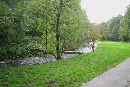
Click image to visit gallery of 3 images.
This walk covers grassland, moorland and has views of the pretty little reservoir itself. I would term this walk as "easy" but for the many areas of very boggy ground and the almost impassable beck (grid ref. SD946612). I generally park by the bridge taking the Malham road to the left at grid ref. SD933585. You may consider parking with consideration of the residents further on in the hamlet itself.
From the T Junction (grid ref SD934586) head up the dead-end road through the hamlet, crossing a cattle grid and then a bridge. Follow the road to the right, still alongside the beck. As the road climbs to the reservoir keeper's house, turn left up the farm road to Way Gill Farm, signed Reservoir Head. Do not enter the farmyard but turn into the field on the right and cross to a gate to the immediate right of the house. Go through it, turn right and gently descend, the reservoir being straight ahead. Go over the stile (grid ref. SD942605). Turn left and follow the track towards High Cow House, then take the stile on the right at grid ref. SD943607 immediately after crossing a small beck.
Head down field-side parallel with the beck to approach the reservoir. Turn left along the bottom of the field and go on through a couple more gates and stiles above the upper reach of the reservoir to arrive at a beck that can be nigh-on impossible to cross dry-shod after rain and finally a substantial stone arched bridge over Hetton Common Beck (grid ref. SD947612). Cross the bridge and take the indistinct path up the rough pasture, half left for a few yards, then turning right to rise gradually. The path slowly levels out to arrive at a gate in a descending wall at the head of Moor Lane (grid ref. SD950607).
Go through the gate, then immediately the gate on the right signed BW Winterburn. Cross to the gate ahead, pass through Alan's Plantation, a plantation of newly planted trees, and then cross rough moorland keeping in touch with the three or four unmarked but clearly visible stocky waymark posts. You arrive at Long Hill Farm. Go through the gate. Keep the wall on your right, passing two more marker posts and "Aquila", another large dwelling, and at the second gate strike out at 11 o/c in the direction indicated by the signpost at grid ref. SD946598. (Do not spend time trying to find the bridleway according to the map - it seems to have been re-ridden on a new line). You will see a gate in the middle of the wall ahead - make for the end of the wall about 75 yards to its left (grid ref. SD946594). From the corner of this field you head downhill in a south-easterly direction leaving the walls behind you. If you're sharp-eyed you'll spot the faint bridleway, which eventually leads you down to a gate (grid ref. SD948589).
After the gate keep the wall on the left and follow uphill and down, passing the deserted farmhouse of Owslin Laithe on your left and finally arriving at the gate at the lane (grid ref. SD944583). Cross and take the Friars Head bridleway. Keep the wall on your left. Cross a stile at grid ref. SD944581, pass Scarnber Laithe, pass under power lines and arrive at a bridlegate at grid ref. SD940576. On your left are the hills above Flasby - Rough Haw and Sharp Haw, and further left the shape of Rylstone Cross silhouetted on its ridge. Turn immediately through the gateway on the right, and head across the field at 10 o/c to the gate in the corner by the power pole. Follow the wall downhill through two gates, the power lines in the adjoining field keeping you company. Pass through the final gate at the road. Friars Head farmhouse stands opposite, a superb 17th Century yeoman's farmhouse with four well-proportioned bays and lots of mullion windows. This house is said to stand on the site of a grange (monastic farm) that once belonged to the monks of Furness Abbey. Turn right and walk ½ mile back to Winterburn.
Other walks nearby
| Walk 3107 | Flasby Fell from Flasby | easy/mod | 6.5 miles |
| Walk 1377 | Calton and Hanlith Moors | easy/mod | 6.5 miles |
| Walk 2385 | Airton & Bell Busk Circular | easy/mod | 6.8 miles |
| Walk 3109 | Rylstone Edges & Cracoe from Rylstone | easy/mod | 6.0 miles |
| Walk 1701 | Bordley Hall & Malham Moor from Threshfield Moor | easy/mod | 7.0 miles |
| Walk 3307 | Gargrave to Flasby | easy/mod | 6.5 miles |
| Walk 1051 | Gordale Scar & Malham Cove (Route 2) | moderate | 7.0 miles |
| Walk 1239 | Gordale Scar & Malham Cove | easy/mod | 6.5 miles |
| Walk 1274 | Nappa Cross & Malham | easy/mod | 5.5 miles |
| Walk 2602 | Gordale Scar & Malham Cove (Route 3) | moderate | 9.1 miles |
Recommended Books & eBooks
Walking in the Yorkshire Dales: South and West
 Part of a two-book set, this guidebook describes 44 walks in the southern and western Yorkshire Dales, including the famous 23 mile Three Peaks circuit over Pen-y-Ghent, Whernside and Ingleborough. The other, mostly circular routes of 3½ to 13 miles cover the scenic region between Sedbergh, Kirkby Lonsdale, Settle, Skipton and Grassington.
More information
Walking in the Yorkshire Dales: North and East
 This guidebook contains 43 circular day walks in the north and east Yorkshire Dales. It explores the dales, hills and moors between Kirkby Stephen and Pateley Bridge. Walking ranges from gentle 3 mile strolls to more strenuous day-long rambles across the Howgills, Wensleydale, Swaledale, Nidderdale, Mallerstang and Coverdale.
More information
Messaging & Social Media
Message Walking Britain and follow the latest news.

Mountain Weather
Stay safe on the mountains with detailed weather forecasts - for iOS devices or for Android devices.