Gordale Scar & Malham Cove (Route 3)
Yorkshire Dales Walk
Nat Park - Yorkshire Dales - Malhamdale
County/Area - North Yorkshire
Author - Mike Bexley
Length - 9.1 miles / 14.8 km Ascent - 1300 feet / 394 metres
Time - 5 hours 50 minutes Grade - moderate
Walk Route Description
Click image to see photo description.
The village of Malham has become a focal point for exploring the limestone scenery of the southern half of the Yorkshire Dales National Park. The area, particularly to the north of the village, offers spectacular countryside with Malham Cove of particular note. Alternative routes are described in walk 1239 and walk 1051.
This walk includes all the highlights of Malham's limestone scenery. The walks starts in the National Park car park (grid ref. SD900627) which has toilets and an information centre. Exit the car park and turn left into the village. After 200 metres cross the road and follow Malham Beck upstream to the first pedestrian bridge. Cross this and head downstream following the Pennine Way until a path junction near Mires Barn (grid ref. 902624). Turn left and follow the well maintained path east and then north to enter pleasant woodland with Gordale Beck on your right.
The path continues easily to Janet's Foss, a pretty waterfall cascading into a pool. Climb the path to the left of the waterfall and join Gordale Lane. Turn right and continue along the lane until you reach the gate that leads to Gordale Scar. The broad path soon enters a narrow chasm. Ahead Gordale Beck cascades down from a ledge.
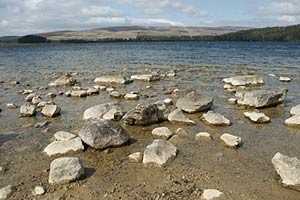
After viewing this collapsed cave return to the lane and turn left, eastwards. Hawthorne Lane at first is a very steep hill but this levels off on reaching Smearbottoms Lane. Continue on these lanes then turn left at Lee Gate Farm (grid ref 926 644). Follow the climbing field path on the right of the wall then through a gate into a bridleway and another gate on the left. The clear path heads west keeping to the wall and fence on the left. Passing the remains of a Roman Camp with its information board, over a footbridge of the stream that runs down to Gordale and arrives at Street Gate. Rather than follow the metalled road, fork half right and continue to Malham Tarn.
There are a number of paths but you need to reach the road (grid ref. 893658) where the path heads south to Malham Cove. With the stream on your left continue past the point where it disappears underground following the clear and ignoring the path off to the left. The immediate scenery will suddenly change as you enter a wonderful limestone gorge. The path swings right and then turns sharp left to descend via steps into Watlowes dry valley. This leads without further problems to the limestone pavement above Malham Cove.
Reaching the cliff turn right but do be careful as it is a fair drop into the cove and the rock slabs can be slippery. Reaching the west end of the cliff a stepped path takes you down into the valley. At the first fork trend right and this path brings you out on Cove Road. Turn left into the lane and all that remains is a gentle downhill stroll back to the start.
Maps 

| Ordnance Survey Explorer OL2 | Sheet Map | 1:25k | BUY |
| Anquet OS Explorer OL2 | Digital Map | 1:25k | BUY |
| Ordnance Survey Digital Map Subscription | |||
| Latest Ordnance Survey Discounts | |||
Other walks nearby
| Walk 1282 | Malham Tarn & Arncliffe | moderate | 12.5 miles |
| Walk 3092 | Malham Cove, Malham Tarn & Watlowes | easy | 4.4 miles |
| Walk 2385 | Airton & Bell Busk Circular | easy/mod | 6.8 miles |
| Walk 1377 | Calton and Hanlith Moors | easy/mod | 6.5 miles |
| Walk 2066 | Winterburn Reservoir circular | easy | 6.0 miles |
| Walk 1701 | Bordley Hall & Malham Moor from Threshfield Moor | easy/mod | 7.0 miles |
| Walk 2332 | Mastilles Lane & Bordley from Kilnsey | easy/mod | 6.8 miles |
| Walk 3107 | Flasby Fell from Flasby | easy/mod | 6.5 miles |
| Walk 3109 | Rylstone Edges & Cracoe from Rylstone | easy/mod | 6.0 miles |
| Walk 2617 | Nappa Cross & Victoria Cave from Langcliffe | moderate | 9.5 miles |
Recommended Books & eBooks
Pennine Way Map Booklet
 Map of the 270 miles (435km) Pennine Way National Trail, between Edale in the Peak District and Kirk Yetholm in the Scottish Borders. This booklet is included with the Cicerone guidebook to the trail, and shows the full route on Ordnance Survey 1:25,000 maps. This popular long-distance route typically takes three weeks to complete.
More information
Walking in the Yorkshire Dales: South and West
 Part of a two-book set, this guidebook describes 44 walks in the southern and western Yorkshire Dales, including the famous 23 mile Three Peaks circuit over Pen-y-Ghent, Whernside and Ingleborough. The other, mostly circular routes of 3½ to 13 miles cover the scenic region between Sedbergh, Kirkby Lonsdale, Settle, Skipton and Grassington.
More information
