Ullapool - a Munro Quartet including Beinn Dearg
Highland Walk
County/Area - Highland - Central Highland
Author - Peter Smyly
Length - 16.0 miles / 26 km Ascent - 5350 feet / 1621 metres
Time - 13 hours 20 minutes Grade - very hard
Walk Route Description
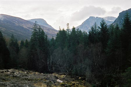
Click image to visit gallery of 10 images.
Mountains included in this walk are Beinn Dearg (3,556 feet), Cona' Mheall (3,209 feet), Meall nan Ceapraichean (3,205 feet) and Eididh nan Clach Geala (3,041 feet). This is a long and demanding walk which will most likely need a full day and, ideally, long hours of daylight to accomplish it. The walk requires a climb which, in terms of height gain, is the rough equivalent of climbing Snowdon from near to sea level, followed by three more lots of descent and re-ascent to climb the other three peaks, before walking back down to the start point. The position of the first three Munros are like three points of a triangle with Beinn Dearg to the south, Cona' Mheall to the east and Meall nan Ceapraichean to the north.
The start point of the walk is to the south of Loch Broom, where you need to park to the side of the A835 road about six miles south of Ullapool and near Balblain. A wide track leads to, and then through, a forest to the east with the River Lael on the left. The path emerges from the forest to head south east along the Gleann na Sguaib valley. The stalker's path follows the valley with the River Lael on the right. A lochan with a small island, Lochan Lathail, is passed on the way up to Bealach an Lochain Uaine between Beinn Dearg and Meall nan Ceapraichean where another small lochan, Lochan Uaine, is located, one of several small pools. Follow a wall up the slopes of dome-shaped Beinn Dearg most of the way to the top which is marked by a sizeable cairn.
To reach the next summit, Cona' Mheall, go back down to the bealach and then continue south east, down at first, then up to reach the summit ridge, marked by a cairn. On the way, the pretty Loch a'Choire Ghranda is seen below to the right, backed by impressive cliffs which show another side to Beinn Dearg. From the ridge top of Cona' Mheall, there is a steep drop to reveal the wildly situated Loch Prille with its elongated shape and a big waterfall issuing down from near its outflow.
To reach the third Munro involves returning to the bealach, then heading up more pathless slopes to reach the top of Meall nan Ceapraichean which is of a similar height to Cona' Mheall. The small lochan, passed on the way to the bealach earlier on in the walk, now shows to dramatic effect way below to the left.
From the summit, pass over the top of Ceann Garbh and aim for the dip to the right of the largest lochan below, Lochan a' Chnapaich. Another pathless ascent leads to the top of the final Munro of the day, Eididh Nan Clach Geala which has a fine view of distant mountains such as the Fannichs.
Next, head in a south westerly direction down the shoulder of Eididh nan Clach Geala to eventually rejoin the stalker's path which leads back down the valley. Therefore to conclude the walk, you need to follow the path back through the forest to the start point of the walk.
Maps 

| Ordnance Survey Explorer 436 | Sheet Map | 1:25k | BUY |
| Anquet OS Explorer 436 | Digital Map | 1:25k | BUY |
| Ordnance Survey Digital Map Subscription | |||
| Latest Ordnance Survey Discounts | |||
Other walks nearby
| Walk 1018 | Beinn Ghobhlach | moderate | 6.0 miles |
| Walk 2274 | Cul Mor from Knockan Crag | mod/hard | 8.5 miles |
| Walk 2529 | Stac Pollaidh Circular | easy/mod | 2.8 miles |
| Walk 1017 | Stac Pollaidh | easy/mod | 3.0 miles |
| Walk 1347 | Meall a' Ghiubhais from Kinlochewe | moderate | 8.0 miles |
| Walk 1305 | Sgurr nan Fhir Duibhe from Kinlochewe | hard | 7.5 miles |
| Walk 1773 | Ben Wyvis (western approach) | mod/hard | 8.0 miles |
| Walk 1530 | Little Wyvis ascent from near Garve | moderate | 6.4 miles |
| Walk 1319 | The Bone Caves of Inchnadamph | easy | 3.0 miles |
| Walk 1316 | Falls of Kirkaig | easy | 5.8 miles |
Recommended Books & eBooks
Skye's Cuillin Ridge Traverse
 This 2-volume set provides all the information required to complete the main ridge traverse on Skye's Black Cuillin. Strategy, gear, training, navigation and logistics are covered, and 10 classic scrambles are described. A lightweight second guidebook gives the scrambler detailed maps, topos and route description for the ridge traverse itself.
More information
Great Mountain Days in Scotland
 Inspirational guidebook to 50 challenging routes for mountaineers, scramblers, hillwalkers and fell runners, many long enough to backpack over 2 days, especially in winter (12 to 25 miles). A mix of classic routes and unsung gems across Scotland from Galloway to the Outer Hebrides in widely differing wild landscapes. With customised OS mapping.
More information
