Everton & Potton from Sandy
Bedfordshire Walk
County/Area - Bedfordshire
Author - Tony Kellett
Length - 12.0 miles / 19.5 km Ascent - 400 feet / 121 metres
Time - 6 hours 20 minutes Grade - moderate
Walk Route Description
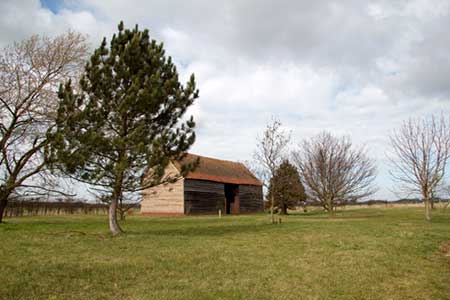
Click image to see photo description.
This walks starts in Sandy from the car park at grid ref. TL173491. The route is based on one produced by Central Bedfordshire Council which has been extended to include lunch at the Royal Oak in Potton. After parking turn left along High Street for just under 200 metres. Turn left into St Swithun�s Way, then right into Cherrycroft and after 25 metres locate the alleyway on your left. This leads across the railway to the Pinnacle Recreation Ground. Continue straight across the field into woodland following the waymarked path to the left. Reaching Sand Lane (grid ref. TL178493), turn right. After 500 metres turn left onto the Greensand Ridge Walk (grid ref. TL183492).
This long distance path leads through fields and along farm tracks and paths to reach Tempsford Road (grid ref. TL190517). Cross the road carefully and continue ahead following a signed bridleway. The path joins an old runway past Gibraltar Farm. This former RAF airfield was one of the most secret in Britain during World War 2. Just over 300 metres beyond Gibraltar Farm you reach a junction of paths (grid ref. TL194528). Here bear right and continue past Joan�s Wood and Hare Home Wood towards Woodbury Sinks.
Reaching a field gate (grid ref. TL209526), leave the concrete track and bear left ascending past Woodbury Sinks (on your left) to follow a track to reach the Greensands Ridge Walk at a junction. Turn right here and follow the waymarked path through the Woodbury Estate to Story Farm (grid ref. TL207517). Continue straight ahead along the clear track into the centre of Everton.
At the Thornton Arms public house turn left and follow Potton Road for just one a kilometre. Note that there is no path alongside this road so do take care with passing traffic. Reaching Ashmore Farm (grid ref. TL 210505) turn right onto a byway. After 400 metres (grid ref. TL209502) turn left into Mill Lane. Continue along this track to Potton. Mill Lane leads into Everton Road which is followed in an easterly direction before turning right into Horslow Street. Keep straight ahead into Chapel Street to reach a T-junction (grid ref. TL220491) with Blackbird Street. The walk continues right here however the Royal Oak public House is a short distance on the left should you wish to have lunch or get some refreshments.
Continue ahead into Station Road. After 300 metres turn right into Newtown. Turn left into Old Bedford Road. This leads into a bridleway which is followed in a westerly direction to reach a junction with a tarmac road (grid ref. TL207495). Go straight across passing the Sandy transmitter on your left. After 800 metres turn left to follow the Long Riding bridleway to reach Potton Road. Cross the road carefully and enter the Lodge (the National HQ of the RSPB). Immediately inside the entrance gates turn right along the waymarked 'Fir's Trail' and continue towards Sandy. Reaching Potton Road (grid ref. TL183485), bear left and follow the pavement back into Sandy and the start of the walk.
Maps 

| Ordnance Survey Explorer 208 | Sheet Map | 1:25k | BUY |
| Anquet OS Explorer 208 | Digital Map | 1:25k | BUY |
| Ordnance Survey Digital Map Subscription | |||
| Latest Ordnance Survey Discounts | |||
Other walks nearby
| Walk 2714 | Between Beeston and Old Warden | easy/mod | 11.5 miles |
| Walk 3113 | Sandy and Everton Circular | easy/mod | 7.5 miles |
| Walk 2305 | Gamlingay, Tetworth & Everton from Potton | easy/mod | 9.5 miles |
| Walk 2810 | Haynes Circular | easy/mod | 7.0 miles |
| Walk 1130 | Clophill and Haynes Circular | easy/mod | 6.0 miles |
| Walk 1798 | Little Paxton & River Ouse Circular | easy/mod | 6.4 miles |
| Walk 1985 | Houghton Park Circular | easy | 4.0 miles |
| Walk 3103 | Wimpole Park and Whaddon | easy/mod | 8.3 miles |
| Walk 3115 | Ampthill & Steppingley Circular | easy/mod | 9.0 miles |
| Walk 3513 | Ampthill and Clophill Circular | moderate | 12.0 miles |
