West Wittering to Chichester (New Lipchis Way)
Chichester Harbour Walk
Region - Chichester Harbour
County/Area - West Sussex
Author - Lou Johnson
Length - 9.2 miles / 15 km Ascent - 250 feet / 76 metres
Time - 4 hours 50 minutes Grade - easy/mod
Walk Route Description
Click image to see photo description.
Starting from West Wittering this linear walk follows the New Lipchis Way to Chichester. The route follows the shores of Chichester Harbour with its extensive salt marshes contrasting with busy marinas through West Itchenor and Westlands to reach Birdham Poll Marina. Turning inland, the walk follows the disused Chichester Ship Canal into the City of Chichester. Chichester is served by a regular train service and bus routes 52 and 53 link Chichester with West Wittering.
The walk starts from West Wittering by the Wittering pub (grid ref. SZ780985). There is a bus stop near the pub. With your back to the pun, turn right and left into Pound Road. Take the first lane on the right (Ella Nore Lane) signed as a private road, footpath only. Continue for a kilometre to reach the shore of Chichester Harbour. Turn right onto the New Lipchis Way which is followed through to Chichester. The path runs close to the shore before turning inland near Rockswood where a left turn (grid ref. SZ782998) takes you back to the shore.
Follow the path for just under three kilometres to reach West Itchenor harbour office and ferry pier (grid ref. SU800014). Bear right inland along the road. After 150 metres turn left along the access drive to Itchenor Sailing Club with adjacent fingerpost. Reaching the moorings, turn right and follow the onward path along the shoreline. The path soon veers inland to join Spinney Lane. Turn left for 300 metres and take the path on the right along the edge of Westlands Copse. The onward path crosses a field and continues to the tight of Westlands Farm.
Reaching Westlands Lane, turn right and continue for 400 metres and turn left over a culvert with adjacent fingerpost (grid ref. SU815005). Go straight across the first junction, then follow Greenacres for 150 metres and take the signed path on the left between houses to regain the shore. Turn right along the shore, pass a slipway, and then veer half-right along the left-hand edge of a field to a lane. Bear right, and then left at the first junction along The Causeway to pass moorings on your left. Continue ahead at the first junction and then turn left at the next to reach the Chichester Ship Canal at Salterns Lock (grid ref. SU827011).
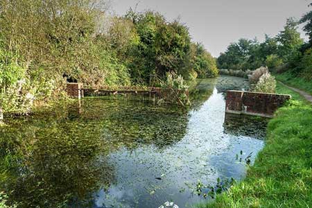
Cross the lock and turn right. Continue with canal on your right along a road. Pass the extensive mooring on the eft and continue ahead soon joining the towpath. Pass under Cutfield Bridge on the A286. Swap sides of the canal and continue for 2.5 kilometres under Crosbie Bridge to reach Pyntz Bridge (grid ref. SU865022). The can turns left here and the towpath swap to the other side. Another two kilometres takes you under Chichester bypass to reach the Basin. Follow the path to the left and then right to join the A286 at a crossroads. Bear right following the sign to Chichester City Centre, railway station and bus station.
Maps 

| Ordnance Survey Explorer OL8 | Sheet Map | 1:25k | BUY |
| Anquet OS Explorer OL8 | Digital Map | 1:25k | BUY |
| Ordnance Survey Digital Map Subscription | |||
| Latest Ordnance Survey Discounts | |||
Other walks nearby
| Walk 2828 | Dell Quay from Chichester Marina | easy | 3.8 miles |
| Walk 2368 | Bosham & Fishbourne | easy | 5.2 miles |
| Walk 1656 | Thorney Island circular from Prinsted | easy/mod | 9.0 miles |
| Walk 2043 | Thorney Island from Emsworth | easy/mod | 9.0 miles |
| Walk 2044 | Six Harbour Villages, Chichester | moderate | 10.0 miles |
| Walk 3548 | Stoughton, Kingley Vale & Bow Hill from Stoughton Down | easy/mod | 5.2 miles |
| Walk 1835 | Treyford & Didling from Hooksway | easy/mod | 6.0 miles |
| Walk 1872 | Charlton, Singleton & Goodwood Circular | easy/mod | 6.5 miles |
| Walk 2373 | Hambledon Circular | easy/mod | 6.1 miles |
| Walk 2422 | Butser Hill and Wether Down from Buriton | moderate | 12.5 miles |
