Lode Mill, Quy Water & Quy Fen
Cambridgeshire Walk
County/Area - Cambridgeshire
Author - Lou Johnson
Length - 4.2 miles / 6.8 km Ascent - 150 feet / 45 metres
Time - 2 hours 20 minutes Grade - easy
Maps 

| Ordnance Survey Explorer 209 | Sheet Map | 1:25k | BUY |
| Anquet OS Explorer 209 | Digital Map | 1:25k | BUY |
Walk Route Description
Click image to see photo description.
This walk from the village of Lode, east of Cambridge, explores an interesting landscape away from the formal gardens of the National Trust's Anglesey Abbey. The low-lying pastures are criss-crossed by drainage channels and the route follows one of these, Quy Water, and also visits Quy Fen. The walk follows clear paths and includes a section of the Harcamlow Way.
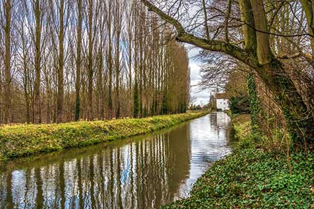
Limited on street parking near the Post Office of High Street in Lode is the starting point (grid ref. TL553627). After parking and with your back to the Post Office cross the road to a narrow lane to the right of a thatched cottage (signed Lode chapel and footpath. Pass the chapel and continue along a path behind houses. This leads to Lode Mill, a restored water mill. Cross the footbridge and turn left to follow a path with Quy Water on your left. Follow the path for two kilometres to reach Stone Bridge (grid ref. TL517611).
Turn sharp right onto a signed path and continue a short distance to reach a bridleway. Turn right and follow the Drove Way through a left-hand bend, and straight across a cross track to a fork (grid ref. TL516622). Fork right to join the Harcamlow Way. The path is initially enclosed between hedges but soon reaches an open area. Bear left on a clear path across grass to reach the southern end of Quy Fen. Around the fen is an ideal spot for a picnic.
After exploring the fen, return to the southern end and turn left along a grassy path. Away to your right is a memorial stone enclosed by a low fence which commemorates the death of William Ison who was struck by lightning in 1873. After visiting the memorial return to the main path and continue to a gate and cross a footbridge (grid ref. TL518628). Keep ahead on a clear path passing a small stand of trees and hidden pond, which will be on your left. The path leads into a wide track between hedges After 200 metres, turn right along Darn Drove, again enclosed by hedges. Reaching the end of the enclosed section, turn left along a clear track heading into woodland. Exiting the trees keep to the right-hand side of the filed and continue back to bridge by Lode Mill. Turn left along Mill Road and follow this back to High Street.
An alternative start is to use the pay and display parking provided for visitors to the National Trust Anglesey Abbey. After parking, walk to the far end of the overflow car park and join a path that leads to the Mill.
Other walks nearby
| Walk 1938 | The Devil's Dyke from Reach | easy | 5.8 miles |
| Walk 3569 | Swaffham Prior & Devil's Dyke from Reach | easy/mod | 6.6 miles |
| Walk 3721 | Oakington and Longstanton round via Rampton Drift | easy | 6.0 miles |
| Walk 2476 | Moulton & Gazeley Circular | easy | 6.7 miles |
| Walk 1963 | Elsworth & Conington | moderate | 10.1 miles |
| Walk 3444 | Fen Drayton Nature Reserve Walk | easy | 4.6 miles |
| Walk 2243 | Mare Way & Wimpole Estate from Orwell | easy | 5.2 miles |
| Walk 2242 | Cavenham Heath and Lark Valley from Mildenhall | easy/mod | 7.8 miles |
| Walk 3103 | Wimpole Park and Whaddon | easy/mod | 8.3 miles |
| Walk 3741 | St. Ives, Houghton & the Hemingfords | easy | 5.6 miles |
Recommended Books & eBooks
No suggestions for this area.Messaging & Social Media
Message Walking Britain and follow the latest news.

Mountain Weather
Stay safe on the mountains with detailed weather forecasts - for iOS devices or for Android devices.