Oakington and Longstanton round via Rampton Drift
Cambridgeshire Walk
County/Area - Cambridgeshire
Author - Peter Smyly
Length - 6.0 miles / 9.8 km Ascent - 100 feet / 30 metres
Time - 3 hours 10 minutes Grade - easy
Maps 

| Ordnance Survey Explorer 225 | Sheet Map | 1:25k | BUY |
| Anquet OS Explorer 225 | Digital Map | 1:25k | BUY |
Walk Route Description
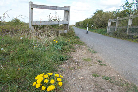
Click image to visit gallery of 4 images.
This easy Cambridgeshire circular walk explores the pleasant countryside lying to north-west of Cambridge. The route follows paths, tracks and country lanes. The Oakington stop (grid ref. TL418651) on the Cambridgeshire Guided Busway is the start and end point for this circular route.
Follow Oakington Road to the north-east as far as Lamb's Cross (grid ref. TL425657). There is a pavement initially, later this becomes a roadside walk, and, in the latter part, there is the option to follow a field edge on the right to get off the road. A left turn at Lamb's Cross along a bridleway, known as Rampton Drift, leads past a farm on the right into open countryside. Follow the route ahead and, after about a mile, turn left off Rampton Drift (grid ref. TL420676) to follow a road, later a track, to join up with the guided busway.
Important note - when crossing the guided busway, pay careful attention, as buses travel very fast along this route, also look out for cyclists alongside the busway as this is also a popular cycling route.
Cross here to follow the track ahead which leads to Rampton Road. Keep following the road ahead until you reach a crossroads. Here on the right a slight digression can be made to view an unusual looking building, a cantilevered pillbox. However, the route continues the other way, along Long Lane, a bridleway to begin with but, after it bends round to the right, it continues with a left turn along a narrow country lane, passing a church on the left. Turn left at the next junction and keep following the road ahead, Longstanton Road, until eventually the streets of Oakington are reached. A left turn along Coles Lane leads to a T junction at the High Street. Turn left and follow the road ahead, passing St Andrew's Church on the right, then a turn to the right down Mill Road leads to Station Road and a left turn here returns you to the starting point of the walk.
Other walks nearby
| Walk 1963 | Elsworth & Conington | moderate | 10.1 miles |
| Walk 3444 | Fen Drayton Nature Reserve Walk | easy | 4.6 miles |
| Walk 2352 | Lode Mill, Quy Water & Quy Fen | easy | 4.2 miles |
| Walk 3741 | St. Ives, Houghton & the Hemingfords | easy | 5.6 miles |
| Walk 1938 | The Devil's Dyke from Reach | easy | 5.8 miles |
| Walk 3569 | Swaffham Prior & Devil's Dyke from Reach | easy/mod | 6.6 miles |
| Walk 2243 | Mare Way & Wimpole Estate from Orwell | easy | 5.2 miles |
| Walk 3103 | Wimpole Park and Whaddon | easy/mod | 8.3 miles |
| Walk 1798 | Little Paxton & River Ouse Circular | easy/mod | 6.4 miles |
| Walk 2305 | Gamlingay, Tetworth & Everton from Potton | easy/mod | 9.5 miles |
Recommended Books & eBooks
No suggestions for this area.Messaging & Social Media
Message Walking Britain and follow the latest news.

Mountain Weather
Stay safe on the mountains with detailed weather forecasts - for iOS devices or for Android devices.