Upham & Owslebury Circular
Hampshire Walk
County/Area - Hampshire
Author - Lou Johnson
Length - 6.5 miles / 10.6 km Ascent - 650 feet / 197 metres
Time - 3 hours 50 minutes Grade - easy/mod
Walk Route Description
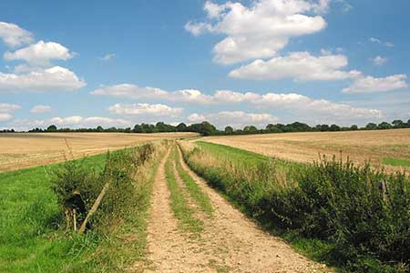
Click image to see photo description.
Walk from Owslebury exploring the downs and rolling countryside to the south of the village. The route visits the village of Upham, uses a section of the Monarch's Way and includes possible refreshments at the Ship Inn (Owslebury) and Brushmakers Arms (Upton). On street parking is available near St Andrew's Church o Main Street in Owslebury (grid ref. SU515234).
After parking enter the churchyard and walk half-left along the signed footpath (Pilgrims Trail) to exit the churchyard onto Pitcot Lane. Turn right and continue ahead to pass through a kissing gate onto an enclosed green lane. Stay on the clear track for a kilometre to reach Baybridge Lane. Go straight across the lane and over a stile to continue along a green lane past Phillips Farm. Reaching the edge of Austin's Copse, turn left through a gate and follow the path with the copse on your right. After 350 metres turn left along Greenhill Lane keeping the hedge on the left of the path/track. After 400 metres turn right at fingerpost. The path runs along the left-hand edge of a field. After a short section through trees join an enclosed track and continue to a T-junction (grid ref. SU533219). Turn right and continue past Woodlock's Down Farm.
Just beyond the farm, turn left at a three-way fingerpost. Follow the path across the first field. Entering the next field walk straight across to the trees on the far side. Waymarks indicate the onward route through trees into the next field. Turn left and follow the right-hand field edge to exit through trees onto a Longwood Dean Lane (grid ref. SU538210). Bear right and continue ahead into Upham. Reaching the first junction, fork left and continue past the Brushmaker's Arms to a junction. Turn right and continue past the church to the next junction. Turn right towards Owslebury and after 100 metre turn left over a stile to follow Monarch's Way. Stay on the waymarked Monarch's Way for just under two kilometres to reach Red Lane (grid ref. SU 521214).
Go straight across the track into trees along a waymarked path which leads to Whaddon Lane (grid ref. SU512216). Turn right and after 200 metres fork right into Lower Baybridge Lane. The lane is initially enclosed by trees but after 500 metres enters open countryside with a metal farm gate on the right. Turn left here through a gap in the hedge (no waymark) and follow the path along the left-hand edge of fields. You soon pass Great Coney Park Wood on your left. Beyond the wood the path maintains direction and climbs back to the churchyard in Owslebury.
Maps 

| Ordnance Survey Explorer OL32 | Sheet Map | 1:25k | BUY |
| Anquet OS Explorer OL32 | Digital Map | 1:25k | BUY |
| Ordnance Survey Digital Map Subscription | |||
| Latest Ordnance Survey Discounts | |||
Other walks nearby
| Walk 1034 | Beacon and Old Winchester Hills on the South Downs | moderate | 10.5 miles |
| Walk 3324 | Cheriton Mill & Tichborne from Cheriton | easy | 5.7 miles |
| Walk 2662 | Beacon Hill and Warnford | easy/mod | 6.0 miles |
| Walk 2710 | Old Winchester Hill from Exton | easy/mod | 5.5 miles |
| Walk 2093 | Farley Mount Circular | easy/mod | 6.5 miles |
| Walk 1964 | Abbotstone from Old Alresford | easy | 5.1 miles |
| Walk 2373 | Hambledon Circular | easy/mod | 6.1 miles |
| Walk 2533 | East Meon to Old Winchester Hill | moderate | 12.0 miles |
| Walk 2394 | East Meon & Wether Down | easy/mod | 8.0 miles |
| Walk 2459 | Upper Wield & Godsfield Circular | easy/mod | 6.7 miles |
Recommended Books & eBooks
Walking Hampshire's Test Way
 Guidebook to walking the 71km (44 mile) Test Way in Hampshire from high on the chalk downs of Inkpen Beacon to the Eling Tide Mill near Southampton Water. Following the beautiful, crystal clear River Test, it passes picturesque villages and fascinating historic sites. Also includes 15 day walks to explore this lovely part of pastoral England.
More information
