Butser Hill and Wether Down from Buriton
South Downs Walk
Nat Park - South Downs
County/Area - Hampshire
Author - Peter Smyly
Length - 12.5 miles / 20.3 km Ascent - 1450 feet / 439 metres
Time - 7 hours 40 minutes Grade - moderate
Maps 

| Ordnance Survey Explorer OL33 | Sheet Map | 1:25k | BUY |
| Anquet OS Explorer OL33 | Digital Map | 1:25k | BUY |
| Ordnance Survey Landranger 197 | Sheet Map | 1:50k | BUY |
| Anquet OS Landranger 197 | Digital Map | 1:50k | BUY |
Walk Route Description
Click image to visit gallery of 8 images.
The South Downs Way extends from Winchester in Hampshire in the west to Beachy Head near Eastbourne in Sussex to the south-east. Butser Hill (889 feet) is the highest point on the main ridge of the South Downs and is situated in the Hampshire section of the South Downs on the western part of the trail. This walking route is of a "there and back" type since the linear nature of the ridge does not readily lend itself to a circular route. The walk includes three other named hills, Tegdown Hill, Hyden Hill and Wether Down, though for all-round views, Butser Hill is the one that best fits that description. There are a few relatively steep sections, but gradients are mostly easy going.
There are a few car parks in the vicinity of Butser Hill and a walk to the top of it can be made as easy or difficult as one wishes in terms of the walk-in distance. One car park to the south west offers a short gentle stroll across grass to the top. Another one, next to a café and shop just off the busy A3 to the south offers a reasonable walk of about a mile up grassy slopes to the top. A third car park is located next to the Buriton Chalk Pit Nature Reserve. All three car parks are crossed on this route.
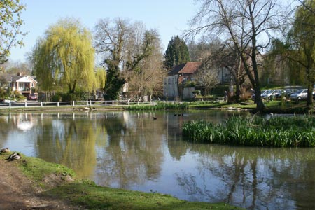
This walk starts at the pretty village of Buriton to the east, from where it is a three mile walk to the top of Butser Hill. Cars can be parked outside St Mary's Church, next to the village duck pond. On the other side of the pond, signposts indicate the Hangers Way and a public footpath leads up through the Buriton Chalk Pit Nature Reserve, crossing under the railway line. The Hangers Way is a 21 mile long-distance footpath through Hampshire which starts at Alton railway station. This walk features the other end of the trail where it concludes at the Queen Elizabeth Country Park.
The path leaves the woods of the Nature Reserve at an intersection of secondary roads where a left turn is for the South Downs Way, but this is not the way to go on this walk. Cross to a car park and follow the unsurfaced road ahead uphill with glimpses of a view looking back to the car park between gaps in the hedgerow on the left. The route through the Queen Elizabeth Country Park, which is popular with cyclists, goes downhill again before levelling out. Take a path on the right, going uphill at a Y junction and the traffic of the A3 can soon be heard ahead. After crossing a minor road, a steep path leads down through trees to a car park, shop and cafe. It is important to go this way to enable safe access to the other side of the A3 via a subway from where the grassy slopes of Butser Hill now dominate the view ahead. By way of variation, a shallow valley near the top is occupied by trees and bushes. There are two basic approach routes, each up a grassy slope. This route takes the one on the right. Looking back, in the distance beyond the A3, Windmill Hill can be seen, and further away, if the day is not too hazy, the sea of the south coast can be seen. The top of Butser Hill has a radio mast than can be seen for miles around and there is a triangulation pillar. The top of the hill is more or less level and mostly grassy with a few bushes and trees. A faint path leads around the perimeter and reveals views all around including one to the north east where the town of Petersfield can be seen. However, if the top of the hill seems a little plain and ordinary, there is a potential surprise in store. A short walk towards the north-west of the summit area, shows a very different side of the hill. A steep chalk escarpment is revealed which goes down to a narrow, steep-sided dry valley and a view of this feature is worth a short digression from the summit area. According to the map, Ramsdean Down is the name of the spur and Rake Bottom the valley below.
The route now follows the secondary tarmac road to the south west, past a round house where there are public conveniences, then follows a country lane, Limekiln Lane, to the south-west past fields on either side. Pass Harvesting Lane on the right and at the next road junction, take a country lane due west and follow the South Downs Way along the bridleway ahead which crosses Tegdown Hill and Hyden Hill. Despite the names of these two hills, on observing the landscape at this point of the walk, it is only the view to the north that indicates that you are on a hill at all, as there is a distant valley and a ridge beyond it. Contour lines on the map, showing the shape of a spur to the north of the South Downs Way, also confirm this impression. In springtime, Hyden Hill is notable for its field of bright yellow flowers. At the next set of houses, follow the road ahead initially to the right offering a retrospective view of the route from Butser Hill, then left and a right turn past Mercury Park leads along a public bridleway to a farm beyond which is Wether Down with its twin radio masts, a popular spot with hang gliders This is the furthest point on the walk and it is now time to retrace the outgoing route. By way of a slight variation, the top of Butser Hill can be omitted by taking a path off down to the right which descends by a different route with the A3, car park and café clearly in view ahead.
Other walks nearby
| Walk 3260 | Butser Hill Circular | easy/mod | 6.9 miles |
| Walk 2533 | East Meon to Old Winchester Hill | moderate | 12.0 miles |
| Walk 2394 | East Meon & Wether Down | easy/mod | 8.0 miles |
| Walk 1835 | Treyford & Didling from Hooksway | easy/mod | 6.0 miles |
| Walk 2373 | Hambledon Circular | easy/mod | 6.1 miles |
| Walk 3548 | Stoughton, Kingley Vale & Bow Hill from Stoughton Down | easy/mod | 5.2 miles |
| Walk 2662 | Beacon Hill and Warnford | easy/mod | 6.0 miles |
| Walk 2710 | Old Winchester Hill from Exton | easy/mod | 5.5 miles |
| Walk 1976 | Noar Hill from Selborne | easy/mod | 5.0 miles |
| Walk 2043 | Thorney Island from Emsworth | easy/mod | 9.0 miles |
Recommended Books & eBooks
Walks in the South Downs National Park
 Guidebook with 40 circular walks throughout the South Downs National Park, exploring the beautiful chalk hills between Eastbourne and Winchester. The walks range from under 5 miles to 11 miles, including Beachy Head and the Seven Sisters, Ditchling Beacon and hundreds of prehistoric sites. Accessible all year, but wild flowers best in spring.
More information
Walking Hampshire's Test Way
 Guidebook to walking the 71km (44 mile) Test Way in Hampshire from high on the chalk downs of Inkpen Beacon to the Eling Tide Mill near Southampton Water. Following the beautiful, crystal clear River Test, it passes picturesque villages and fascinating historic sites. Also includes 15 day walks to explore this lovely part of pastoral England.
More information
Messaging & Social Media
Message Walking Britain and follow the latest news.

Mountain Weather
Stay safe on the mountains with detailed weather forecasts - for iOS devices or for Android devices.