Noar Hill from Selborne
Hampshire Walk
County/Area - Hampshire
Author - Lou Johnson
Length - 5.0 miles / 8.1 km Ascent - 600 feet / 182 metres
Time - 3 hours 10 minutes Grade - easy/mod
Walk Route Description
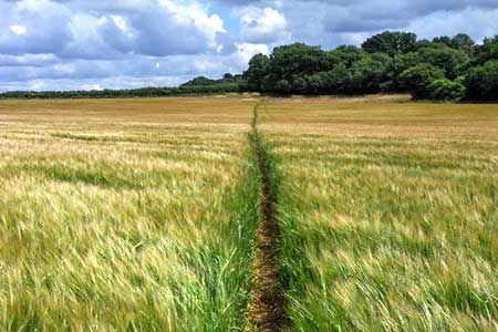
Click image to see photo description.
This Hampshire walk from Selborne explores a rolling landscape with a patchwork of woodland and farmland. The route starts by following the zigzag path which provides some excellent views across the village. The walk continues across Selborne Common before crossing a broad valley onto Noar Hill. The route follows a section of the Hangers Way around the hill and back to Selborne.
The walk starts from the Selborne village car park (grid ref. SU742335) on the south side of the B3306 through the village. After parking take the signed zig-zag path which climbs steeply onto Selborne Common. Reaching the ridge turn right and follow the main path across the common. Partially wooded with grassy open spaces you soon reach the end of the common (grid ref. SU729328). Turn left and follow Green Lane down to a road where you take the path opposite. Walk half-left across the field to a lane. Turn right and take the footpath into trees.
Almost immediately turn right off the lane top join a bridleway. The way ahead soon leaves the trees and reaches another lane (grid ref. SU736318). Go straight across and follow the path with a hedge on your left to the end of the field. The path then crosses a smaller field to reach a junction of paths. Maintain direction at the junction and join Hangers Way which will be followed back to Selborne. The path contours across the slopes of Noar Hill through woodland curving left to descend to High Common where there are open grassy areas.
Continue along Hangers Way down to a lane (grid ref. SU738323). Turn right and continue to a T-junction where you take the path opposite over a stile. At the end of the field turn right and keeping Homestead Farm on your right continue ahead keeping to the right-hand side of fields to join a lane. Continue straight ahead along the lane back to the start of the walk in Selborne.
Maps 

| Ordnance Survey Explorer OL33 | Sheet Map | 1:25k | BUY |
| Anquet OS Explorer OL33 | Digital Map | 1:25k | BUY |
| Ordnance Survey Digital Map Subscription | |||
| Latest Ordnance Survey Discounts | |||
Other walks nearby
| Walk 3693 | Alton to Farnham using St Swithun's Way | moderate | 12.0 miles |
| Walk 1128 | Bradley & Burkham Circular | easy | 5.5 miles |
| Walk 2459 | Upper Wield & Godsfield Circular | easy/mod | 6.7 miles |
| Walk 2533 | East Meon to Old Winchester Hill | moderate | 12.0 miles |
| Walk 2394 | East Meon & Wether Down | easy/mod | 8.0 miles |
| Walk 2422 | Butser Hill and Wether Down from Buriton | moderate | 12.5 miles |
| Walk 3260 | Butser Hill Circular | easy/mod | 6.9 miles |
| Walk 1514 | Gibbet Hill & the Devil's Punch Bowl from Haslemere | easy/mod | 7.0 miles |
| Walk 1964 | Abbotstone from Old Alresford | easy | 5.1 miles |
| Walk 3228 | Black Down from Haslemere | easy/mod | 10.0 miles |
Recommended Books & eBooks
Walking Hampshire's Test Way
 Guidebook to walking the 71km (44 mile) Test Way in Hampshire from high on the chalk downs of Inkpen Beacon to the Eling Tide Mill near Southampton Water. Following the beautiful, crystal clear River Test, it passes picturesque villages and fascinating historic sites. Also includes 15 day walks to explore this lovely part of pastoral England.
More information
