Hever & Markbeech from Chiddingstone Walk
Walk 2427 - Route Maps
Route Map
Digital Maps - Copyright © 2011-2024. All rights reserved.
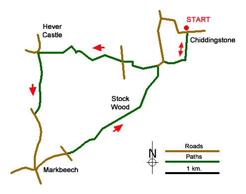
Sketch Map
Suggested Maps 

| Ordnance Survey Explorer 147 | Sheet Map | 1:25k | BUY |
| Anquet OS Explorer 147 | Digital Map | 1:25k | BUY |
| Ordnance Survey Digital Map Subscription | |||
| Latest Ordnance Survey Discounts | |||
It is recommended you take a map. The preferred scale is 1:25k.
Start Point Details
Ordnance Survey Grid Ref TQ501451
Latitude 51.185426 Longitude 0.146338
Postcode TN8 7AH
what3words start feared.insect.ties
Walk description may contain detailed information on the start point for this walk.
Further Information
Walk grading - Learn how each walk is assessed and select a walk to suit your ability and experience by going to Walk Grading Details.
Messaging & Social Media
Message Walking Britain and follow the latest news.

Mountain Weather
Stay safe on the mountains with detailed weather forecasts - for iOS devices or for Android devices.