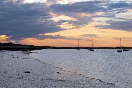
The Rivers Ore & Alde from Orford
Suffolk Walk
County/Area - Suffolk
Author - Lou Johnson
Length - 11.0 miles / 17.9 km Ascent - 200 feet / 61 metres
Time - 5 hours 40 minutes Grade - easy/mod
Maps 

| Ordnance Survey Explorer 212 | Sheet Map | 1:25k | BUY |
| Anquet OS Explorer 212 | Digital Map | 1:25k | BUY |
Walk Route Description
Click image to see photo description.
This walk explores the Suffolk coast and countryside from the village of Orford with its Dutch style buildings. The route uses paths and quiet country lanes and includes the estuaries of the Rivers Ore and Alde. The start is the large car park to the south of Orford just off the B1084 (grid ref. TM424496). After parking exit the car park and turn left down to the shore of the River Ore. Just before reaching the river turn left along the signed footpath with the beach and river to your right.
Continue along the riverside path for approximately 5 miles to reach a headland (grid ref. TM460553) where the River Alde join the River Ore. The path now heads west. Ignore the first path on your left (grid ref. TM452550) and continue for a further 250 metres to reach a path on your left (grid ref. TM450550). Go past a large house on your left to join an access drive. Follow this drive until you reach a tarmac lane on a corner (grid ref. TM439545). Turn left here and follow the lane. After 400 metres the lane turns sharp right and you should continue along the lane to the next road junction (grid ref. TM428533).
Bear left and follow this lane keeping straight ahead at a junction (grid ref. TM426531). Continue south along this lane for a further 400 metres to take a clear track on your right just past some houses (grid ref. TM425527). Follow this track into Tunstall Forest to a T-junction of tracks (grid ref. TM421526). Turn left here and continue south to a road with a church across the road to your left (grid TM420519). Go straight across to follow a clear track with the hedge to your immediate left. Reaching another lane (grid ref. TM420515) go straight across and continue following the track with the field boundary still on your immediate left.
Reaching the B1084 by Millfield Cottages (grid ref. TM417508), cross over and take the track opposite. Follow this for just over 200 metres and turn left down an enclosed track which leads back to the A1084 on the outskirts of Orford (TM419501). Here, take the left-hand fork (Munday's Lane) which soon becomes Castle Lane. Reaching the village centre, turn right into Castle Hill, pass Orford Castle and your right and follow the road as it bends left. Reaching a junction walk straight ahead between houses and take the footpath leading down to the River Ore. Turn left along the river and you are soon back at the start of the walk.
Other walks nearby
| Walk 1529 | Aldeburgh and Thorpeness Circular | easy/mod | 8.5 miles |
| Walk 3267 | Ramsholt, River Deben and Shottisham Circular | easy/mod | 9.2 miles |
| Walk 1648 | Church End & Erwarton from Shotley Gate | easy | 6.0 miles |
| Walk 2017 | Pin Mill to Shotley Gate | easy | 5.5 miles |
| Walk 1639 | Erwarton, Church End & River Orwell from Pin Mill | easy/mod | 8.0 miles |
| Walk 3642 | Shotley Gate & Ewarton from Chelmondiston | moderate | 10.6 miles |
| Walk 3603 | Blythburgh from Wenhaston | easy | 5.0 miles |
| Walk 1775 | Walberswick Circular | easy | 4.5 miles |
| Walk 2014 | Southwold | easy | 4.0 miles |
| Walk 2374 | Freston Circular | easy/mod | 6.6 miles |
Recommended Books & eBooks
Suffolk Coast and Heath Walks
 Guidebook to three long-distance routes exploring the varied landscapes of the Suffolk Coast and Heaths AONB. The Suffolk Coast Path covers 55 to 60 miles from Lowestoft to Felixstowe. The Stour and Orwell Walk is 40 miles from Felixstowe to Cattawade near Manningtree, while the Sandlings Walk is 59 miles from Ipswich to Southwold.
More information
Messaging & Social Media
Message Walking Britain and follow the latest news.

Mountain Weather
Stay safe on the mountains with detailed weather forecasts - for iOS devices or for Android devices.