Upton-upon-Severn Circular
Pub Walk + Riverside Walk + Countryside
Worcestershire Walk
County/Area - Worcestershire
Author - Lou Johnson
Length - 6.8 miles / 11.1 km Ascent - 340 feet / 103 metres
Time - 3 hours 40 minutes Grade - easy/mod
Walk Route Description
Click image to see photo description.
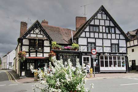
Starting from the historic town of Upton-upon-Severn, which is located on the west bank of the River Severn, this walk crosses attractive countryside to the isolated church at Queenhill. The route continues to the banks of the river and follows the Severn Way north back to Upton-upon-Severn. The town hosts a variety of festivals and can be very busy so choose a date when parking when parking is less problematic.
The walk starts from the Banwell Park Sports Ground on Old Street (grid ref. SO851403) where free parking is available. After parking exit the carpark and turn right and then take first left just before the fire station into Minge Lane. And after 150 metre turn right along Rectory Road. Take the first signed footpath on the right just past number 4. The path crosses a field and continues past a small wood on your immediate right. Part way along the wood, the path turns left and continues with a hedge on your right. Turn right over a stile and head across the field to join a track before Southend Farm. Bear left along the track, pass between the farm buildings and take the signed path on the left with adjacent fingerpost (grid ref. SO849342).
The path continues along the right-hand edge of the field and, pass the Women�s� Institute to reach Avenue Road. Turn left and follow the road for 600 metres. Just after passing a half-timbered house on the left, turn right through a gap in the hedge and join a track. The path bears left after 150 metres through a small wood. And crosses a field to the far right-hand corner. Cross two stiles and then continue along a grassy track running parallel to a hedge on your right. At the end of the hedge maintain direction across pastures to pass to the left of a small pond. Entering the next field continue half left passing to the right of a small wood. Continue across the field to the far side and bear left along the field edge. Entering the next field, cross the stile on the right and cross tow fields to reach a lane (grid ref. SO853369).
Turn left along the lane. Reaching the next junction, turn right (signed to Bredon School). Continue along the lane to pass St Nicholas Church on your left. Just past the church turn left into a field. The path runs along the left-hand edge into the next field. Head slightly right across this field aiming for a stile in the hedge opposite. The route runs parallel to a hedge on your left, crosses a stream and then maintains direction to a dilapidated stile in the field corner. Cross this to join the Secern Way. This long- distance footpath is followed for four kilometres. Nearing Upton-upon-Severn you pass through Ham Meadow nature reserve. Reaching housing, continue into Dunn's Lane. Reaching the Swan Hotel, fork right along the waterfront. Bear left into High Street at the Kings Head. High Street leads into Old Street and the car park is some 500 metres from the river on the right.
Maps 

| Ordnance Survey Explorer 190 | Sheet Map | 1:25k | BUY |
| Anquet OS Explorer 190 | Digital Map | 1:25k | BUY |
| Ordnance Survey Digital Map Subscription | |||
| Latest Ordnance Survey Discounts | |||
Other walks nearby
| Walk 2380 | The Malverns from the Gullet | moderate | 12.0 miles |
| Walk 2676 | River Severn & Apperley from Tewkesbury | easy/mod | 7.5 miles |
| Walk 2664 | Herefordshire Beacon from British Camp car park | easy | 2.0 miles |
| Walk 1211 | The Worcestershire Beacon | easy/mod | 4.5 miles |
| Walk 2326 | Herefordshire Beacon from Hollybush | easy/mod | 6.5 miles |
| Walk 1853 | Bredon Hill from Kemerton | easy/mod | 5.2 miles |
| Walk 1556 | The Malverns - end to end | hard | 10.0 miles |
| Walk 1658 | Malverns circular from Noirth Hill | very hard | 18.0 miles |
| Walk 1355 | Stoulton Circular | easy/mod | 7.5 miles |
| Walk 3502 | Two Rivers Walk to Powick and Worcester | easy | 6.5 miles |
