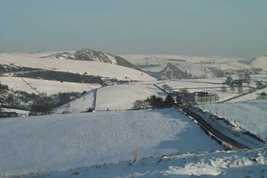
Upper Dove Valley from Hollinsclough
Peak District Walk
Nat Park - Peak District - Dove Valley Chrome Hill
County/Area - Staffordshire & Derbyshire
Author - Mike Bexley
Length - 7.5 miles / 12.2 km Ascent - 1600 feet / 485 metres
Time - 5 hours 20 minutes Grade - moderate
Walk Route Description
Click image to see photo description.
The Peak District walk visits a lovely quite dale following the infant River Dove. There is no urgency here as the rest of the world rushes by leaving this dale and its scattered settlements unchanged.
Start from the telephone box in Hollinsclough Village (grid ref. 066664) and walk up the lane to the left of the Chapel. Take the first footpath on the right dropping down to cross over the River Dove by a footbridge. Take the left path leading to Fough with the river in the valley on the left and Hollins Hill high on the right. Continue north to Booth Farm (grid ref. 068680).
Turn left down the farm road, then over a stile on the right prior to the buildings. The path proceeds behind these buildings then keeps to the right of a wire fence. Do not cross over the river on the left but keep to right of the field (the path is not too clear) and through some gate posts. The path then develops leading you to Thirkelow Farm. Continue up their farm track with Thirkelow Rocks on your right to the road (grid ref. 048694).
Turn left on the road then left again along a farm track passing an open barn on your right. The track leads to Fairthorn Farm but prior to dropping down to the converted farm take the footpath stile on the left leading to a small pond (this is a new right of way to avoid a broken footbridge in Fairthorn Farm garden and is not shown on the maps), follow the edge of the pond turning left on the other side gradually proceeding right down to a bridge over a stream then up the fields ahead over a stile and up some steps to the secluded house in the woods at Brand Side (grid ref. 044689).
Proceed up their drive and just after the first gate branch left following the path that keeps to the left boundary fence of a house. After clearing the house, continue in the same direction to Grid Reference 045684 a derelict farm at the end of a track. There are seven footpaths leading from this farm, to find your path requires you to walk south with the house and building on your left then down the fields to a very small footbridge over the narrow River Dove.
A steep climb takes you up the fields ahead to Nether Colshaw Farm (grid ref. 043681). Turn left up their farm track. On reaching the road, turn right then over the stile on the left. Keep to the right of the first house, then the left of the farm buildings ahead down some steps to a lane. Cross over the stile opposite continuing down the fields to the left hand corner. Go over a stile and up the fields to the road junction ahead (grid ref. 043671).
Turn left down the minor road. At Golling Gate turn right along a bridleway to Moseley Farm. Keep straight on along the farm road to turn left down to Willshaw Farm. After the farmhouse follow the sign on the right to Willshaw Hill. This path skirts the hill to the derelict Hill Top Farm. Proceed through the gate and garden to the exit gate and path across the fields to the road (grid ref 052659).
Cross the road and down the farm track opposite. Do not miss the right turn down the bank and over the stile to the river. Do not take the bridge but turn left over the fence stile then diagonally up fields to the left of the bushes to a bridleway leading to Ball Bank House Farm (grid ref 061653). On reaching the farm turn left and up their farm track to a lane. Left again up this lane, then on reaching the road go over the stile opposite. The path keeps to the left of the fence and wall, then on reaching the lane turn right and proceed straight on. The lane deteriorates underfoot to boulders descending rapidly to Hollinsclough phone box and your transport.
NOTE - There is a character living in Hollinsclough (he was still alive in 2001) called George Mellor. He was born in 1919 and has lived there since. The local church published a 40 page booklet of five of his walks. It is a gem, not so much for the walks but he writes how life was during his childhood and earlier. Who lived where and who did what.
Walks with George
Hollinsclough Methodist Publications 1998
ISBN 1-899610-07-3
Maps 

| Ordnance Survey Explorer OL24 | Sheet Map | 1:25k | BUY |
| Anquet OS Explorer OL24 | Digital Map | 1:25k | BUY |
| Ordnance Survey Digital Map Subscription | |||
| Latest Ordnance Survey Discounts | |||
Other walks nearby
| Walk 1861 | Chrome and Parkhouse Hills from Earl Sterndale | easy/mod | 5.0 miles |
| Walk 1862 | Earl Sterndale and High Wheeldon from Longnor | easy/mod | 6.0 miles |
| Walk 2723 | Pilsbury Castle, Hartington & Sheen from Longnor | easy/mod | 9.6 miles |
| Walk 2272 | Flash Circular from Cistern Clough | moderate | 8.0 miles |
| Walk 1043 | Chelmorton & the Monsal Trail | easy/mod | 8.1 miles |
| Walk 3709 | Sparklow, Crowdicote & Pilsbury Circular | easy/mod | 9.0 miles |
| Walk 1652 | Three Shires Head | easy | 4.5 miles |
| Walk 2233 | Flash & Three Shires Head | easy/mod | 6.2 miles |
| Walk 2577 | Hawk's Nest, Goldstitch Moss & Lud's Church | moderate | 8.0 miles |
| Walk 1596 | Lud's Church and Roach End from Gradbach | easy/mod | 4.5 miles |
Recommended Books & eBooks
Great Mountain Days in the Pennines
 An inspirational guidebook to 50 classic walks on the rolling Pennine landscape. The graded routes, between 6 and 13 miles in length, cover classic Pennine fells and moorland such as Whernside, Ilkley Moor and Pendle Hill; exploring the North and South Pennines, Yorkshire Dales, Howgills and Dark Peak. Many routes are also suited to fell running.
More information
Dark Peak Walks
 Guidebook to 40 walks in the Dark Peak area of the Peak District National Park. 35 circular routes for most abilities, from 8km to 19km, around Edale, Marsden, Fairholmes, Baslow and Castleton, including Kinder Scout and Mam Tor, and 5 longer (25km to 45km) routes highlighting the best of the Gritstone Edges, High Moorland and Deep Valleys.
More information
