Sparklow, Crowdicote & Pilsbury Circular
Peak District Walk
Nat Park - Peak District - Dove Valley Chrome Hill
County/Area - Derbyshire
Author - Lou Johnson
Length - 9.0 miles / 14.6 km Ascent - 900 feet / 273 metres
Time - 5 hours 20 minutes Grade - easy/mod
Walk Route Description
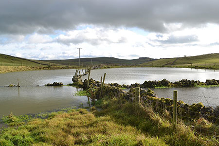
Click image to see photo description.
This Peak District circular walk from Sparklow on the High Peak Trail offers relatively easy walking to explore the Upper Dove Valley between Crowdicote and Pilsbury. The route uses generally well signed paths and bridleways, and offers an interesting exploration of the limestone landscape of this area. The start is reached off the A515 Ashbourne to Buxton road, between Parsley Hay and Pomeroy.
The start is the Hurdlow car park at Sparklow (grid ref. SK128659). After parking walk the short way to the High Peak Trail and head northwest along this excellent trail. Continue along the trail for about three kilometres to reach the end of the trail (grid ref. SK111673). Turn left along cycleway 68 passing an extensive quarry on your right to reach a lane (grid ref. SK109665). Turn right and continue for 650 metres to reach Wheeldon Trees and a road junction. Bear right and almost immediately take the path adjacent to the fingerpost on your left. You soon reach the boundary of National Trust High Wheeldon. Turn right as directed by a yellow area and continue downhill with the wall to your right. Continue to a road (grid ref. SK098663).
Turn left and continue below High Wheeldon which rises steeply on your left. After 300 metres turn right down a narrow-surfaced lane (Green Lane). After 200 metres the lane bears right, turn right over a wall stile along a waymarked path keeping the wall on your left. Follow this path past Meadow Farm to regain the road in Crowdicote. Turn right along the road. Turn right at the next T-junction, continue past the Packhorse Inn and the next two cottages to turn left along a no through road (grid ref. SK101652). You are now on the South Peak Loop bridleway. Pass Bridge End Farm on your left and continue for 800 metres across fields to cross a walled green lane (grid ref. SK108645). Continue straight ahead on a signed path across two large fields to cross the bridleway by Pilsbury Castle (grid ref. SK115639).
Follow the yellow arrows veering left uphill from the bridleway at Pilsbury Castle. The path reaches a lane by a barn (grid ref. SK121635). Cross the lane and maintain direction across fields passing the pool marked on OS maps (grid ref. SK129634). More fields are crossed to reach another road by Vincent House Farm (grid ref. SK1376320). Cross the road and follow the signed path through the farmyard. Continue ahead on the right-hand track continuing straight ahead where the track bends to the right. The onward path to Parsley Hay crosses several fields with the path following walls on your left to reach a small wooden gate and a road at Darley Farm (grid ref. SK142637).
Turn right along the road then left into Darley Farm. Follow the yellow arrows through the farmyard and continue across a field (wall on your right) to regain the High Peak Trail. Turn left and you have three kilometres of easy walking back to the start.
Maps 

| Ordnance Survey Explorer OL24 | Sheet Map | 1:25k | BUY |
| Anquet OS Explorer OL24 | Digital Map | 1:25k | BUY |
| Ordnance Survey Digital Map Subscription | |||
| Latest Ordnance Survey Discounts | |||
Other walks nearby
| Walk 1146 | Bradford & Lathkill Dales | moderate | 11.3 miles |
| Walk 3046 | Lathkill Dale & Monyash | easy | 4.0 miles |
| Walk 1861 | Chrome and Parkhouse Hills from Earl Sterndale | easy/mod | 5.0 miles |
| Walk 1862 | Earl Sterndale and High Wheeldon from Longnor | easy/mod | 6.0 miles |
| Walk 2723 | Pilsbury Castle, Hartington & Sheen from Longnor | easy/mod | 9.6 miles |
| Walk 1043 | Chelmorton & the Monsal Trail | easy/mod | 8.1 miles |
| Walk 1206 | Chelmorton & Flagg from Taddington | easy/mod | 6.0 miles |
| Walk 1369 | Tissington Trail - Hartington to Parsley Hey | easy | 4.0 miles |
| Walk 1042 | Pilsbury Castle | easy/mod | 5.5 miles |
| Walk 2301 | Biggin & Parsley Hay from Hartington | easy/mod | 9.5 miles |
Recommended Books & eBooks
Walking in the Peak District - White Peak East
 Guidebook describing 42 half-day and day walks in the limestone landscapes of Derbyshire's White Peak, part of the Peak District National Park. One of two volumes, this book covers the east of the region, with potential bases including Bakewell, Eyam, Castleton, Birchover, Matlock and Wirksworth.
More information
Great Mountain Days in the Pennines
 An inspirational guidebook to 50 classic walks on the rolling Pennine landscape. The graded routes, between 6 and 13 miles in length, cover classic Pennine fells and moorland such as Whernside, Ilkley Moor and Pendle Hill; exploring the North and South Pennines, Yorkshire Dales, Howgills and Dark Peak. Many routes are also suited to fell running.
More information
