Morrone (Morven) from Braemar
Cairngorms Walk
Nat Park - Cairngorms - Cairngorm South
County/Area - Aberdeenshire
Author - Andy Smith
Length - 7.4 miles / 12 km Ascent - 1800 feet / 545 metres
Time - 5 hours 30 minutes Grade - moderate
Maps 

| Ordnance Survey Explorer OL58 | Sheet Map | 1:25k | BUY |
| Anquet OS Explorer OL58 | Digital Map | 1:25k | BUY |
Walk Route Description
Click image to visit gallery of 9 images.
Escaping Munro status by just 181 feet, this fine Corbett often gets overlooked as people flock west towards the Cairngorm massif via Linn of Dee. It is however a very rewarding summit producing fine views in every direction for miles around with the added bonus that the route can be completed in half a day.
Braemar is a large village but considering it's highly isolated location it has surprisingly healthy options for accommodation, the most popular being the Caravan Club campsite or the SYHA opposite. There are also two large hotels within the village centre along with self catering cabins.
The walk starts from the centre of the village (grid ref. NO150913). Leave the village on the small road to the south which follows the River Clunie. Continue along this road for 3km passing the golf course until a chained access track is reached at grid reference NO153883 next to a sheepfold. Leave the road climbing the track uphill across the hillside, this can be quite exposed to the weather and slightly on the tedious side, nevertheless the improving views soon produce a reward.
The track continues to climb and after an hour or so starts turning right towards the summit which is now clearly in view. The large radio mast dominates the top but can also offer welcome shelter from high winds once reached! On top you take in fine views in all directions, Linn of Dee is the real treat though with the River Dee and its lush green forest cutting up towards the huge southern Cairngorm range.
Leave the summit to the northeast in the opposite direction from the ascent track and locate the only path heading downhill back towards the village which is well marked with cairns. After half an hour Braemar suddenly comes into view nestling amongst the mountains, here you can reflect what a beautiful part of Britain you are currently in as you stride a cracking pace downhill towards this superb village.
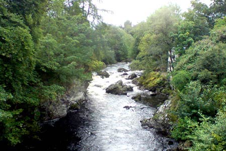
A fence is reached at grid ref. NO144904. Turn left here and continue downwards passing the cairn and bench as you enter the woods. Pass the pond to your right avoiding the huge duck population, and head down the small road which leads you back into the village centre. A short but rewarding way to spend a summer's afternoon in this great National Park.
Other walks nearby
| Walk 3108 | Creag Choinnich circular | easy/mod | 4.0 miles |
| Walk 1864 | Glen Quoich & Glen Lui (near Braemar) | moderate | 10.0 miles |
| Walk 1119 | Ben Macdui & Carn a' Mhaim | hard | 19.0 miles |
| Walk 2356 | The Cairnwell ridge from Glenshee Ski Centre | mod/hard | 9.3 miles |
| Walk 1881 | Ben Macdui & Cairn Lochan from the Ski Centre | hard | 10.4 miles |
| Walk 2672 | Cairngorm Mountain via Coire an t-Sneachda | mod/hard | 6.0 miles |
| Walk 1390 | Cairn Lochan via the Fiacaill Buttress from Ski Centre | very hard | 5.7 miles |
| Walk 1276 | Loch Avon Circular via Cairn Gorm Mountain | hard | 9.0 miles |
| Walk 2314 | Cairngorm & Ben Macdui from the ski centre | hard | 11.0 miles |
| Walk 2421 | Braeriach via the Chalamain Gap | hard | 15.0 miles |
Recommended Books & eBooks
Great Mountain Days in Scotland
 Inspirational guidebook to 50 challenging routes for mountaineers, scramblers, hillwalkers and fell runners, many long enough to backpack over 2 days, especially in winter (12 to 25 miles). A mix of classic routes and unsung gems across Scotland from Galloway to the Outer Hebrides in widely differing wild landscapes. With customised OS mapping.
More information
Messaging & Social Media
Message Walking Britain and follow the latest news.

Mountain Weather
Stay safe on the mountains with detailed weather forecasts - for iOS devices or for Android devices.