 Walking Britain
Ben Macdui & Cairn Lochan from the Ski Centre
Cairngorms Walk
Nat Park - Cairngorms - Cairngorm North
County/Area - Highland
Author - Andy Smith
Length - 10.4 miles / 16.9 km Ascent - 3000 feet / 909 metres
Time - 7 hours 40 minutes Grade - hard
Walk Route Description
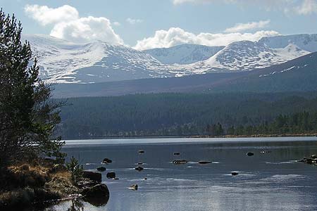
Click image to visit gallery of 4 images.
The Cairngorms offer some of the finest winter walking in Scotland with sub-zero temperatures and arctic storms; they give a real impression of how the country used to be long ago during the big freeze, along with some of the native wildlife such as the grouse and arctic white hare.
This high level walk has an added advantage of starting at altitude for those wishing to "bag the big ones" in shorter winter days, and takes in the second highest mountain in the British Isles, Ben Macdui.
From Aviemore take the B970 to Coylumbridge where you take unclassified road Glenmore. Passing Loch Morlich the road turns south before slowly winding uphill toward the ski centre (Grid ref. NH990060) where there is a large car park with plenty of parking. From there, walk under the start of the ski tows to the path leading away south into the hills. After a short while the path splits, bear right climbing steadily past Lurchers Crag and onto Miadan Creag.
Continue south with Cairn Lochan to your left; here even in summer the path seems non existent on these slow rolling summits and care is needed not to stray too close to the Lairig Ghru gully to the right. There now follows a steady 4km walk uphill to Ben Macdui, which is now in sight. Good navigational skills are a must here as the weather can break within minutes, immersing these high levels in dense cloud. However on a good day the views looking right across to Braeriach and Cairn Toul are breathtaking, especially during the winter. After a short steep climb, the grand summit of Ben Macdui is finally reached with superb views looking south into the Lairig Ghru with the river Dee over 2000ft below.
From the summit, head north retracing your footsteps toward Cairn Lochan. About half way along the path splits; take the right fork and head for the summit (Grid ref. NH984025). From the summit, the views across to Aviemore are stunning giving you the impression you can reach out and put it in your pocket! Continue east with the drop to your left. There is the option of a scramble down the small path of Fiacaill Buttress (for highly competent walkers), or as I did, follow the ridge round to the left over Fiacaill à Choire Chais taking in a good view of Cairn Gorm mountain itself. Keeping left of the ski tows, head downhill and drop down to the path just below the cairn. This will take you back to the ski centre and civilisation.
Maps 
| Ordnance Survey Explorer OL57 | Sheet Map | 1:25k | BUY |
| Get Ordnance Survey Digital Map Subscription | |||
| Latest Ordnance Survey Discounts | |||
Other walks nearby
| Walk 2672 | Cairngorm Mountain via Coire an t-Sneachda | mod/hard | 6.0 miles |
| Walk 1390 | Cairn Lochan via the Fiacaill Buttress from Ski Centre | very hard | 5.7 miles |
| Walk 1276 | Loch Avon Circular via Cairn Gorm Mountain | hard | 9.0 miles |
| Walk 2314 | Cairngorm & Ben Macdui from the ski centre | hard | 11.0 miles |
| Walk 2421 | Braeriach via the Chalamain Gap | hard | 15.0 miles |
Start Point Details
Ordnance Survey Grid Ref NH990060
Latitude 57.1339318016142 Longitude -3.67083586487515
Postcode PH22 1RB
what3words start ever.pads.shuffles
Walk description may contain detailed information on the start point for this walk.
Further Information
Cairngorms Walking
Walking in the Cairngorms National Park, which was formed in 2003 to protect the unique aspects of the area, offers some of the great walks of Scotland. It is the UK's largest national park with a large mountain range at its heart with diverse communities around it. The habitat offers a secure haven for many of Britain's rarest bird, animal and plant species. Forests include remnants of the original Caledonian pine forest which contrast with large areas of heather moorland to foster ecological diversity. Of particular interest to hill walkers is that four of Scotland's five highest peaks can be found in this National Park where the arctic wilderness is the largest example of arctic mountain landscape in the British Isles.
Walking GuideAccommodation
Find Accommodation nearby by using the regional accommodation lists
Go to regional accommodation lists
Self Catering & Cottage Holidays
Properties throughout the UK & Europe
Messaging & Social Media
Message Walking Britain and follow the latest news.


Mountain Weather
Stay safe on the mountains with detailed weather forecasts - for iOS devices.