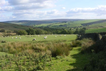
Pinhaw Beacon from Lothersdale
North Yorkshire Walk
County/Area - North Yorkshire - Skipton
Author - Allan Friswell
Length - 4.0 miles / 6.5 km Ascent - 800 feet / 242 metres
Time - 2 hours 50 minutes Grade - easy
Maps 

| Ordnance Survey Explorer OL21 | Sheet Map | 1:25k | BUY |
| Anquet OS Explorer OL21 | Digital Map | 1:25k | BUY |
| Ordnance Survey Landranger 103 | Sheet Map | 1:50k | BUY |
| Anquet OS Landranger 103 | Digital Map | 1:50k | BUY |
Walk Route Description
Click image to visit gallery of 5 images.
A straightforward ramble, generally well signed with superb views from Pinhaw Beacon. The start point is the Hare and Hounds Public House in Lothersdale (Grid ref. SD958459). Turn left from the pub and then left again almost at once and climb the path signed Pennine Way. After passing through a gate, turn left and follow the fence on your left uphill. The fence becomes a wall about halfway up. Cross the stile in the corner of the field and cross the next field to the stile ahead, which gives on to a lane (Grid ref. SD957469).
Follow the path ahead towards the farm, and where it turns left you should cross the stile and keep straight on along the gravelled track with the wall on your left. The stile in the top corner leads you on to Carleton Moor, ablaze with purple heather when the author did this ramble. Follow the very clear path which soon turns sharp left (Grid ref. SD955472) following close to the wall, and continue all the way up to the trig point of Pinhaw Beacon. The view is truly 360 degrees with the hills of Pendle, Whernside, Pen-y-Ghent, Ingleborough and Buckden Pike all visible. To have attained such a vista after such a straightforward short climb seems hardly fair!
The Pennine Way is clear on the ground and you follow this in a SW direction till you reach the corner of a wall where, ignoring the signposts, you turn left and follow the right hand wall. You quickly come to a waymarker post without its sign (Grid ref. SD942469); here you strike across the moor at veering slightly left, passing a small white pole some kind soul has stuck there for our guidance. When you reach a small plantation (Grid ref. SD943468) you cross the two stiles and turn left along the track to a third stile. In the next field you cross veering slightly right from the stile, making for a wall-stile near the far corner. Cross this and go straight down the field to the stile at the lane by the farm (Grid ref. SD946465). Negotiate the stile opposite and make your way down hill to White Hill Lane. (Grid ref. SD947463).
Here you turn right, then left at the junction, signed "Crosshills, Lothersdale". Walk down the road to the hamlet of The Fold, and turn right in the direction of the fisheries. After some 100 yards take the path on the left. Ignore the fact that it is pointing straight at a wall and follow the clear track down to the bridge across Lothersdale Beck, after passing through a gate. Take the left hand gate after the bridge and climb the path. Where it turns right you should keep to the left and follow the wall, climbing to the stile in the top corner close to Spen House Farm (Grid ref. SD952455). From here, follow the stream to Lower Spen Farm. Pass through the farmyard to the lane - try to ignore the irritating yapping Jack Russell. Then you turn right and follow the road back to the start point.
Other walks nearby
| Walk 1793 | Lothersdale | easy/mod | 6.0 miles |
| Walk 2661 | Keighley Moor Reservoir & Hitching Stone from Cowling | moderate | 9.5 miles |
| Walk 2657 | Bradleys Both, near Skipton | easy/mod | 5.5 miles |
| Walk 2904 | Cross Hills to Skipton via Low Bradley | easy/mod | 6.5 miles |
| Walk 3430 | Farnhill Moor from Kildwick | easy/mod | 4.5 miles |
| Walk 2304 | East Marton and the Drumlins | easy/mod | 5.5 miles |
| Walk 2293 | Weets Hill | easy/mod | 5.3 miles |
| Walk 1811 | Sharp Haw in Airedale | easy/mod | 7.0 miles |
| Walk 3215 | Steeton to Ilkley without a car | moderate | 7.5 miles |
| Walk 3079 | Silsden Reservoir circular | easy | 6.0 miles |
Recommended Books & eBooks
Trail and Fell Running in the Yorkshire Dales
 Guidebook to 40 of the best trail and fell runs in the Yorkshire Dales National Park. Ranging from 5 to 24 miles, the graded runs start from bases such as Ribblehead, Dent, Sedbergh, Malham and Grassington and take in the region's diverse delights, from castles and waterfalls to iconic mountains such as Whernside, Ingleborough and Pen Y Ghent.
More information
The Pennine Way
 Guidebook to the Pennine Way National Trail with OS map booklet. The 265 mile route from Edale to Kirk Yetholm takes three weeks to walk and is suitable for fit and experienced long distance walkers. The route crosses the Peak District, Yorkshire Dales and North Pennines National Parks. Includes separate OS 1:25,000 map booklet of the route.
More information
Messaging & Social Media
Message Walking Britain and follow the latest news.

Mountain Weather
Stay safe on the mountains with detailed weather forecasts - for iOS devices or for Android devices.