Hemel Hempstead, Great Gaddesden, Nettleden & Potten End
Chilterns Walk
Region - Chilterns
County/Area - Hertfordshire
Author - Peter Smyly
Length - 10.8 miles / 17.6 km Ascent - 900 feet / 273 metres
Time - 6 hours 20 minutes Grade - moderate
Walk Route Description
Click image to visit gallery of 3 images.
Hemel Hempstead railway station is situated on the train line between London Euston and Northampton, one stop before Berkhamsted and the Grand Union Canal is just a few minutes' walk away. This walk in rural Hertfordshire starts and ends at Hemel Hempstead station. It includes a couple of miles of canal tow path at the end and a few hundred yards of it near the start. In between, much of the walk follows sections of the Chiltern Way and the Hertfordshire Way across fields, through woodland, and along country lanes.
Hemel Hempstead to Great Gaddesden
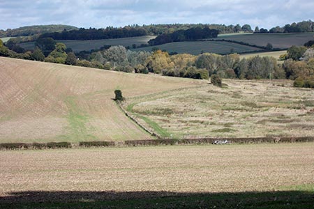
The first five miles or so take you in an approximately north westerly direction as far as the village of Great Gaddesden with its church and views across to the other side of a dry valley.
From the railway station, start by crossing London Road and follow Fishery Road as far as the canal. Turn left along the tow path and leave the canal at the first bridge to follow Old Fishery Lane. On reaching a T junction, turn left along North Ridge Way and follow the road round to the right as it goes uphill. Leave this road on the left when a public footpath sign appears on the left next to a mini roundabout. The path passes through a residential area but soon leaves this behind to enter woodland. Bear downhill to the left to a path junction and then go to the right to continue through woods to a road called Long Chaulden. This the first of five roads to be crossed on part of the Chiltern Way as far as Great Gaddesden.
After the fifth road crossing, Nettleden Road, you leave the Chiltern Way before it reaches the next road to bear left by the Watercress Beds via a field edge to reach the village of Great Gaddesden. A left turn here along a road and then a right turn brings you to the church.
Great Gaddesden to Potten End
Leave the village by a path behind the church leading uphill across a couple of grassy fields before a path borders the next field on the left, leading to a road. Turn left here and then almost immediately right, passing a Buddhist Centre. Follow the path ahead to the next village of Nettleden (the valley where the nettles grow).
Turn left along the road at Nettleden and then almost immediately right uphill through woodland, passing under a bridge. When the gradient eases off, look out for a metal kissing gate on the right and this is the way to go next. Follow the tarmac road ahead and turn sharp left just before the farm to follow another path leading downhill to another minor road. This time follow the road to the left as far as a pub and take a bridleway uphill to the right. When you reach another road, turn left downhill, then right along the next road. Passing a set of wooden signposts take the next path left through more woodland to reach Potten End.
Potten End to Hemel Hempstead
Emerging from the path through woods at a road, cross this road and bear left towards the village green with its pond. At the end of the green on the right, look out for a public footpath sign, a path off Hempstead Lane that leads along a narrow course behind houses. Keep following the path ahead until emerging at a road with a picture sign for "Bullbeggars" and a house on the right. A let turn here along the road reveals a narrow path through woods to the right and following the course of this path brings you out at a narrow country lane, Little Heath Lane.
The next bit of the Hertfordshire Way is the one real downside of this walking route as there is no option but to follow the lane ahead downhill, being alert to any oncoming traffic until eventually the railway line is crossed at a bridge and around the next corner to the right, the canal comes into view.
The tow path alongside the canal leads back to the start point of the walk, re-joining the earlier route at the point where you first left the canal.
Maps 

| Ordnance Survey Explorer 182 | Sheet Map | 1:25k | BUY |
| Anquet OS Explorer 182 | Digital Map | 1:25k | BUY |
| Ordnance Survey Digital Map Subscription | |||
| Latest Ordnance Survey Discounts | |||
Other walks nearby
| Walk 1504 | Potten End Circular | easy/mod | 6.0 miles |
| Walk 3403 | Chipperfield to Kings Langley Circular | easy | 5.0 miles |
| Walk 1507 | Chipperfield Common circular | easy | 2.0 miles |
| Walk 1815 | Hertfordshire Way between Chipperfield and Bovingdon | easy/mod | 7.5 miles |
| Walk 2795 | Circular from Great Gaddesden to Little Gaddessden | easy/mod | 7.5 miles |
| Walk 2999 | Mansions & Parklands from Great Gaddesden | easy/mod | 7.0 miles |
| Walk 3503 | Circular from Berkhamsted | easy | 4.0 miles |
| Walk 1297 | Berkhamsted and Northchurch Commons | easy | 5.0 miles |
| Walk 1399 | Berkhamsted & Northchurch Commons | easy | 5.5 miles |
| Walk 1833 | Great Gaddesden | easy | 5.2 miles |
