Circular Waterside Walk around Warwick
Warwickshire Walk
County/Area - Warwickshire
Author - Millennium Way
Length - 4.5 miles / 7.3 km Ascent - 140 feet / 42 metres
Time - 2 hours 20 minutes Grade - easy
Walk Route Description
Click image to see photo description.
This easy circular Warwickshire walk is just under 4.5 miles and although it can be completed in under two hours it is better to take at least a half day or more, so that you can explore some of the historical sites and amenities along the way. Short sections of the route are along roads but mostly you will be walking along riverbank, near to parks or by the canal. Also, you will pass the historic Warwick Castle and St. John's House Museum near to the centre of Warwick. During the first part of the walk, you will enjoy a short section of The Millennium Way.
A From the car park entrance (grid ref. SP309655) cross Park Drive using the pedestrian crossing then go right to pass under left hand arch of viaduct and proceed up the path of Princes Drive. Pass under the railway bridge to reach the large roundabout. Stay on pavement going to left of roundabout entering Old Warwick Road then cross road via the pedestrian crossing. Turn right back towards the roundabout and after 40 yards take entrance left to towpath of Grand Union Canal, going right to keep canal on left hand side (you have now joined the Millennium Way).
B Go under bridge 43 then past The Moorings pub. Continue for approx. 1.5 miles and after passing under bridge 49, turn right up the slipway to reach the main road (here we leave the Millennium Way). Turn right on main road to cross bridge over canal to head into Warwick.
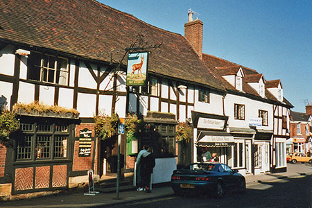
C Continue along main road under railway bridge then pass Railway Pub on left. Continue past entrance to Warwick Railway Station on right. Pass entrance to Priory Park and continue to main road junction. Cross over road via pedestrian crossing and go right past St John's House (The Fusiliers Museum with free entry). At the junction of three roads take the middle road up Smith Street - a road with some independent shops and a wide range of places to eat. The Roebuck Inn on your right is Warwick's oldest Public House, dating back to 1470 - it is dog friendly. At the top of the road is the old East Gate into Warwick with St. Peters Chapel on top and the Gateway Cafe left. Turn left down Castle Hill to the roundabout (note the entrance to Warwick Castle on right and picturesque Mill Street - you may wish to divert to go into Mill Street and view the cobbled street with impressive timber framed buildings). Cross roundabout to continue down A425 passing St. Nicholas Church L to pass the main entrance to St. Nicholas park.
D Just a few yards before reaching the bridge take the flight of steps left down into the park (a short detour onto the bridge will give you the iconic view of Warwick Castle down the river). At the bottom of the steps go past "Warwick Boats" to find the riverside path. Continue along path with river right (a lovely picnic spot). You will reach a large footbridge spanning the river (do not cross bridge) and here you should cross straight over cycle track and then veer slightly R onto the grass track with river right and rear of houses left. Soon you arrive a little closer to the river to walk along a pleasant tree-lined riverside track. Continue on some way to go under railway bridge to reach the canal viaduct. Go under arch of viaduct then go immediately left for quite a few paces to find metal steps which will take you high up to the canal towpath (you are now back on the Millennium Way which you walked earlier, but in the other direction).
E Go left on towpath with canal right to go under bridge 45. After 160 paces, as the canal narrows over the railway, take footpath left (signposted Link to Princes Drive), and continue along narrow track between fences with railway in cutting right. Eventually you will re-join the river on left. You will see a weir, a white concrete road bridge and a railway viaduct higher up. Pass the weir then leave the riverside walk to emerge on to the main road. Take the pedestrian crossing and go into the car park adjoining Victoria Park, where you started.
Maps 

| Ordnance Survey Explorer 221 | Sheet Map | 1:25k | BUY |
| Anquet OS Explorer 221 | Digital Map | 1:25k | BUY |
| Ordnance Survey Digital Map Subscription | |||
| Latest Ordnance Survey Discounts | |||
Other walks nearby
| Walk 1040 | Leamington Spa circular | easy | 4.5 miles |
| Walk 1077 | Newbold Comyn Park from Offchurch | easy | 4.8 miles |
| Walk 3518 | Offchurch Circular | easy/mod | 8.1 miles |
| Walk 3712 | Leek Wootton & Woodloes Park Circular | easy/mod | 7.1 miles |
| Walk 1349 | Hunningham & Wappenbury Circular | easy | 5.3 miles |
| Walk 2929 | The Pleasance & Meer End from Kenilworth | easy/mod | 7.0 miles |
| Walk 3703 | Kenilworth Castle circular | easy/mod | 6.6 miles |
| Walk 2813 | Long Itchington to Ufton and Return | easy/mod | 8.0 miles |
| Walk 1819 | Long Itchington Circular | easy/mod | 6.5 miles |
| Walk 3710 | Burton Green & Beechwood Circular | easy/mod | 5.8 miles |
