Compton Verney Circular from Combrook
Warwickshire Walk
County/Area - Warwickshire
Author - Lou Johnson
Length - 7.2 miles / 11.7 km Ascent - 450 feet / 136 metres
Time - 4 hours 0 minutes Grade - easy/mod
Maps 

| Ordnance Survey Explorer 206 | Sheet Map | 1:25k | BUY |
| Anquet OS Explorer 206 | Digital Map | 1:25k | BUY |
Walk Route Description
Click image to see photo description.
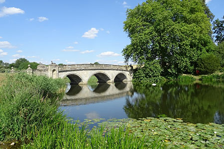
This Warwickshire walk from Combrook explores the area to the east of the historic manor of Compton Verney House which is surrounded by parkland landscaped by Capability Brown. Today the historic house is a venue for visual arts and music. The route passes the ornamental lakes, the Poolfield osier beds and passes through glorious parkland.
The start is the village of Combrook where limited street parking is available near St. Mary & St. Margaret parish church (grid ref. SP307517). After parking follow the no through road (School Lane) keeping the church on your right. After 200 metres turn left (grid ref. SP307519) onto a bridleway with blue waymarks. The bridleway passes Compton Pools on your right crosses a large field and joins a track. Continue along the track to reach the B4086 (grid ref. SP307528). Turn left along this road and after 200 metres turn right along a tarmac drive. Continue ahead at the first junction and follow the driveway around to the right to pass Home Farm (on your left). Continue along what is now a track for just over a kilometre to a road junction (grid ref. SP318540).
Go straight across and follow the lane for 800 metres. Reaching woodland on your left take the next lane on the right (grid ref. SP323545). Continue ahead towards Hill Fields Farm. Turn left along a green lane, just before a wooden fence and solitary tree on the left (grid ref. SP326543). Follow this track and pass Banisters Meadow Farm on your right. Continue along the farm access drive to a road (grid ref. SP331549). Turn right and after 100 metres go right across a stile. Follow the path across several fields following yellow waymarked to Poolfield Coppice (grid ref. SP336537). At this point you may be aware of vehicles being tested on the adjacent Vehicle Proving Ground.
Turn right and follow the bridleway/track around the south side of the Poolfield Osier Beds. Reaching the driveway for Poolfield Cottages, turn left and after 150 metres go through gate on the right. Continue through trees and across a field to join a road (grid ref. SP321536). Bear right and after 50 metres turn left over a stile with yellow waymarks. Follow the path south through the parkland of Compton Verney House to reach the B4086 after passing through a large car park. Bear right along the B4086 until just before a bridge and turn left onto a path with yellow topped way post (grid ref. SP311526). Cross a field and pass through woodland. Leaving the trees, bear half right across a field to reach School Lane. Turn left and the start is a short walk away.
Other walks nearby
| Walk 2125 | Edge Hill & Ratley from Radway | easy/mod | 5.4 miles |
| Walk 3222 | Edge Hill and Upton House | easy/mod | 6.5 miles |
| Walk 3665 | Honington & Idlicote Circular | easy/mod | 6.0 miles |
| Walk 2673 | Stratford-upon-Avon circular | easy | 3.8 miles |
| Walk 2489 | Upper Brailes Circular | easy/mod | 5.6 miles |
| Walk 2340 | Ilmington Down | easy/mod | 4.3 miles |
| Walk 2408 | Ebrington & Hidcote from Ilmington | easy/mod | 8.0 miles |
| Walk 3249 | Hidcote & Ilmington Down | easy/mod | 8.0 miles |
| Walk 1971 | Gallow Hill, Epwell & Swalcliffe | easy/mod | 7.8 miles |
| Walk 1359 | Stratford-upon-Avon from Milcote | easy/mod | 7.0 miles |
Recommended Books & eBooks
No suggestions for this area.Messaging & Social Media
Message Walking Britain and follow the latest news.

Mountain Weather
Stay safe on the mountains with detailed weather forecasts - for iOS devices or for Android devices.