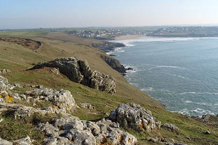
Polzeath & Pentire Point from Rock
Cornwall AONB Walk
Region - Cornwall AONB
County/Area - Cornwall
Author - Lou Johnson
Length - 11.4 miles / 18.5 km Ascent - 1400 feet / 424 metres
Time - 7 hours 10 minutes Grade - moderate
Maps 

| Ordnance Survey Explorer 200 | Sheet Map | 1:25k | BUY |
| Anquet OS Explorer 200 | Digital Map | 1:25k | BUY |
Walk Route Description
Click image to see photo description.
This Cornwall coastal walk starts from Rock on the Camel Estuary. The route follows the South West Coast Path past Brea Hill to reach Polzeath. The route continues along the coastal path to Pentire Point and along the cliffs at Port Quin Bay. The route then turns inland and uses country lanes and paths to cross the peninsula and return to the start. As with many coastal walks, the route is undulating with many ascents and descents.
The walk starts from the pay and display car park at the western end of the waterfront in Rock by the Rock Ferry slipway (grid ref. SW928757). After parking exit the western end of the car park and join the signed South West Coast Path (SWCP) with the Camel Estuary on your left. The path is generally well-signed and easy to follow. Reaching Brea House, keep left and pass Brae Hill which rises on your right. You can, if you wish, make a brief ascent before continuing along the SWCP. Cross a footbridge (grid ref. SW929774) and continue through the dunes at the back of Daymer Bay.
Reaching the car park for Daymer Bay, bear left and continue along the SWCP. The route continues past Trebetherick Point where it bears northeast along the Greenway to reach the sandy beach at Polzeath. Reaching the road in Polzeath, bear left and pass the large car park on your left. Turn left oat the fingerpost just past the Surf Shop (grid ref. SW937789) and bear right along the back of the car park. Join a walled lane and after 100 metres turn left along the SWCP. Continue north, joining a short section of road at Pentireglaze Haven. Where the main road turns right, turn left at the fingerpost to continue along the SWCP.
Continue northwest to reach Pentire Point where it is worth spending some time enjoying the view which extends from Trevose Lighthouse to the southwest and Tintagel Castle in the east. Follow the path and continue eastwards to The Rumps which was the site of an Iron Age fort. Follow the clear path past Com Head to reach the small beach at Lundy Bay to reach a footpath junction at Lundy Hole (grid ref. SW958798). Turn right and follow the steep path uphill which leads across several fields to reach the farm buildings at Portreath. Continue along the access drive to reach a road by the Bee Centre (grid ref. SW962792).
Turn left along the road (care needed) for 100 metres and bear left onto a lane signed to Mesmear Farm. Continue past this farm and after a further 800 metres reach a T-junction (grid ref. SW952783). Cross the road and take the footpath opposite up some stone steps. Cross a field to join a track. Turn left and follow the track as it bends sharp left. Turn right and pass the club house (on your right). Follow the path across the golf course (marked with white stones). Leaving the golf course, the path continues west across two fields, passes between houses and joins a road (grid ref. SW936776).
Cross the road to join another path (no fingerpost). The path crosses two fields and passes St. Enodoc's church (keep church to your right). The route then crosses another golf course (route marked with stones) to reach a footbridge (grid ref. SW930769). Cross the bridge and turn left and soon after bear right onto a short path that leads back to the SWCP. Bear left along the coast path (estuary on your right) and return to the start.
Other walks nearby
| Walk 3589 | Padstow from Little Petherick | easy | 5.0 miles |
| Walk 2462 | The Rumps & Pentire Point | easy/mod | 4.0 miles |
| Walk 3264 | Port Quin & Port Isaac Circular | easy/mod | 5.7 miles |
| Walk 1547 | Trevose Head & Constantine Bay from Porthcothan | easy/mod | 8.5 miles |
| Walk 1961 | Porthcothan to Watergate Bay | easy/mod | 6.8 miles |
| Walk 1104 | Newquay to Porthcothan coast path | moderate | 10.5 miles |
| Walk 1029 | Tintagel to Boscastle | moderate | 9.0 miles |
| Walk 1883 | Advent Church | easy | 5.2 miles |
| Walk 1808 | Brown Willy, exploring Cornwall's highest Tors | easy/mod | 4.0 miles |
| Walk 3279 | Tors of Bodmin Moor | moderate | 10.0 miles |
Recommended Books & eBooks
The South West Coast Path
 Guidebook to walking the entire South West Coast Path National Trail. The route runs for 630 miles from Minehead to Poole along the north Devon, Cornish, south Devon and Dorset coastline. Divided into 45 stages, this long-distance coastal trek could be completed within 4 weeks, or walked in sections. Guide includes maps and essential information.
More information
Walking in Cornwall
 This guidebook includes routes to 40 day walks in Cornwall. From short, easy strolls to longer, wilder routes, there is plenty to appeal to both families and experienced walkers. The walks explore the interior and coasts, including walks through picturesque villages, old tin-mining areas and the Lizard and Land's End Peninsulas.
More information
Messaging & Social Media
Message Walking Britain and follow the latest news.

Mountain Weather
Stay safe on the mountains with detailed weather forecasts - for iOS devices or for Android devices.