Advent Church from Harpur's Downs
Cornwall Walk
County/Area - Cornwall
Author - Lou Johnson
Length - 5.2 miles / 8.5 km Ascent - 500 feet / 152 metres
Time - 3 hours 10 minutes Grade - easy
Walk Route Description
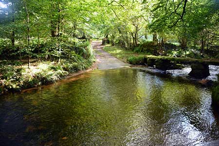
Click image to see photo description.
A pleasant walk on the northern edge of Bodmin Moor starting from Harpur's Downs. The route offers views to Brown Willy, the highest point in Cornwall and nearby Rough Tor. During the walk you will pass two abandoned settlements with remnants of the longhouses seen in the landscape. The route also visits the isolated Advent church near Tresinney which lies a considerable distance from its parishioners.
The start is the road junction on Harpur's Downs (grid ref. SX115798) where parking is available on the grassy triangle between the roads. After parking, head southwest across grass to a stile. The path then keeps to the left-hand side of several fields before passing through a small wood to reach a track Turn right past Newton Farm and continue along the farm's access track to a road (grid ref. SX107793).
Turn left and where the road bends left continue ahead onto a track. Pass through a yard and continue along an obvious sunken track passing the site of the medieval village of Carweather. Follow the track downhill to gate and shortly after a barn. Keep to the right and continue over a cross a clapper bridge over the River Camel to reach a lane (grid ref. SX098806). Turn right and immediately left to pass through wooden gate into a field. Keep to the right-hand side of two fields. Entering the third field head straight across to reach a lane (grid ref. SX100812).
Turn right along the lane towards Tresinney. Follow the lane for 350 metres to reach a junction. Turn right and continue to the next junction. Keep ahead at the next junction and continue to a fingerpost on the left signed to Advent Church. Leave the churchyard at the eastern end crossing stile ignoring the path on the right. Follow path over five fields. Exit the last filed via a stile onto a lane (grid ref. SX110812). Bear left up the lane and continue for a kilometre to the next junction at Watergate (grid ref. SX120814).
Turn right and follow the lane for 1.4 kilometres. Turn left over stile by a metal gate (grid ref. SX114804). Descend the slope with a hedge on your right, cross a stream, using stepping stones, and continue along the waymarked path uphill and back to the start at Harpur's Downs.
Maps 

| Ordnance Survey Explorer 109 | Sheet Map | 1:25k | BUY |
| Anquet OS Explorer 109 | Digital Map | 1:25k | BUY |
| Ordnance Survey Digital Map Subscription | |||
| Latest Ordnance Survey Discounts | |||
Other walks nearby
| Walk 1808 | Brown Willy, exploring Cornwall's highest Tors | easy/mod | 4.0 miles |
| Walk 3279 | Tors of Bodmin Moor | moderate | 10.0 miles |
| Walk 1029 | Tintagel to Boscastle | moderate | 9.0 miles |
| Walk 3606 | Berry Down from St Neot | easy/mod | 5.6 miles |
| Walk 3264 | Port Quin & Port Isaac Circular | easy/mod | 5.7 miles |
| Walk 2247 | Draynes Bridge & Siblyback Lake | easy/mod | 5.0 miles |
| Walk 2730 | St Gennys & Castle Point from Crackington Haven | easy/mod | 3.0 miles |
| Walk 2731 | Cambeak & Crackington Haven | easy/mod | 4.3 miles |
| Walk 2462 | The Rumps & Pentire Point | easy/mod | 4.0 miles |
| Walk 3738 | Polzeath & Pentire Point from Rock | moderate | 11.4 miles |
Recommended Books & eBooks
Walking in Cornwall
 This guidebook includes routes to 40 day walks in Cornwall. From short, easy strolls to longer, wilder routes, there is plenty to appeal to both families and experienced walkers. The walks explore the interior and coasts, including walks through picturesque villages, old tin-mining areas and the Lizard and Land's End Peninsulas.
More information
