Tinto from Wiston (southern approach) Walk
Walk 3752 - Route Maps & Profile
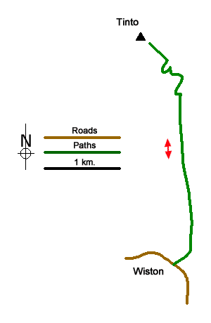
Route Map
Digital Maps - Copyright © 2011-2024. All rights reserved.
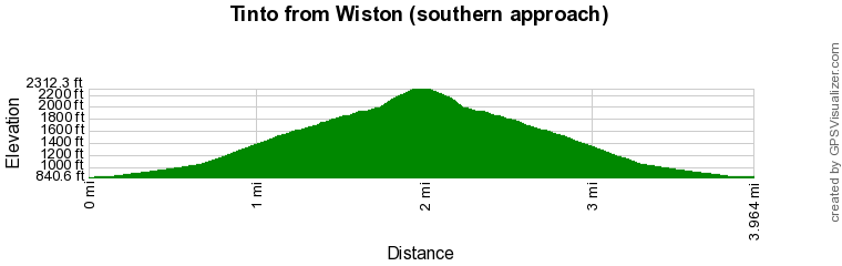
Route Profile
Sketch Map
Suggested Maps 

| Ordnance Survey Explorer 335 | Sheet Map | 1:25k | BUY |
| Anquet OS Explorer 335 | Digital Map | 1:25k | BUY |
| Ordnance Survey Digital Map Subscription | |||
| Latest Ordnance Survey Discounts | |||
It is recommended you take a map. The preferred scale is 1:25k.
Start Point Details
Ordnance Survey Grid Ref NS956322
Latitude 55.572241 Longitude -3.657293
Postcode ML12 6HT
what3words start shaves.fact.reclusive
Walk description may contain detailed information on the start point for this walk.
Further Information
Walk grading - Learn how each walk is assessed and select a walk to suit your ability and experience by going to Walk Grading Details.
Messaging & Social Media
Message Walking Britain and follow the latest news.

Mountain Weather
Stay safe on the mountains with detailed weather forecasts - for iOS devices or for Android devices.