Tinto from Wiston (southern approach)
South Lanarkshire Walk
County/Area - South Lanarkshire
Author - Lou Johnson
Length - 4.2 miles / 6.8 km Ascent - 1500 feet / 455 metres
Time - 3 hours 40 minutes Grade - moderate
Walk Route Description
Click image to see photo description.
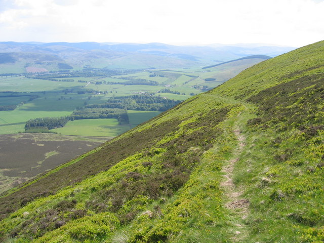
This walk to the summit of Tinto follows the less popular southern approach from Wiston. The route climbs the southern, steeper slopes of Tinto using a path that zigzags up the hillside to reach the summit. The path is indistinct in places but should pose no problems to experienced hillwalkers.
The start is by the main entrance to Wiston Lodge (grid ref. NS956322) where there is space for a car or two. After parking, walk up the driveway and continue past the left-hand side of Wiston Lodge. Where the track bends to the right, continue ahead into a field. Keep to the right-hand side of the field and continue upwards. Continue up the right-hand side three more fields to enter open country (grid ref. NS957333).
The path steepens before climbing more slowly to reach the foot of the south face of Tinto. A series of zigzags leads up to the right of the rocky outcrop of Pap Craig. The path becomes less obvious above the final zigzag so trend right and make the steep ascent beside the fence to reach the summit area via a stile.
In contrast with the walk so far, on fine days you are likely to meet many walkers and paragliders who have approached the summit from the north. Take time to explore the summit area with its massive cairn, trig column and topograph. The view is outstanding including parts of the Lake District, southern section of the Cairngorm National Park and many other summits as detailed on the topograph. You could descend by the main north descending north see Tinto (northern approach. However, this would need two cars. Otherwise descend by the route of ascent down to Wiston.
Maps 

| Ordnance Survey Explorer 335 | Sheet Map | 1:25k | BUY |
| Anquet OS Explorer 335 | Digital Map | 1:25k | BUY |
| Ordnance Survey Digital Map Subscription | |||
| Latest Ordnance Survey Discounts | |||
Other walks nearby
| Walk 3751 | Tinto (northern approach) | moderate | 4.5 miles |
| Walk 2135 | Camps Reservoir Circular | easy | 5.8 miles |
| Walk 3294 | Trahenna Hill from Broughton | moderate | 7.1 miles |
| Walk 2268 | Annandale Way | moderate | 9.0 miles |
| Walk 2618 | Broad Law & Megget Stone | moderate | 5.0 miles |
| Walk 2050 | The Crown of Scotland | moderate | 9.0 miles |
| Walk 2035 | Hart Fell via Hartfell Spa | moderate | 7.2 miles |
| Walk 2280 | Hart Fell & Whitehope Heights | moderate | 8.4 miles |
| Walk 2006 | Grey Mare's Tail & White Coomb | mod/hard | 7.2 miles |
| Walk 2008 | Hart Fell via Saddle Yoke & the Black Hope Horseshoe | mod/hard | 8.5 miles |
