Crug Hywel / Table Mountain above Crickhowell
Walk Photo 371701
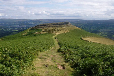
Caption - Table mountain is rather grandiosely named, being just an outcrop on the south side of Pen Cerrig Calch. It was used as a hill fort during the Iron Age - it must have been the obvious choice for that purpose at the time due to its large level surface surrounded by crags on almost all sides! Crickhowell, the town below, was named after the fort. The area surrounding Table Mountain to W, S and E is enclosed farmland.
Walk 3717 : Table Mountain from Crickhowell
Photographer : Rudi Winter
Use back button to return to the photo gallery lists.
Further Information
Location Map
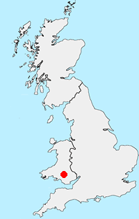
Brecon Beacons
Walking in the Brecon Beacons National Park (Bannau Brycheiniog) covers a wide area in South Wales. The high summits of the Beacons themselves tell only part the story as, like most National Parks, there is a varied range of scenery to be enjoyed within its boundaries. More Information
Messaging & Social Media
Message Walking Britain and follow the latest news.

Mountain Weather
Stay safe on the mountains with detailed weather forecasts - for iOS devices or for Android devices.