East Sussex WalksWalking Routes & Hiking Trails
Find East Sussex walks from the list below which features the best walking routes in the area. Most are circular walks and are listed from the shortest and easiest to the longest more challenging routes.
The East Sussex walks listed below range from short circular walks to more demanding and longer Routes across the South Downs. All walks are free to download and print and all routes have GPS files. The walks include glorious countryside, scenic coastline and with many routes allowing you to explore attractive villages, historic houses and castles, and churches.
| Walk | Description | Grade | Miles |
|---|---|---|---|
| 3575★ | High and Over White Horse | easy | 2.00 |
| 1633★ | Charleston Farm & Firle Beacon | easy/mod | 4.60 |
| 2335★ | Ashdown Forest & Nutley Windmill | easy/mod | 4.70 |
| 1838★ | Bateman's & Holton Hill from Burwash | easy | 5.30 |
| 3756★ | Rye Harbour Circular | easy | 6.00 |
| 1638★ | Beachy Head & Eastbourne from East Dean | easy/mod | 6.20 |
| 1770★ | Southease or Rodmell to Falmer | easy/mod | 6.75 |
| 2486★ | Plumpton Green & South Downs | easy/mod | 7.70 |
| 2684★ | Falmer to Pyecombe & Blackcap by South Downs Way | moderate | 8.75 |
| 3120★ | Alfriston to Rodmell by the South Downs Way | moderate | 9.00 |
| 3574★☩ | Firle Beacon & Cuckmere Valley | moderate | 10.40 |
| 2227★ | East Dean Circular | moderate | 11.00 |
| 1015★ | Ouse Valley & Beddingham Hill from Newhaven Tide Mills | moderate | 12.00 |
| 2903★ | Stanmer to Streat | moderate | 12.50 |
| 3516★ | Eastbourne to Alfriston by the South Downs Way | mod/hard | 12.50 |
| 1038★ | Firle Beacon from Southease | moderate | 13.25 |
| 1357★ | The Seven Sisters from Exceat | moderate | 14.00 |
| 2419★ | Southease, Ditchling Beacon & Lewes | mod/hard | 18.30 |
| 1899★ | Royal Military Canal - Cliff End to Seabrook | hard | 29.00 |
Walks that start in adjacent counties / areas.
Walks that start in adjacent counties or areas but cross the boundary and include sections of the route within East Sussex.
| Walk | Description | Starts In |
|---|---|---|
| 3521★ | Wittersham to Rye (High Weald Landscape Trail) | Kent |
| 2758★ | Cowden Circular | Kent |
★ GPS file ☩ Route profile
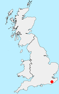
Location Map
East Sussex Guide
East Sussex offers some excellent walking with the South Downs offering many excellent routes. The coast also offers some superb walks including Beach Head which rises 162 metres (530 feet) above the Sea. In land the Weald is worth exploring with its attractive villages and historic buildings. The highest point in the County is Ditching Beacon (248 metres, 814 feet). The most important long-distance footpath is the South Downs Way which provides a basis for shorter circular walks.
Other walks in Britain - For a list of all the areas where walks are available go to the Main Walk Index.
Walk grading - Learn how each walk is assessed and select a walk to suit your ability and experience by going to Walk Grading Details.
Messaging & Social Media
Message Walking Britain and follow the latest news.

Mountain Weather
Stay safe on the mountains with detailed weather forecasts - for iOS devices or for Android devices.